Early Los Angeles City Views (1800s)
 |
|
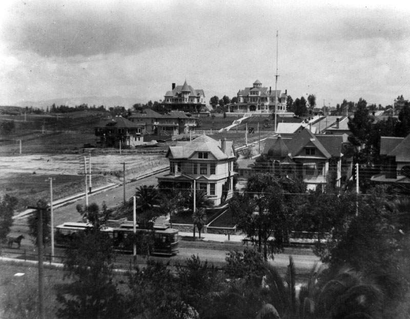
| (ca. 1892)^ - Residences on Orange Street (later Wilshire Boulevard) at Lucas Avenue showing the Shatto Residence on the northwest corner (top of the photo) of Orange Street; next to it is the Johnson residence. The tall pole seen on Lucas Avenue is another one of Los Angeles’ earliest electric stretlights, standing 150-ft tall. Click HERE to see more in Early L.A. Streetlights. The streetcars in the foreground are on 7th Street, carrying passengers from Downtown to Westlake |
Historical Notes The corner house, at 1213 Orange Street, was the residence of George R. and Clara Shatto, and later became the site of Good Samaritan Hospital in Los Angeles. George Shatto, a real estate speculator from Michigan, purchased Santa Catalina Island in 1887 for $200,000 and created the settlement that would become Avalon. He was the first owner to try to develop the island into a resort destination at the height of the real estate boom, and can be credited with building Avalon's first hotel and pier.^ Next to the Shatto house is the Orson Thomas (O.T.) Johnson house at 1221 Orange Street. O.T. Johnson became a very successful businessman in Los Angeles, known for building the Westminster Hotel. Occidental College has the Johnson Hall that was constructed in 1914 and was a gift of the Johnsons. O.T. was also a big supporter of the LA YMCA, donating a reported $35,000 to construct a YMCA building. Johnson built the Florence Crittenden Home and established a clinic in Los Angeles for the aid of poor children. He also built a seventy-five suite apartment building named Anna Craven Johnson Home, after his wife, that was established for the use of widowed mothers with dependent children.* The Good Samaritan Hospital was built on the NW corner of Orange (later Wilshire) and Lucas in 1925. Orange Street was renamed Wilshire Bouelevard in 1934. |
 |
|
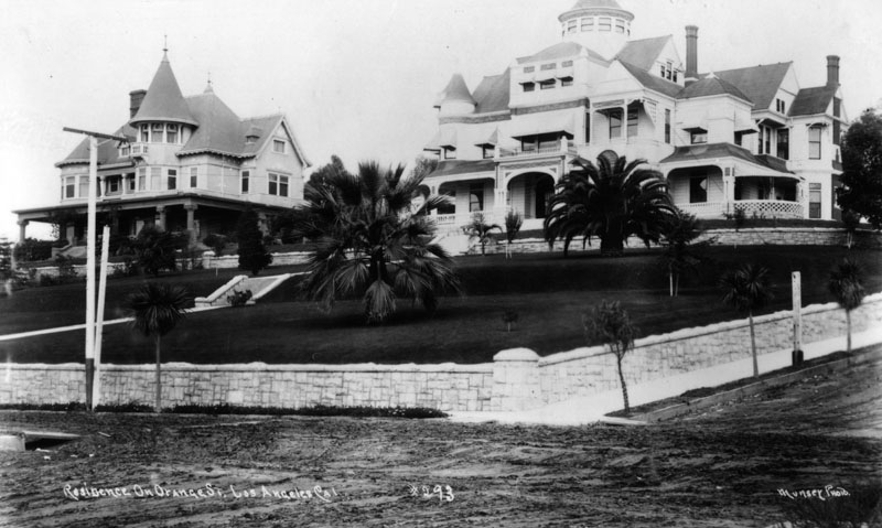
| (1892)^- View looking at the NW corner of Lucas Avenue and Orange Street (later Wilshire Boulevard) showing two Queen Anne style houses, one belongoing to George R. and Clara Shatto (right) and Orson Thomas (O.T.) Johnson (left). Both houses were built ca. 1892). |
Historical Notes What is now the easternmost portion of Wilshire Boulevard was originally a residential avenue called Orange Street, developed as part of the Orange Heights Tract by George Rufus Shatto. Shatto made his fortune in mining and purchased Catalina Island in 1887. In 1890, he began construction of a massive Victorian residence at the intersection of Orange Street and Lucas Avenue, close to his business headquarters in downtown Los Angeles. Designed by Curlett & Eisen, the residence included a four-story tower from which one could see Catalina. Shatto only occupied the residence for a short time, as he was killed in a railroad accident in 1893. Eventually, Good Samaritan Hospital would replace all of the residences along this stretch of Orange Street (later Wilshire Boulevard). Today, two remnants of the original rusticated stone wall are all that remain of this elaborate residence; the other remnant is situated on 6th Street between Lucas Avenue and Bixel Street.* |
* * * * * |
Elysian Heights Area
.png) |
|
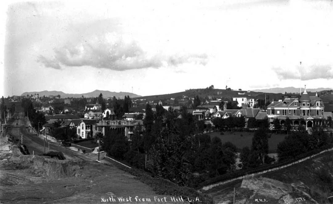
| (ca. 1887)^*# - Birdseye view of Bella Vue Avenue (now Bellevue, this section of which would later become part of Sunset Boulevard) and the Robinson residence shortly after it was built, looking north from Fort Hill. |
Historical Notes The J.W. Robinson mansion can be seen on the hilltop. It was located on Teed Street near Bella Vue Avenue (now Bellevue, this section of which would later become part of Sunset Boulevard). Teed Street was named after Freeman G. Teed who, in the 1880s and 90s, was LA City Clerk and President of the City Council. He was also a real estate speculator.^*# |
 |
|
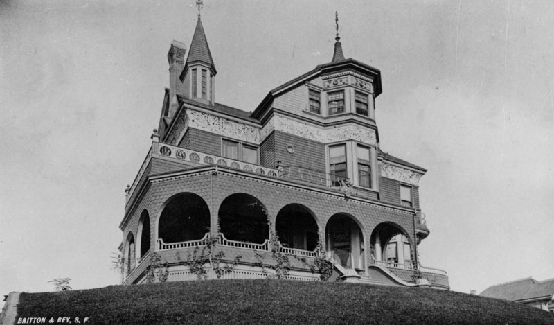
| (ca. 1890)^ - Close-up view of the two-story Victorian style home of Joseph Winchester Robinson, located on Teed Street near Bella Vue Avenue (later Sunset Boulevard). A winged gargoyle watches over the entrance. |
Historical Notes Samuel and Joseph Carter Newsom were the architects. The house was built in 1887 at a cost of $10,000. Joseph Winchester Robinson was the owner of Boston Dry Goods which later became the J. W. Robinson Department Stores.^ |
 |
|
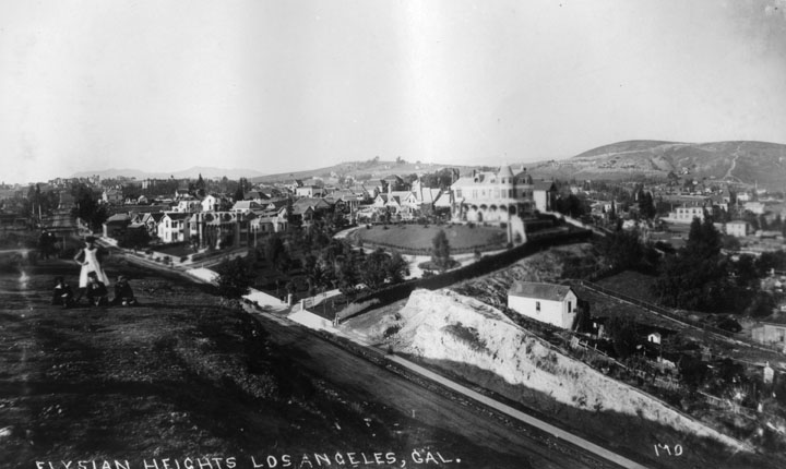
| (ca. 1890s)^ - Panoramic view of Elysian Heights. At left, a woman is visible standing, with three children seated before her on a grassy hill. Bellevue (later Sunset) runs from lower right to middle left. The Robinson Mansion sits high on the hill in the distance fronted by Teed Street. North Hill Street runs away from Bellevue on the other side of the Robinson Mansion. |
Historical Notes J. W. Robinson's “Boston Dry Goods Store” began business in of 1883 at the corner of N. Spring and Temple Streets. Joseph Winchester Robinson advertised that his establishment was characterized by “fine stocks and refined ‘Boston’ service.” The arrival of railroads spurred the enormous and long-lived growth of Southern California, and Robinson’s store brought eastern goods and their attendant sophistication to a willing (and growing) public; in 1887 the store was forced to move to larger quarters at 69-73 N. Spring Street. After returning from a trip back east in 1891, Robinson became ill and passed away in his home at the age of 45. His father, H.W. Robinson came to Los Angeles for the funeral and to look after the business founded by his late son. #*^^ |
 |
|
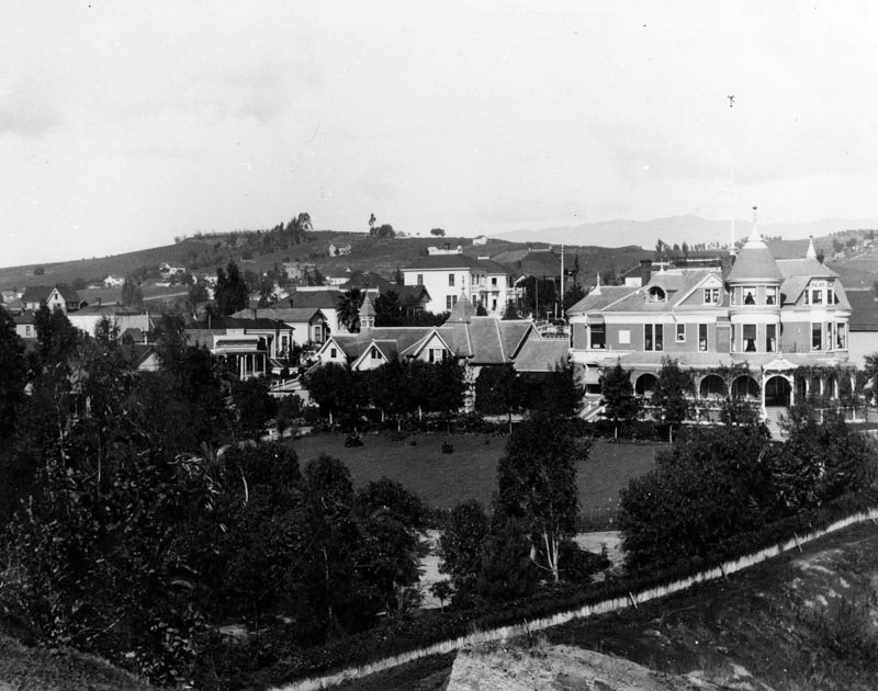
| (ca. 1895)^## - View looking northwest from Fort Moore Hill. The beautiful Victorian mansion (on the right) was purchased by Mrs. Julia S. Ford after the sudden death of J. W. Robinson in 1891. |
Historical Notes The prominent roadway running from center-left to center-bottom, where it is partially obscured by the brow of Fort Moore Hill, is Bellevue (sometimes called Bella View) which would become Sunset Boulevard and then, ultimately West Cesar E. Chavez Avenue. #^* |
 |
|
| (ca. 1897)^ - Panoramic view of the two-story Victorian style home of Mrs. Julia S. Ford, who purchased the residence from J.W. Robinson Estate and then remodeled it. |
 |
|
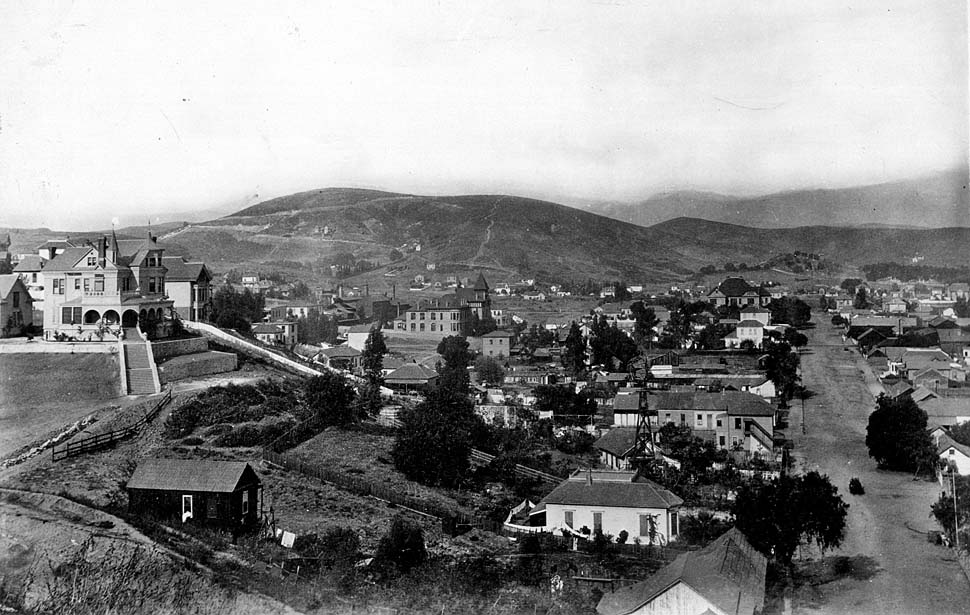
| (ca. 1900)* - View of Sonora Town from Fort Moore Hill looking north along Castelar Street (now Hill Street). |
Historical Notes The Julia S. Ford mansion (previously J.W. Robinson mansion) can be seen on the hilltop, left, overlooking Castelar Street (on the right, running directly away from the camera). Bella Vue (now Bellevue, this section of which would later become part of Sunset Boulevard) is below the frame running right to left. The two-story Victorian style home is located on Teed Street near Bella Vue Avenue. |
* * * * * |
Sonora Town
 |
|
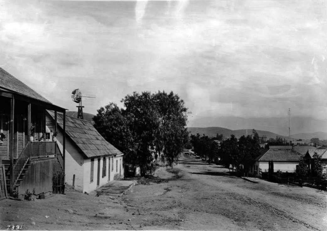
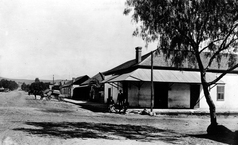
| (1890)* – View of homes along an unpaved Castelar Street (now Hill Street) looking north from Sunset Boulevard in Sonora Town. On the left side of the road, a squat one-story adobe and an elevated Craftsman-style house are visible, along with a windmill and a cluster of trees. To the right, a partially obscured one-story house can be seen through the foliage. In the distance, a tall antenna-like tower appears at center-right—one of Los Angeles' first electric streetlights, standing 150 feet tall. |
Historical Notes The part of the city called Sonora Town was an old adobe village north of the Plaza and Church of Our Lady, Queen of the Angels. It was Los Angeles' first Mexican quarters, or barrio. The area was named for the numerous miners and families who came from Sonora, Mexico, and may have still been around in the 1930s. Now it is Los Angeles' Chinatown District. |
 |
|
| (ca. 1899)^ - Three men are seen relaxing in front of an adobe house with a low hanging roof, at the corner of Castelar Street (now Hill Street) in Sonora Town. Several more homes are visible along Castelar, which has a very wide dirt road as far as the eye can see. A horse-drawn carriage is parked along the right side of the street. |
Historical Notes Hill Street was originally laid out in 1849 by Edward Ord. At that time, the street's northern end was near 4th Street, the roadway being obstructed by its namesake, Bunker Hill. The northern section of the street was originally named Castelar Street, and several institutions along this end of the street still bear that name. |
 |
|
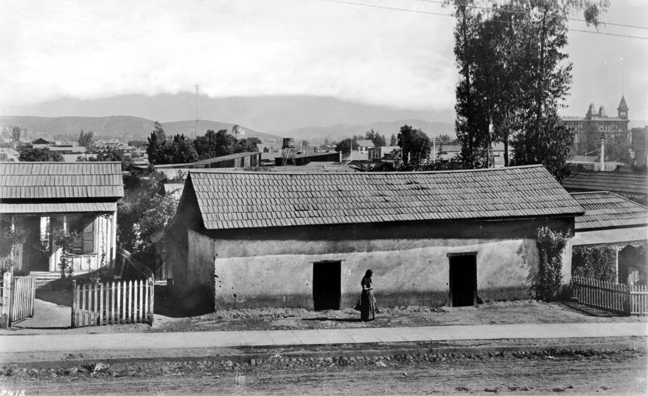
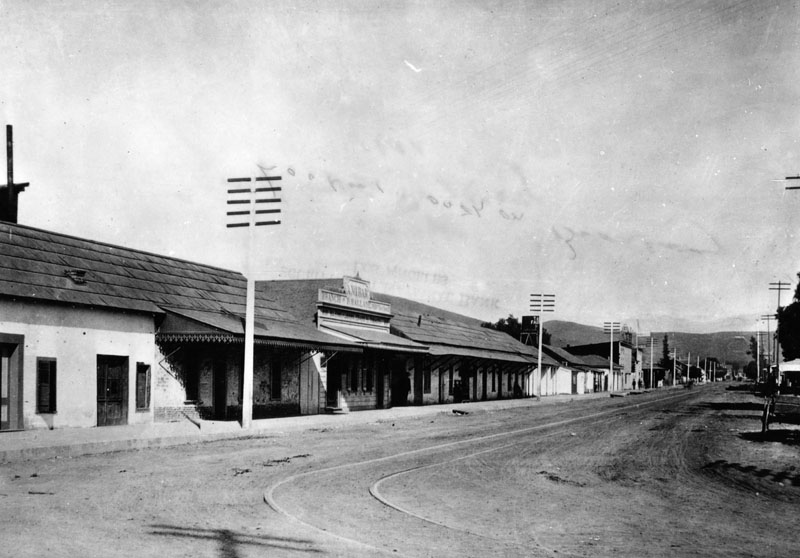
| (1890s)* - View of the east side of Castelar Street near Sunset Boulevard. A woman stands in front of a long adobe which has two door-less doorways. Non-adobe houses cordoned-off by picket fences stand to either side. A water tower and windmill are visible in the center background. The tall building in the upper-right (with three turrets) is the 4-story Sunset Hotel at 703 San Fernando Street (later North Spring Street). The residential area of the city is visible in front of the mountains in the left distance. |
 |
|
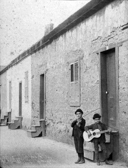
| (1880s)* - View showing two boys posing for the camera with their instruments on North Broadway in Sonora Town. |
 |
|
| (ca. 1890s)* - People outside an adobe house on Buena Vista Street (later renamed North Broadway) in Sonora Town. Trolley car tracks can be seen in the street. |
 |
|
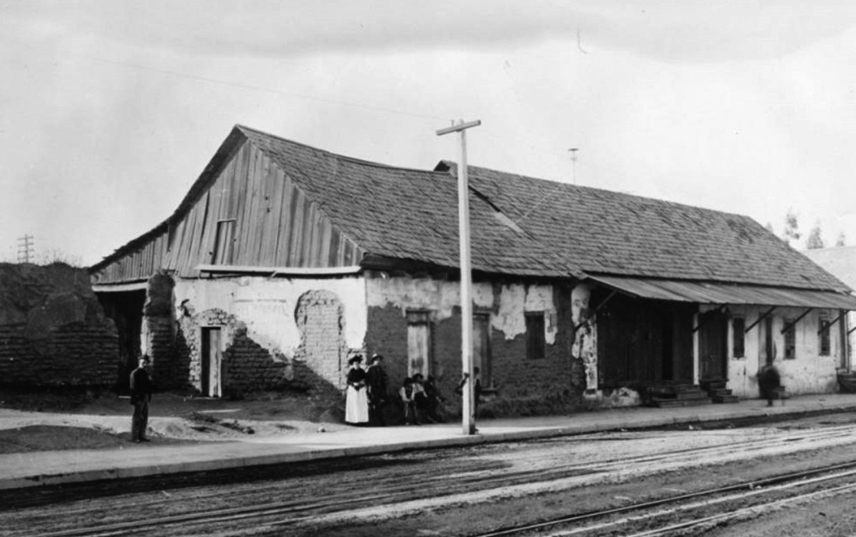
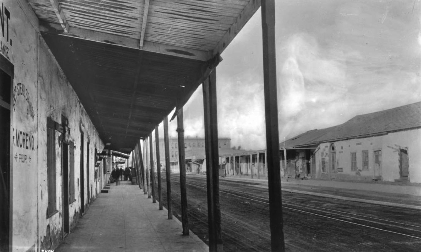
| (1890s)* - A view of the paved patio and walkway of an adobe restaurant owned by G. Moreno, which is located on the 600 block of N. Spring Street in Sonora Town. More adobe buildings can be seen across the street, possibly stores and/or homes. The 3-story building seen in the distance is the San Fernando Hotel, located at 700 N. Spring Street. |
 |
|
| (1895)* - North Broadway (formerly named Buena Vista Street), looking north from Sunset Boulevard in the area known as "Sonora Town". Adobe buildings can be seen along the street; among them is "Branch of P. Ballade House", a saloon that was located at 207 N. Buena Vista Street. |
Historical Notes Click HERE to see more Early Views of Sonora Town |
* * * * * |
Los Angeles Plaza
.jpg) |
|
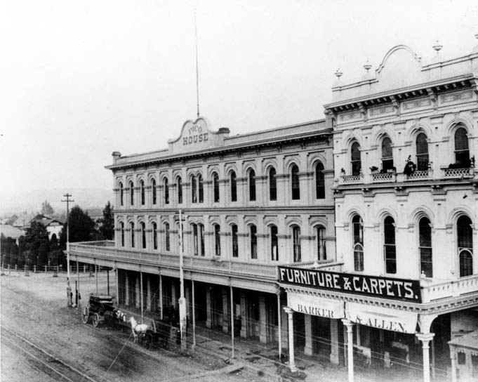
| (1890s)^ - On the left is the Pico House, the Plaza Church in the center. Fort Hill appears in the background, with residences of William Wills, and Mrs. Phineas Banning, and the tower of Los Angeles High School. |
 |
|
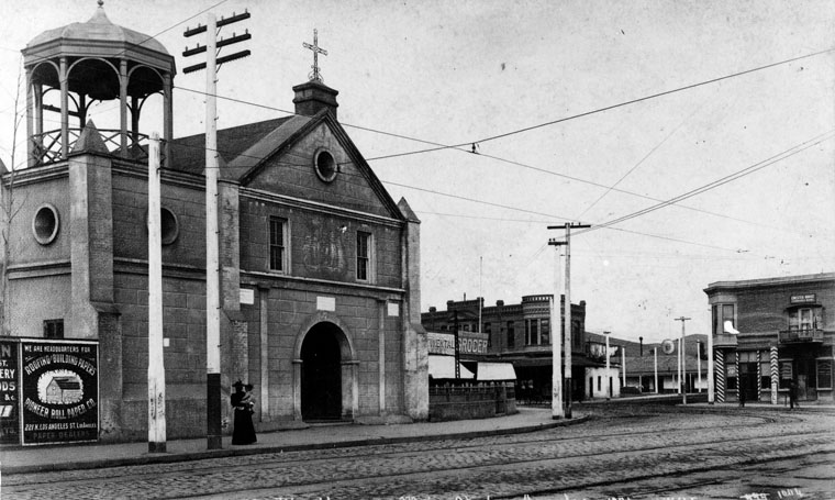
| (1894)^- Plaza Church as seen by looking north from Pico House on Main Street. This was the parish church for Los Angeles and was never a mission. A woman is seen holding a small child in front of the church. |
Historical Notes The surrounding area was named El Pueblo de Nuestra Señora la Reina de los Angeles del Río de Porciúncula ("The Town of Our Lady the Queen of the Angels on the River Porciúncula", which is the present-day City of Los Angeles). A chapel, La Iglesia de Nuestra Señora Reina de los Angeles, was later erected and dedicated on December 8, 1822, and for years served as the sole Roman Catholic church in the Pueblo. It is the oldest church in the city of Los Angeles. |
| (ca. 1895)*### - Men and women gather around the Plaza Church. The church is a stone block building with an arched doorway, ocular window, and a gazebo-like structure mounted on the roof. Shows the faint impressions of paintings on the exterior of the building. Signs on nearby commercial buildings read: "Saloon and Restaurant, Home Brewery" and "F.W. Braun and Co., Druggist." |
 |
|
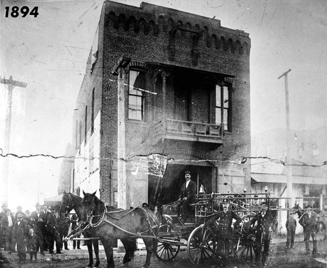
| (1894)#*#^ - Firetruck, men and horses in front of the Plaza Firehouse. To the right stands Governor Pio Pico's Office. |
Historical Notes The Old Plaza Firehouse is the oldest firehouse in Los Angeles. Built in 1884, it operated as a firehouse until 1897. The building was thereafter used as a saloon, cigar store, poolroom, "seedy hotel", Chinese market, "flop house", and drugstore. The building was restored in the 1950s and opened as a firefighting museum in 1960.*^ The Old Plaza Firehouse was dedicated as California Historical Landmark No. 730 (Click HERE to see more in California Historical Landmarks in L.A.) |
 |
|
| (1895)^ - View of Governor Pio Pico's Office located between the Old Plaza Firehouse (left) and the Pico House (right), across from the Plaza. The prominent towers of the Baker Block can be seen in the background. |
Hisorical Notes Pío de Jesús Pico (May 5, 1801 – September 11, 1894) was the last Governor of Alta California (now the State of California) under Mexican rule. In 1821 Pico set up a tanning hut and dram shop in Los Angeles, selling drinks for two Spanish bits (US 25 cents). His businesses soon became a significant source of his income. |
 |
|
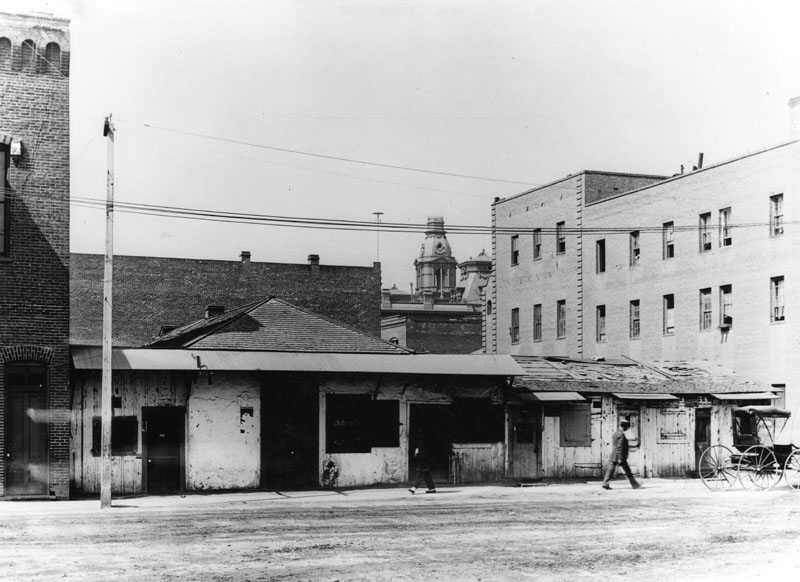
| (1890s)#*#^ - View of Main Street looking northeast. The Plaza, Pico House, and Merced Theater are visible. A sign above the theater reads “Barker & Allen, Furniture & Carpets.” A stagecoach and horse-drawn wagon are parked in front of the Pico House. |
Click HERE to see more in Early Plaza of L.A. |
* * * * * |
Arroyo Seco
 |
|
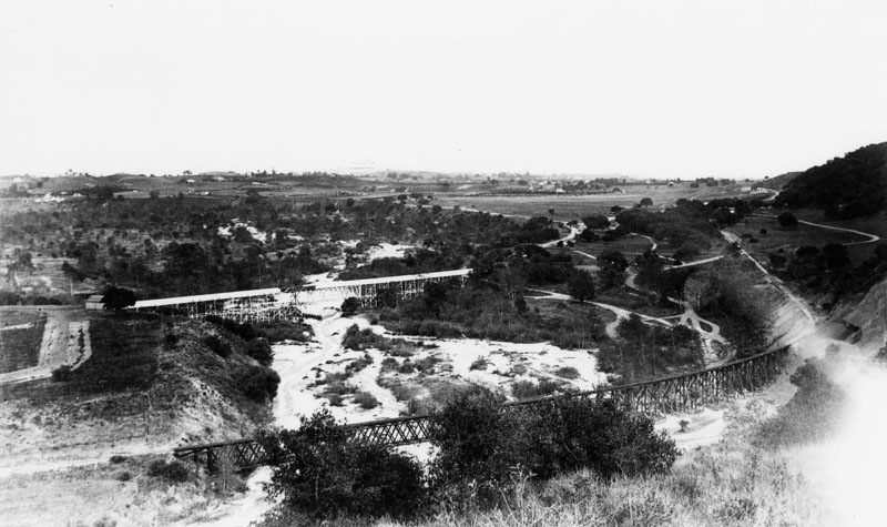
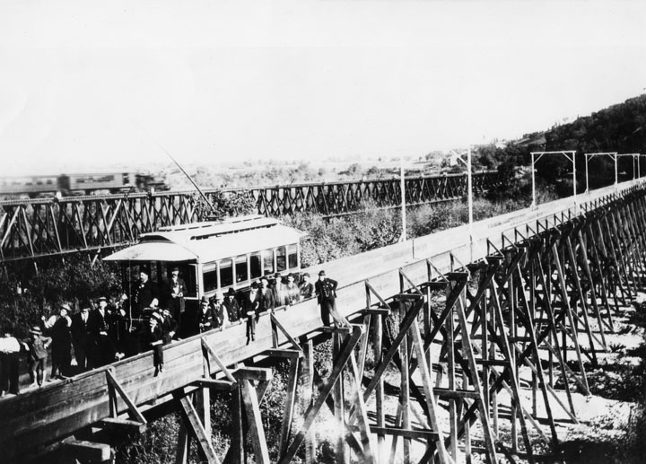
| (1890s)^ - Panoramic view of two railroad bridges in Arroyo Seco, in Pasadena. |
Historical Notes The Arroyo Seco, meaning "dry stream" in Spanish, is a 24.9-mile-long seasonal river, canyon, watershed, and cultural area in Los Angeles County. It was one of the Los Angeles River tributaries explored by Gaspar de Portola in the late summer and fall of 1770. He named the stream Arroyo Seco, for of all the canyons he had seen, this one had the least water. By 1895 a railroad line had been established from Downtown Los Angeles with a grand wooden trestle that cut a straight line crossing from the west side to the east. Eventually this line would hook up with rail lines built from the east to create the cross-country course of the Santa Fe Railroad. For local commutes, an electric traction trolley was put in and operated by the Pacific Electric Railway, a Henry E. Huntington enterprise, which ran the "Red Cars" from the upper Arroyo and Pasadena through the San Gabriel Valley into Los Angeles and many points beyond. The lower Arroyo Seco was served by the Los Angeles Railway "Yellow Car" lines.*^ |
 |
|
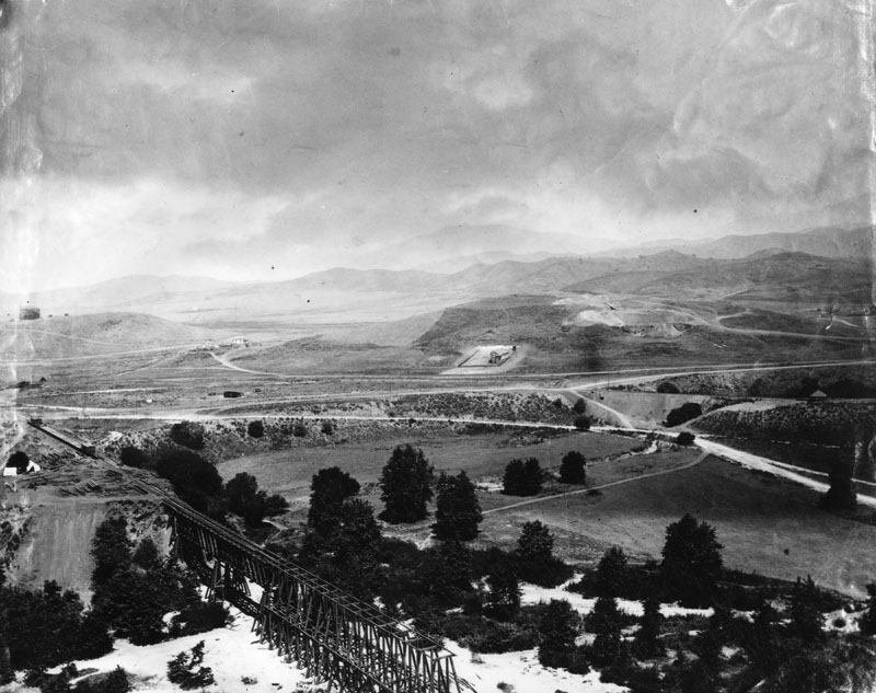
| (1895)^ - Panoramic view of a sparsely-populated Garvanza, with trees and a partly constructed bridge in the foreground across the Arroyo from Highland Park. |
Historical Notes One of the oldest settled areas of Los Angeles, Highland Park is also one of the most scenic due to its location along the Arroyo Seco, between the Mt. Washington hills, the San Rafael hills and the Monterey Hills.*^ Garvanza is considered a sub-district of Highland Park. The area was named for the garbanzo beans that once flourished there. In 1899, Garvanza was annexed by the City of Los Angeles.*^ |
 |
|
| (1895)^ - View of the first electric car over Arroyo Seco near the Cawston Ostrich Farm on March 7, 1895. Pasadena and Los Angeles Railway Co. (Click HERE to see more in Early Views of Pasadena). |
Historical Notes Cawston Ostrich Farm, located in South Pasadena was opened in 1886 by Edwin Cawston. It was America's first ostrich farm and was located in the Arroyo Seco Valley just three miles north of downtown Los Angeles and occupied nine acres. In 1885 Edwin Cawston charted a ship to take fifty of some of the best obtainable ostriches in the world from South Africa to Galveston, Texas. From there, the ostriches endured a treacherous train journey to South Pasadena. Out of the original fifty, only eighteen survived. Cawston bounced back from the loss of over half of his stock and the Ostrich Farm eventually boasted over 100 ostriches from the original batch.*^ |
* * * * * |
Hollenbeck Park
 |
|
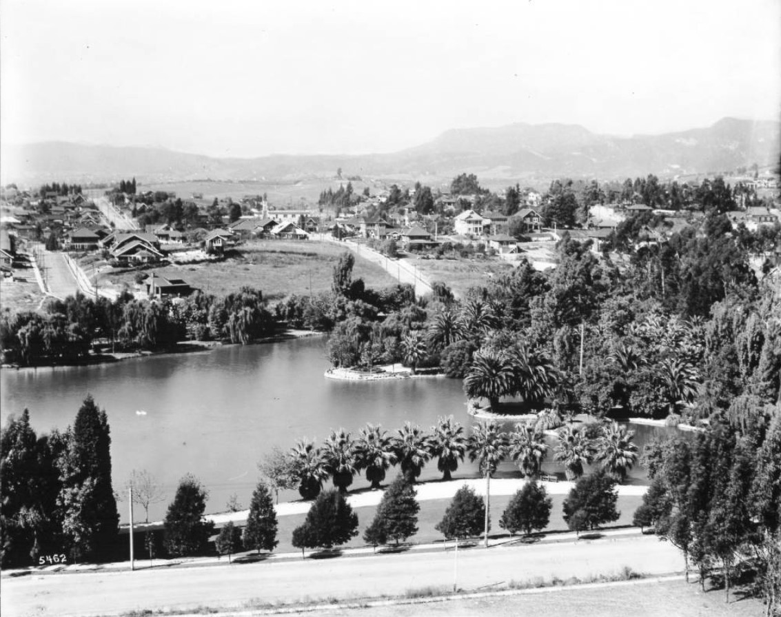
| (ca. 1896)^ – Early view of Hollenbeck Park and lake in Boyle Heights, just after it was created. |
Historical Notes Hollenbeck Park was a reflection of a citywide effort to establish "pleasure grounds" as part of a national "city beautiful" movement that encouraged healthful and attractive oases in urban environments. Consequently, several parks sprung up in the city during the late 1880s and early 1890s including Westlake Park, Elysian Park, Griffith Park and others. The location of the park was a natural arroyo that existed across Boyle Avenue from Mrs. Elizabeth Hollenbeck's estate and a key component of the creation of the facility was the establishment of a dam and reservoir that served as a lake for the new park.* |
 |
|
| (ca.1896)^ – View showing Hollenbeck Park in the foreground with the original J.E. Hollenbeck Residence in the upper-left and the Hollenbeck Home for the Aged in the upper-right. |
Historical Notes William Workman and Elizabeth Hollenbeck, whose late husband John invested heavily in Los Angeles-area real estate and banking before his 1885 death, agreed to donate fifteen and ten acres, respectively, to the city for a new Boyle Heights park to be dedicated to John Hollenbeck. The main condition was that the city commit to spending $10,000 over two years for improvements and the council approved the proposal by early 1892.* |
 |
|
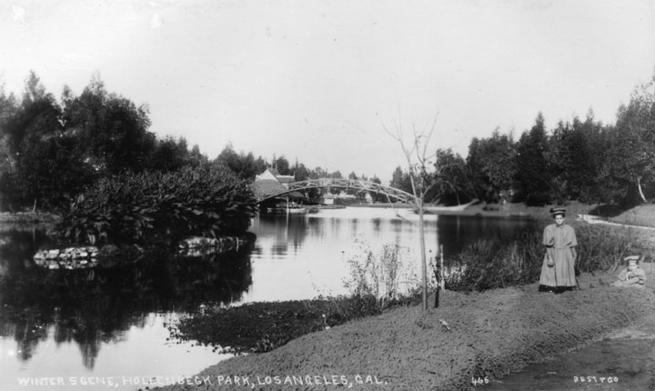
| (ca. 1890s)^ - In a photo entitled "Winter Scene, Hollenbeck Park, Los Angeles, Cal.," a woman and child are shown near the lake. |
Historical Notes The effort to plant trees, bushes and shrubs and grass and lay out walkways, benches and other amenities took some time and the park was dedicated in the middle of 1893. Within a couple of years, a boathouse was established and a franchise awarded for the operation of pleasure boats on the lake.* |
 |
|
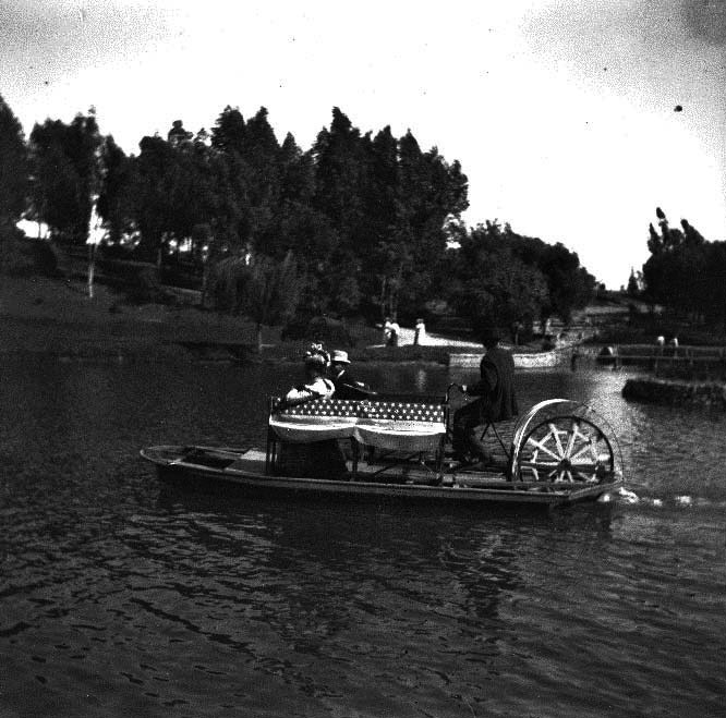
| (ca. 1898)^*# – View showing a man steering a bicycle boat with passengers on the lake at Hollenbeck Park. |
 |
|
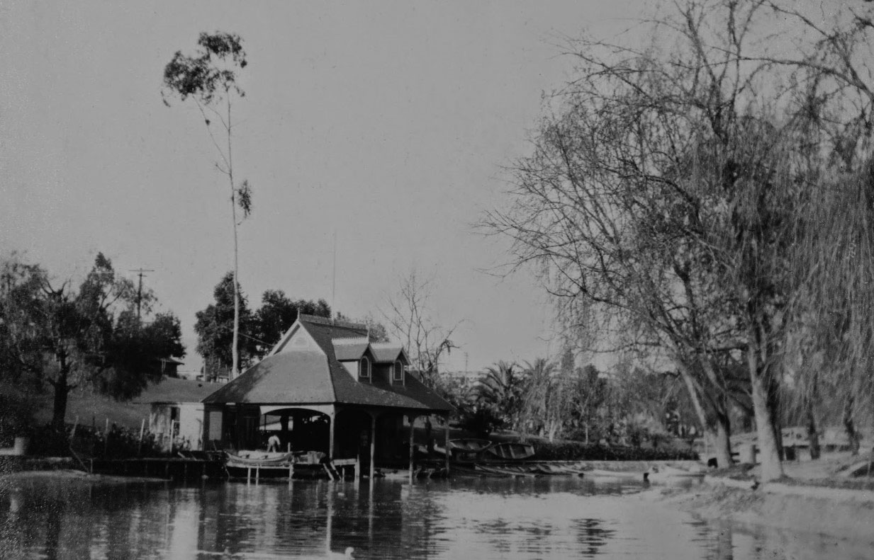
| (1914)* - A view of the original boathouse, built in the 1890s. From the collection of the Workman and Temple Family Homestead Museum, City of Industry, California. |
 |
|
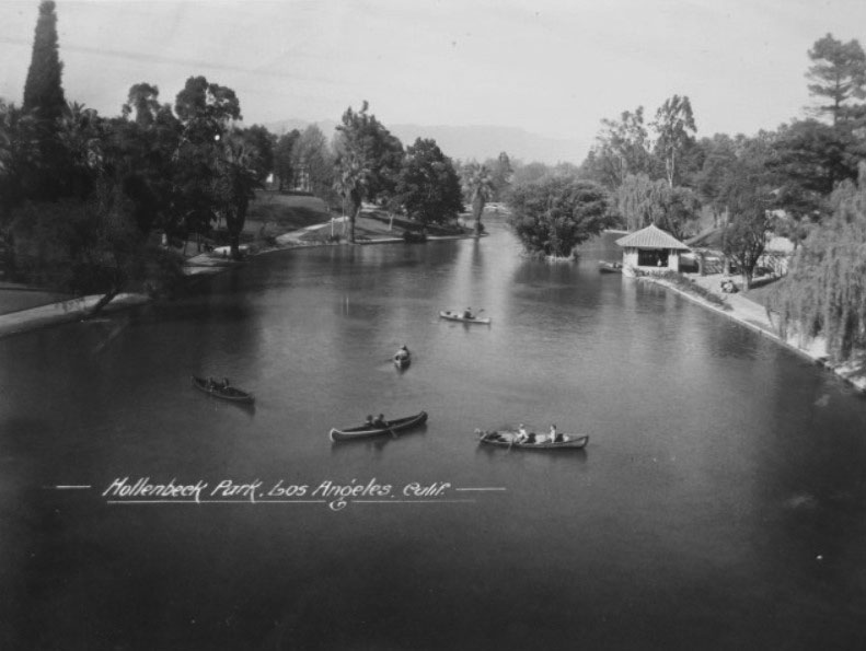
| (n.d.)^ - View showing several people in canoes enjoying the placid waters of the lake in Hollenbeck Park. The boathouse is visible to the right along the lake's edge; a small island, Bamboo Island, sits in the middle of the lake; beyond that, an arched bridge can be partially seen behind still more tree foliage. |
Historical Notes Hollenbeck Park was easily the most visible aspect of Boyle Heights, with many postcards, including real photo cards, professionally published in the first few decades of the 20th century demonstrating its importance. * |
 |
|
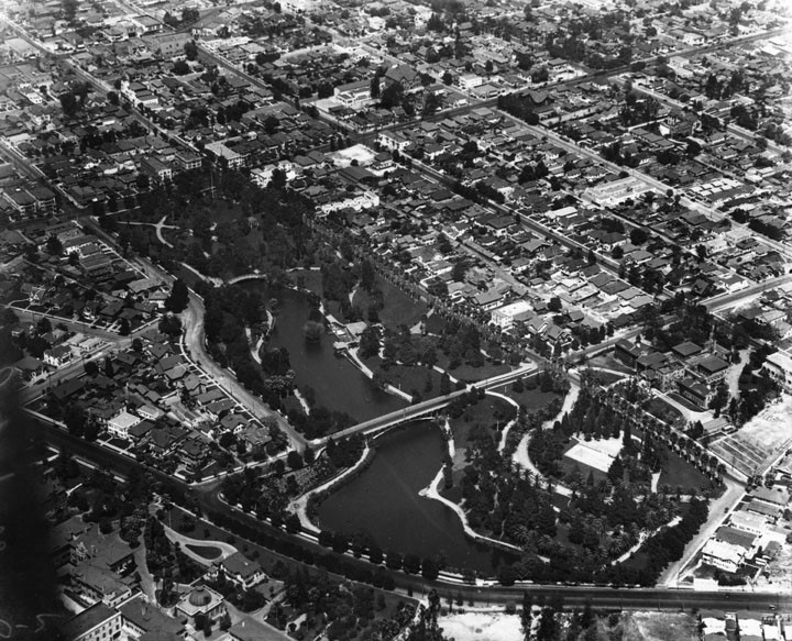
| (1924)^ - Aerial view of Hollenbeck Park and surrounding area. Hollenbeck Home for the Aged can be seen at center-right. |
Historical Notes Over time, development continued to accelerate near the park and elsewhere in Boyle Heights, although development trends in west Los Angeles and the emerging industrial core of the east part of downtown brought about a transformation of Boyle Heights from a middle and upper class residential suburb to a working and middle class enclave.* |
 |
|
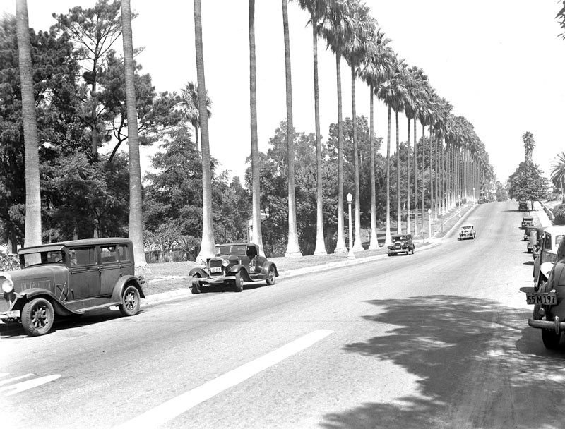
| (ca. 1935)^ - Tall palms along the street skirting Hollenbeck Park. |
Historical Notes In the 1950s, the Golden State Freeway was built against the western boundary of Hollenbeck Park.*^ |
 |
|
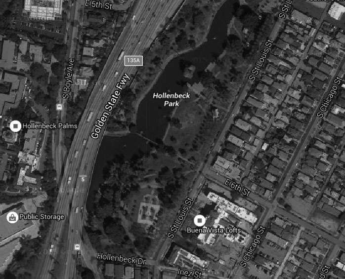
| (2015)#*^# - Google satellite view showing Hollenbeck Park and surrounding area. |
Historical Notes Some of the Park's features include a man-made lake, rolling hills, towering palms, picnic areas, and even a skateboard park. Hollenbeck Park is located at 415 South Saint Louis Street and the corner of Fourth Street in the Boyle Heights area of Los Angeles.^ |
* * * * * |
Los Angeles Athletic Club
 |
|
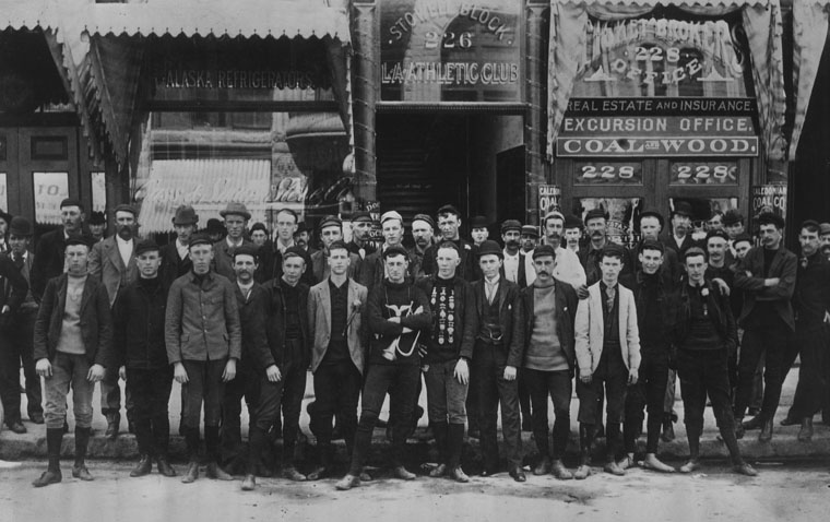
| (1893)^ - Members of the Los Angeles Athletic Club pose in front of the building for a group portrait. The club was located at 226 South Spring Street in the Stowell Block. A young man in front (center) is covered in medals. |
Historical Notes It was on the night of September 8, 1880, in the old Arcadia building located on North Spring Street, that the Los Angeles Athletic Club was born. Forty prominent Angelinos - sons of pioneers, adventurers and athletes - gathered in Frank Gibson's law office to create an American Style Club. During the late 1800's, The Club became a haven for up and coming members of the Los Angeles community. Health, recreation, grace and vigor became the motto of this distinguished club.*#^ The Los Angeles Athletic Club used several locations before settling into its own twelve story building in downtown Los Angeles in 1912. The LAAC building was notable at the time for being the first building in Southern California to have a swimming pool on an upper floor.*^ |
 |
|
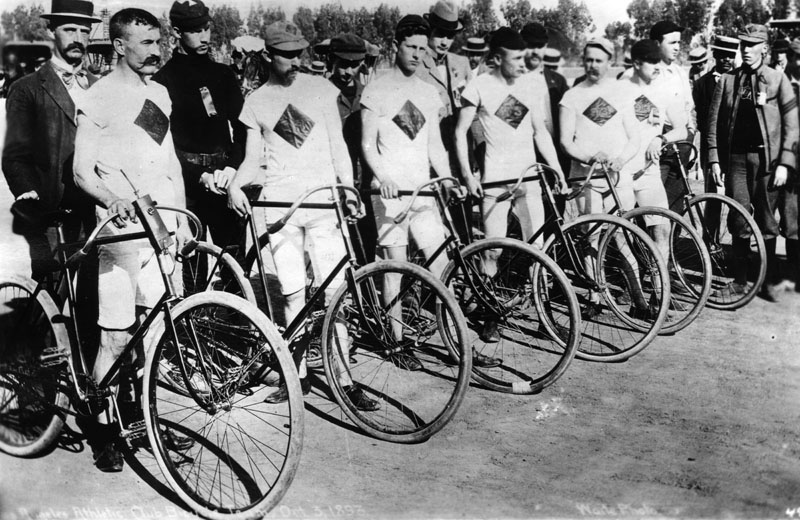
| (1893)^ - Photo of the Athletic Club bicycle team taken before the 2T mile race at Agriculture Park, October 3, 1893. |
Historical Notes Athletes from the Los Angeles Athletic Club have earned numerous medals in the Summer Olympics, with a particularly high number during the 1932 Los Angeles Olympiad. The total medal tally for the LAAC is 97 medals, including 47 gold.*^ |
* * * * * |
Agricultural Park (later Exposition Park)
.jpg) |
|
| (1893)^^ - Agricultural Park (later renamed Exposition Park) Start of 25 mile bicycle race, October 3, 1893. |
Historical Notes In 1880, John Hollenbeck, with former California Governor John G. Downey, horticulturalist Ozro W. Childs and other associates, persuaded the State of California to purchase 160 acres in Los Angeles to foster agriculture in the southland. The property, then known as Agricultural Park, is now known as Exposition Park, home to the Los Angeles Coliseum and the Los Angeles County Museums.*^ |
 |
|
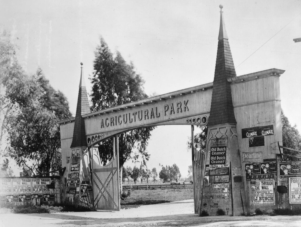
| (ca. 1910)^ - Before Exposition Park, Los Angeles had Agricultural Park, at the same spot. Right here. Seen here is the Wesley Avenue entrance. |
Historical Notes Exposition Park was originally created as an agricultural park, and 160 acres were set aside for the Southern District Agricultural Society. In 1913, it was renamed Exposition Park according to the “City Beautiful” movement with 4 anchor tenants: California Museum of Science and Industry (Exposition Building), National Armory, Domed National History Museum and the Sunken Garden (which in 1928 was later renamed the Rose Garden).^### |
 |
|
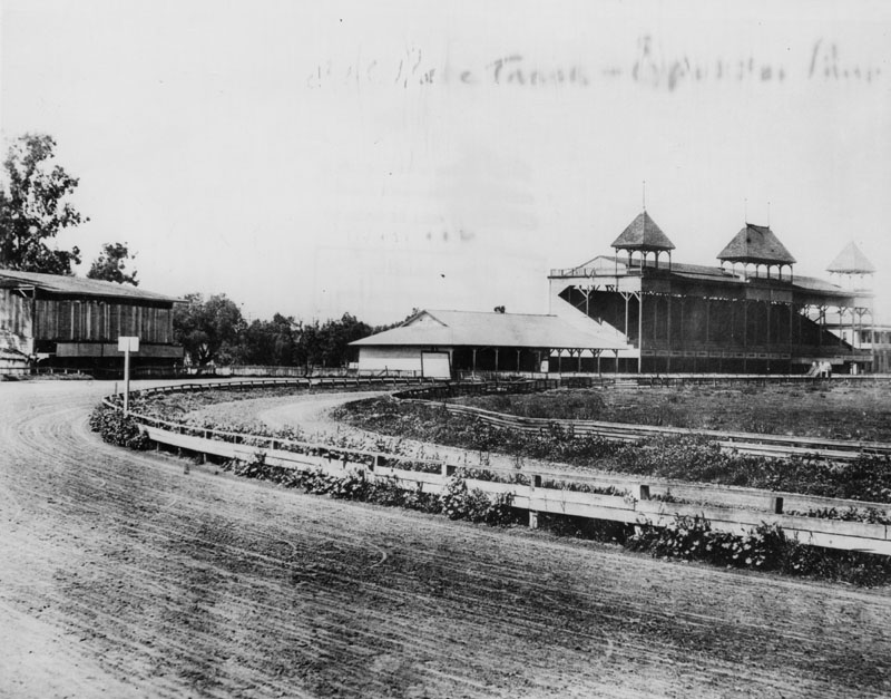
| (ca. 1900)^ - Partial view of the racetrack at Agricultural Park (later Exposition Park) in the early 1900s. Photograph shows the grandstand with three open towers, an adjacent smaller structure, possibly a concession stand, and another unidentified structure on the extreme left. |
Historical Notes Originally, this piece of land served as an agricultural fairground from 1871 to 1911. Farmers sold their harvests on the grounds, while horses, dogs, camels, and later automobiles, competed along the racetrack (seen).^ |
 |
|
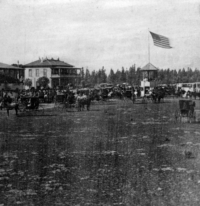
| (ca. 1890s)^ - Race day at Agricultural Park, taken sometime before 1900. The Club House is in the background. |
Historical Notes In the late 1800s and early 1900s, the city's most influential families moved into the neighborhood but did not appreciate the racing and gambling that came with it. As a result, this racetrack was transformed into the now-famous Exposition Park Rose Garden.^ |
 |
|
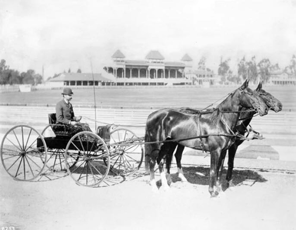
| (1895)* - Photograph of Captain Pierce of the Los Angeles Police Department on carriage with race horse team at the Agricultural Park Horse Show. Behind the Captain and his horse team are the race tracks. In the distances are the buildings and seating to accommodate the audiences that attend the races. |
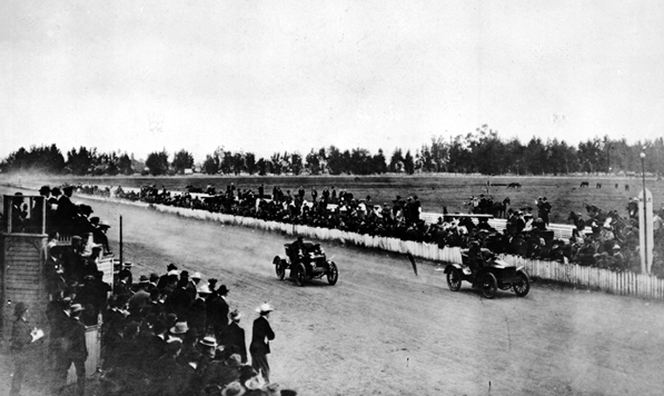 |
|
| (1903)*^#* - View showing a large crowd watching an automobile race in Agricultural Park. |
Historical Notes In 1909, plans were nearly complete for the building of the Natural History Museum (only then it was the Museum of History, Science, and Art) and a state armory. Bids were solicited. The next year, the site changed its name from Agricultural to Exposition park.^ |
 |
|
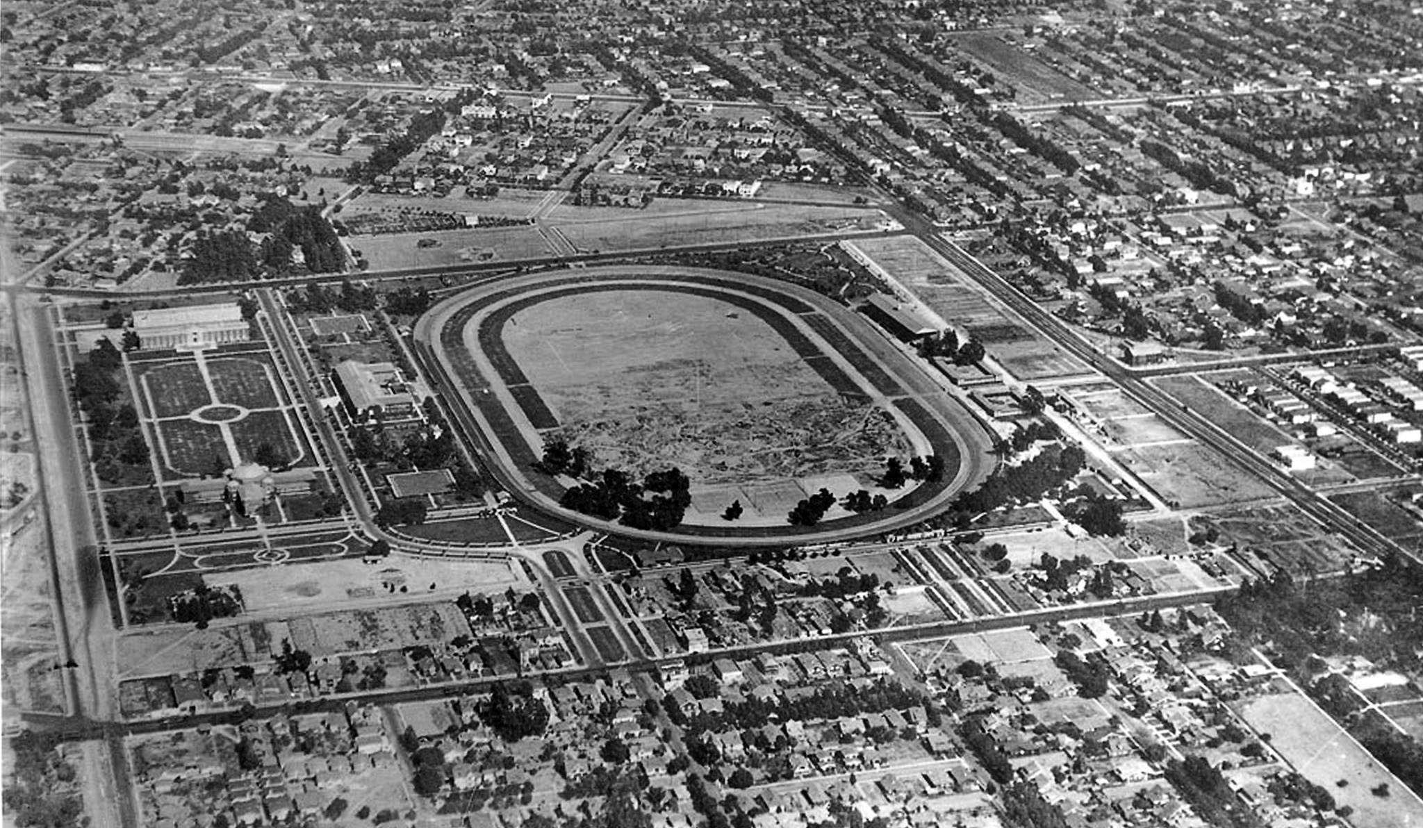
| (1918)*#^* - This aerial photo was taken five years after Exposition Park first opened (Nov. 6, 1913). Note the mile-long auto track, a feature that disappeared after the Coliseum was built in 1923. Click HERE to see more of the Coliseum at Early City Views (1900 - 1925). |
* * * * * |
Mt. Lowe Railway
 |
|
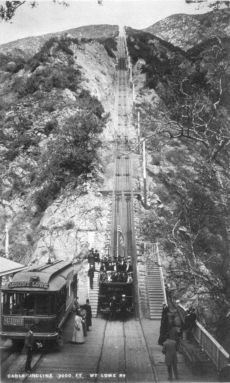
| (1893)^^ - The great Cable Incline (seen above) went from Rubio Pavilion (the bottom) to Echo Mountain (at the top). In this picture one of the black cable cars, named "Rubio" sits at the bottom with some passengers aboard and others waiting nearby. Also on the left is the electric car which brought customers to the station from Mountain Junction. |
Historical Notes At the turn of the century (1893 - 1938) one of the most famous excursion in Southern California was the Mt. Lowe trip. Sightseers from all around the Los Angeles area took a Pasadena car to Altadena and Rubio Canyon. They then transferred to a cable car on the Incline Railway that went up a 62% grade to Echo Mountain. From there they would take a narrow-gauge trolley car winding its way up the rugged San Gabriel Mtns. and finally would arrive at Alpine Tavern on Mt. Lowe, a nearly 7 mile railway ride from the base of the mountain. The views of the valley floor and beyond were spectacular.^ |
 |
|
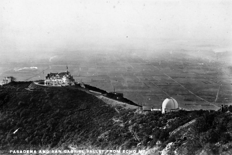
| (ca. 1890s)^ - View overlooking Echo Mountain with Pasadena and the San Gabriel Valley in the background below. |
Historical Notes Buildings at Echo Mountain, reached by the Mount Lowe Railway, included the Echo Mountain House, a 70-room hotel at an elevation of approximately 3500 ft., the 40-room Echo Chalet, the observatory, car barns, dormitories, repair facilities, and a casino/dance hall.^ Click HERE to see more in Early Views of Mt. Lowe Railway. |
 |
|
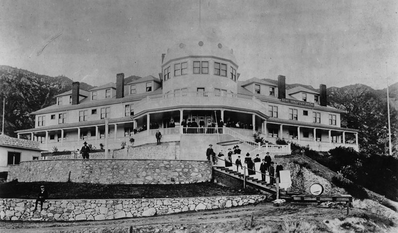
| (ca. 1890s)^ - View of some of the hotel guest standing on the veranda and stairways at the front of Echo Mountain House. |
Historical Notes Completed in the fall of 1894, the Echo Mountain House was a marvel. The four-story Victorian building was marked by a tall, cylindrical tower and capped by a metal dome and a huge American flag. The bright white exterior was marked by a long row of windows on each floor. At the building’s entrance, two sweeping verandas looked off across the canyons and the valley. The interior of the hotel was extravagant, with detailed wood inlay, the finest floral-patterned carpet and handmade furniture throughout. There were seventy guest rooms, large areas for office space, a massive social hall and dining room, a souvenir shop, a Western Union office, a bowling alley, a billiard room, a barbershop and a shoeshine stand.^^## |
 |
|
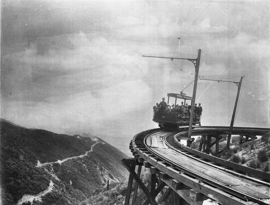
| (1893)^^ - Photograph of the first passengers of Professor S.C. Lowe's dramatic Mount Lowe Railway, July 4, 1893. There are a couple of dozen people in the rail car (number "9") which is headed toward the camera on the circular bridge. The trestle structure is visible below the rails. The hotel on the mountaintop is visible at left as is the rail approach to the hotel. |
Historical Notes From the top of Echo Mtn, passengers could transfer to another trolley line, the Alpine Division, which would take them to the upper terminus at Crystal Springs and Ye Alpine Tavern, a 22-room Swiss Chalet hospice with a complement of amenities from tennis courts, to wading pools, to mule rides. This phase of tracks cut through the broad Las Flores Canyon which gave a tremendous panorama of the valley floor below. At one point a tall trestle was required to bridge a broad and deep chasm with a bridge so named High Bridge.*^ |
Click HERE to see more in Early Views of Mt. Lowe Railway |
* * * * * |
Long Wharf (Pacific Palisades)
 |
|
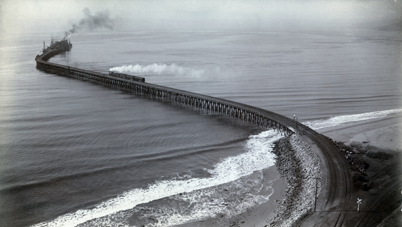
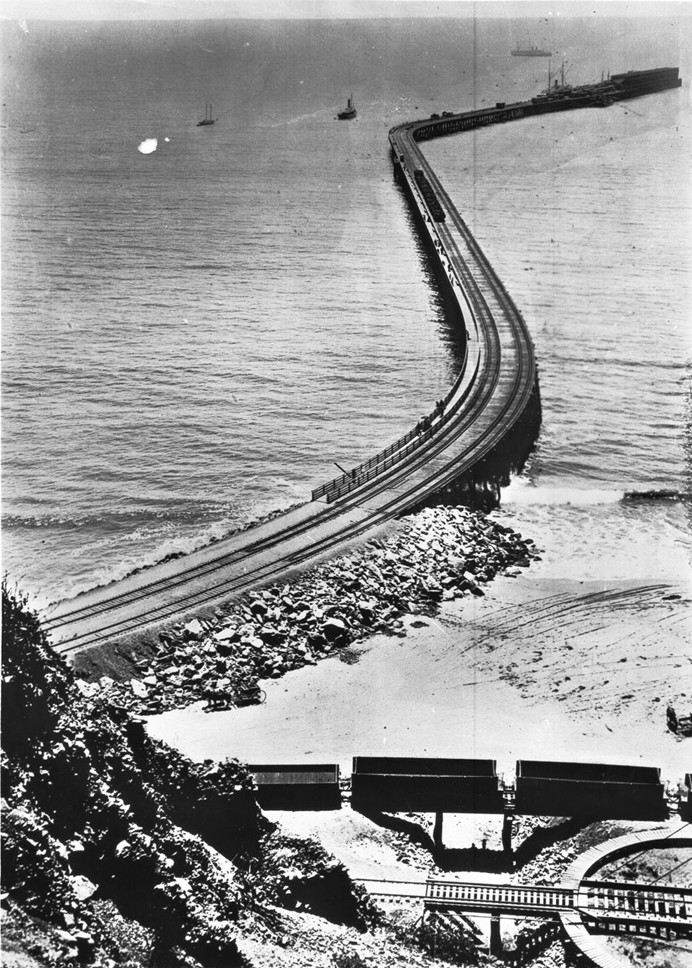
| (ca. 1893) - Aerial view of the Southern Pacific Mammoth Wharf, Port Los Angeles, Calif. The wharf was also known as the old Santa Monica Long Wharf, north of Canyon. A white cloud of smoke can be seen from a train travelling on the tracks to the business end, at the end of the wharf. |
Historical Notes When the Southern Pacific Railroad arrived at Los Angeles, a controversy erupted over where to locate the city's main seaport. The SPRR preferred Santa Monica, while others advocated for San Pedro Bay. The Long Wharf was built in 1893 at the north end of Santa Monica to accommodate large ships and was dubbed Port Los Angeles. At the time it was constructed, it was the longest pier in the world at 4700 feet, and accommodated a train.*^ Also known as the Los Angeles Long Wharf the site was designated as California Historical Landmark No. 881 (Click HERE to see California Historical Landmarks in LA). |
 |
|
| (1898)^ - Photo shows the business end of the mammoth wharf (Long Wharf) in Santa Monica. Several fully loaded railcars can be seen. |
 |
|
| (1893)^^ - View of the entire length of the Long Wharf from the beach all the way to its extremity almost a mile away. Note the RR turntable in the lower right corner. A horse-drawn carriage can be seen on the beach between the rail cars and the wharf. Empty railcars sit on a bridge over a gully. |
Historical Notes In 1897, San Pedro Bay, now known as the Port of Los Angeles, was selected by the United States Congress to be the official port of Los Angeles (Port of Los Angeles) over Santa Monica. Still, the Long Wharf acted as the major port of call for Los Angeles until 1903. Though the final decision disappointed the city's residents, the selection allowed Santa Monica to maintain its scenic charm. The rail line down to Santa Monica Canyon was sold to the Pacific Electric Railway, and was in use from 1891 to 1933.*^ Click HERE to see more in Early Views of San Pedro and Wilmington. |
 |
|
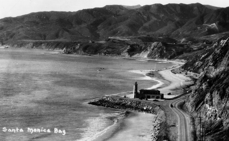
| (ca. 1927)^ - View of the Santa Monica Bay coastline, showing a lighthouse and bathhouse near the Pacific Palisades. The lighthouse stands at the spot where the Long Wharf used to extend out into the ocean. |
Historical Notes The Pacific Palisades lighthouse was built as a bathhouse with a working light in 1927. In the early 1930s the structure along with the beach was sold to Will Rogers and later the beach was given to the state of California and renamed the Will Rogers State Beach.^ |
Click HERE to see more in Early Views of the Long Wharf |
* * * * * |
Santa Monica
 |
|
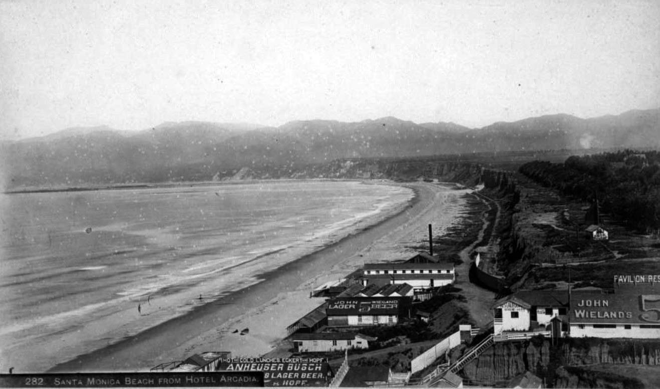
| (1893)#^^ - View showing restaurants on the North Beach, as seen from the Arcadia Hotel. Signs on the restaurants read "Hot and cold lunches, Eckert and Hopf, Anheuser Busch Lager Beer" "Pavilion Restaurant" and "John Wieland lager beer." The Santa Monica Bath House is seen beyond the "John Wieland" sign, with a bandstand shell on the bluffs above (in present-day Palisades Park) and the Long Wharf visible in the distance. |
 |
|
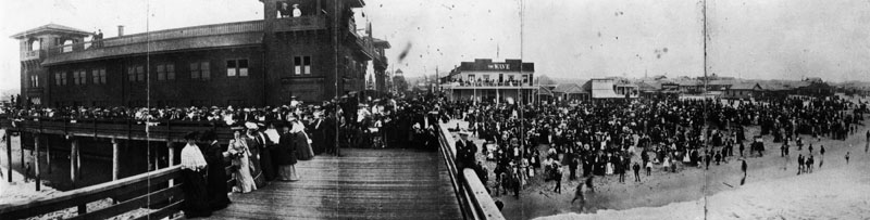
| (ca. 1895)* - A panoramic view of one of the ocean piers and parks along the ocean before 1900. Huge cowds are on the pier and on the beach next to it. |
Historical Notes In 1895, Abbot Kinney acquired the deed to the coastal strip previously purchased by W.D. Vawter and named the area Ocean Park. It became his first amusement park and residential project. A race track and golf course were built on the Ocean Park Casino. After a falling out with his partners he focused on the south end of the property, which he made into Venice of America.*^ Click HERE to see more in Early Southern California Amusement Parks. |
 |
|
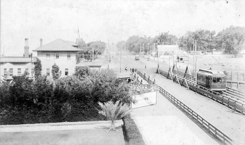
| (1896)^ - View is looking north across the bridge on Ocean Avenue, from the Arcadia Hotel. A trolley can be seen on the right. In the middle of the photograph, a sign reads "Arcadia Baths, hot salt baths, new tubs." |
 |
|
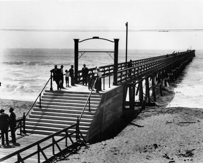
| (ca. 1897)^ - A view of the 500 ft. long Ocean Park pier, built by the Santa Fe Railroad in 1895, and located about 300 feet south of Hill St. This view shows several people standing on the pier as we look towards the ocean. |
Click HERE to see more in Early Views of Santa Monica. |
* * * * * |
Marina del Rey
 |
|
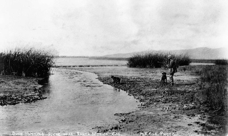
| (1890)*#*^ - Duck hunting in what is now known as the Marina del Rey. |
Historical Notes Prior to its development as a small craft harbor, the land occupied by Marina del Rey was a salt-marsh fed by fresh water from Ballona Creek, frequented by duck hunters and few others. Burton W. Chace, a member of the Los Angeles County Board of Supervisors, referred to the area as mud flats, though today the area would more properly be referred to as wetlands.*^ Click HERE to see more Early Views of Marina del Rey. |
* * * * * |
Playa del Rey
.jpg) |
|
| (ca. 1902)* – View looking east showing a well-dressed man holding his shoes while standing knee deep in the Playa del Rey lagoon. |
Historical Notes The Playa del Rey area, located about two miles south of Kinney's Venice of America resort, was once, centuries ago, the mouth of the Los Angeles River. But after the river shifted course to begin emptying in Los Alamitos Bay in Long Beach, it left behind a sleepy lagoon more than two miles wide and one fifth of a mile wide with a trickle of fresh water flowing to sea along La Ballona Creek. Click HERE to see more Early Views of Playa del Rey. |
* * * * * |
Pico and Figueroa
 |
|
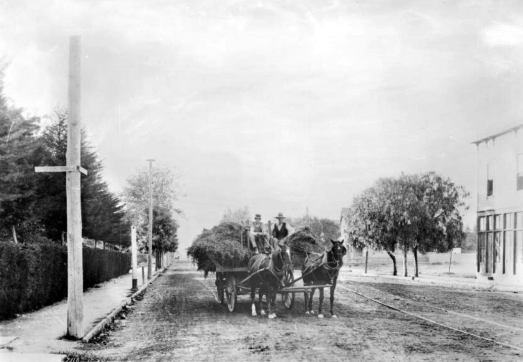
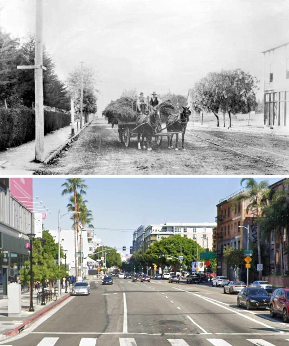
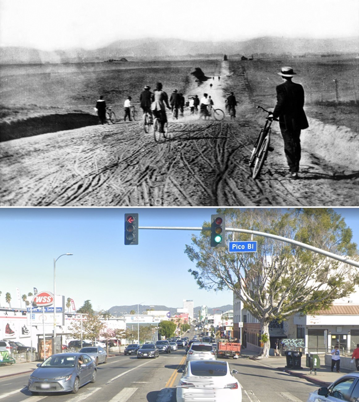
| (ca.1888)* - Photographic portrait of brothers Ralph and Clarence Kinkaid with a load of hay on Pico Boulevard looking east from Figueroa Street. |
Historical Notes In 1888, Pico Boulevard and Figueroa Street marked the edge of a semi rural Los Angeles. The unpaved road was shared by wagons, horses, and an early streetcar line, whose rails can be seen in the dirt. The area was made up of ranches, large residential lots, and a small number of homes belonging to early civic and legal figures. The northeast corner was home to Judge O. Melveny, while the other corners were occupied by private residences, including the Kinkaid ranch itself. These properties sat on large parcels of land, reflecting a time when this part of the city was still open and lightly developed. Pico Boulevard already served as an important east west route, linking farms and ranches to the growing city. Scenes like this show how quickly Los Angeles would change. Within a few decades, open land and private estates would give way to dense housing, commercial buildings, and paved streets shaped by the automobile and urban growth. |
 |
|
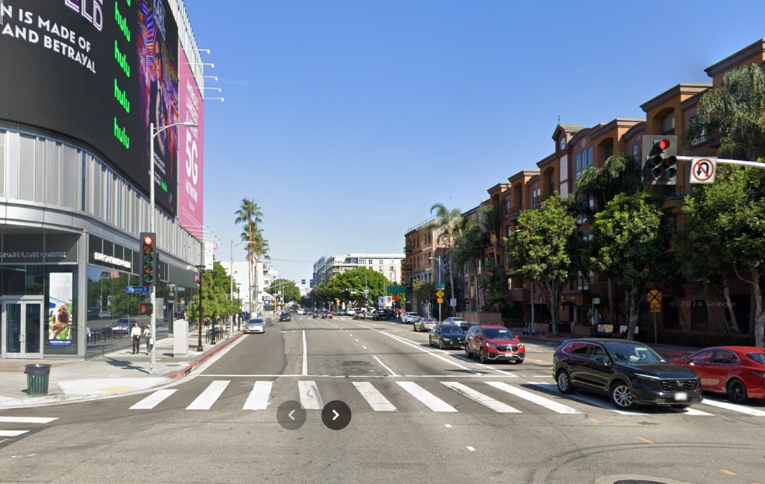
| (2024)* - Google Street View looking east on Pico Boulevard at Figueroa Street. |
Historical Notes Today, Pico Boulevard and Figueroa Street sit at the center of one of Los Angeles most active downtown districts. The intersection is surrounded by wide streets, heavy traffic, and large scale buildings tied to housing, tourism, and entertainment. The high rise on the northeast corner is the AC Hotel Downtown Los Angeles, a modern residential style hotel that reflects recent growth in downtown living and visitor accommodations. Its height contrasts sharply with the low ranch homes and open land that once defined this corner. Behind the camera, the Los Angeles Convention Center stretches south of Pico Boulevard, while the Crypto.com Arena sits just north of Pico. Together, these landmarks show how the area has evolved into a center for major events, tourism, and high density urban life. |
Then and Now
 |
|
| (1888 vs. 2024)* – Looking east on Pico Boulevard at Figueroa Street. Photo comparison by Jack Feldman. |
Historical Notes This comparison highlights one of the clearest transformations in Los Angeles. In 1888, this intersection stood on the edge of the city, surrounded by ranch land, private homes, and dirt roads shared by wagons and horses. By 2024, the same view shows a fully urban landscape shaped by downtown expansion. Housing towers, hotels, and major civic and entertainment venues now fill the blocks that were once large residential lots and farmland. Pico Boulevard remains a key east west route, but its scale and role have changed completely. Seen together, these images show how transportation, housing demand, and public investment reshaped Pico and Figueroa over more than a century. |
* * * * * |
Pico and Flower
 |
|
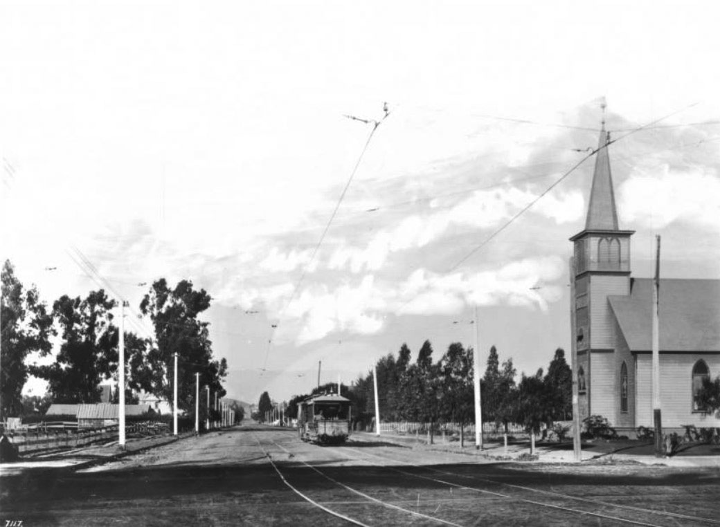
| (1897)* - View of Flower Street looking north from Pico Boulevard. A cable-car makes its way down the unpaved road, with a second set of tracks to the left of it, passing a church to the right. Sidewalks line either side of the street. To the left, a post-and-rail fence surrounds what appears to be a chicken coop and a small pasture. Click HERE to see contemporary view. |
Then and Now
 |
|
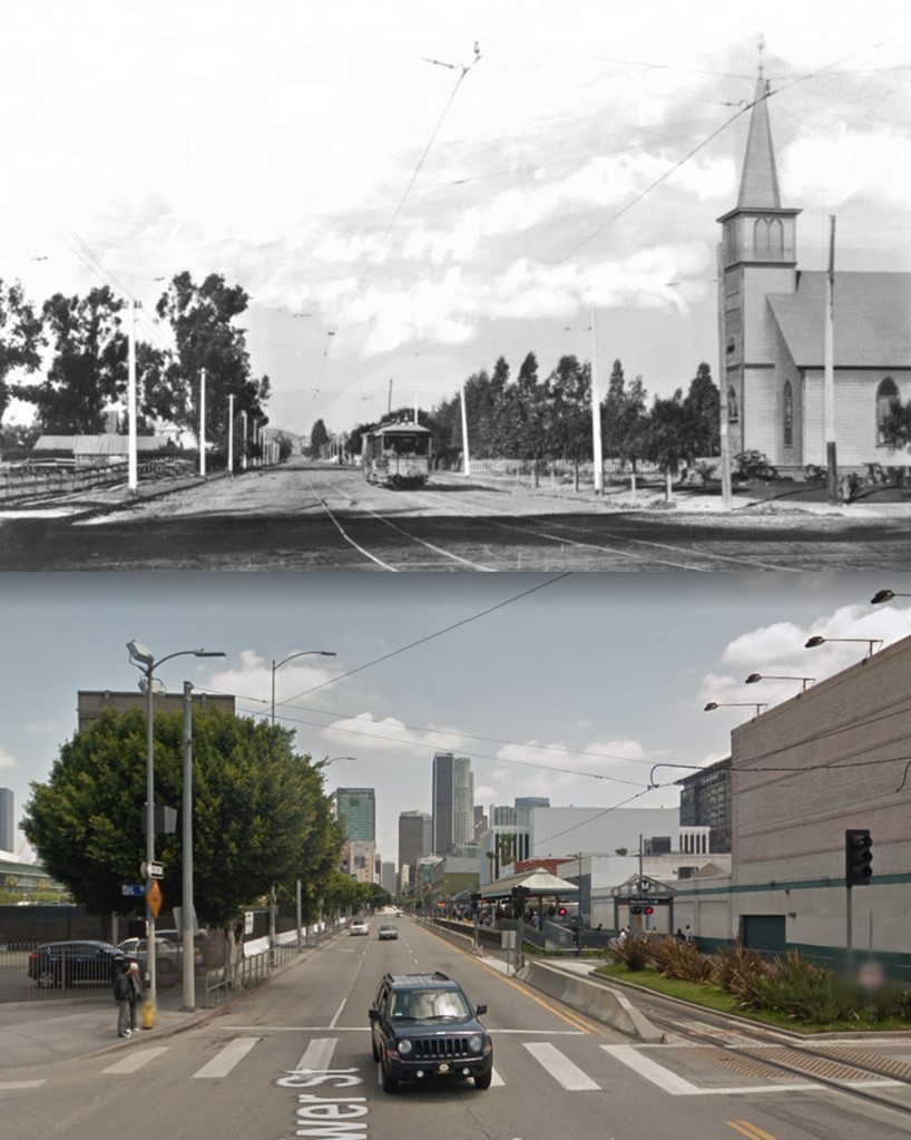
| (1897 vs. 2015)* – Looking North on Flower Street from Pico Boulevard. Photo comparison by Jack Feldman. |
* * * * * |
Pico and Alvarado
.jpg) |
|
| (1895)^ - Farm operations on the Mark C. Jones tract, at what is now Alvarado Street and Pico Boulevard, in 1895. William Dibble is standing in the wagon. |
Historical Notes In 1897, the Los Angeles Golf Club (predecessor of the Los Angeles Country Club) leased the land seen above and built a nine-hole golf course that came to be known as "Windmill Links," due to the use of an old windmill as the clubhouse. Jones subdivided the land into residential lots in 1902. The lots were sold for $10 each, with the caveat that the buyer was required to build a house costing at least $4,000. The area was promoted as a "second Chester Place," referring to the city's most prestigious street in the West Adams district. By 1906, the development was full. Alvarado Terrace Historical District is a designated historic district southwest of Downtown Los Angeles, located along Alvarado Terrace between Pico Boulevard and Alvarado Street. Six homes and a church in the district were designated as Historic-Cultural Monuments in 1971, and the entire district was listed in the National Register of Historic Places in 1984.*^ Click HERE to see complete list of LA HIstoric-Cultural Monuments. |
* * * * * |
Chinatown
 |
|
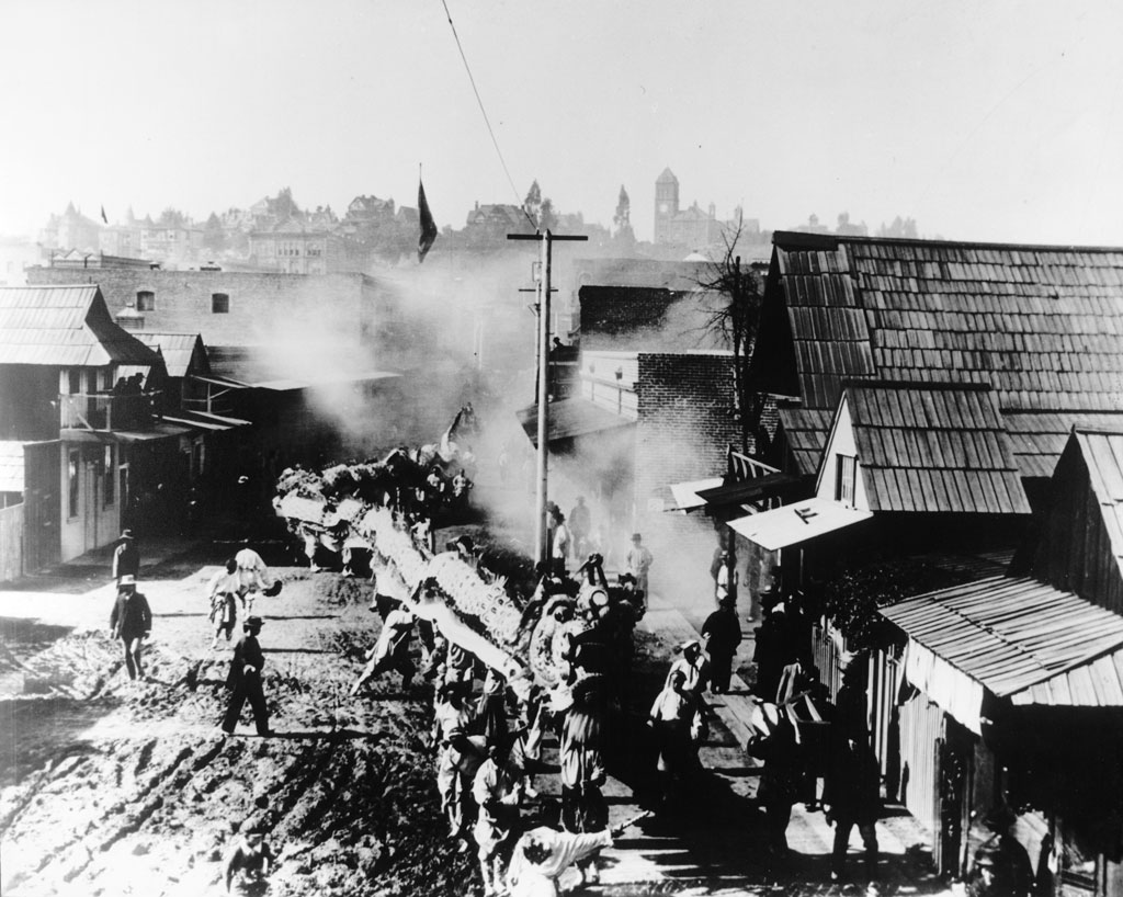
| (ca. 1890s)^^ - View of a Chinese New Year parade in Chinatown, Los Angeles. A dragon winds its way down the dirt street while the few onlookers show minor interest. In the distance the second Los Angeles High School can be seen on Fort Moore Hill. |
* * * * * |
Arcadia and Los Angeles Streets
 |
|
| (ca. 1890)* - View looking south on Los Angeles Street showing hay wagons, commercial buildings lining street. At right is the Arcadia block building housing the Los Angeles Printing Co., broom factory. |
Historical Notes The Arcadia Block building was the first business brick building in Los Angeles. |
 |
|
| (ca. 1895)* - View looking south on Los Angeles Street toward Arcadia Street. The Arcadia Block is seen on the SW corner with the Garnier Block and Jennette Block seen on the right. |
 |
|
| (ca. 1895)* - View looking south on Los Angeles Street toward Arcadia Street.The Arcadia Block is seen on the SW corner with the Garnier Block and Jennette Block seen on the right. Image enhancement and colorization by Richard Holoff |
 |
|
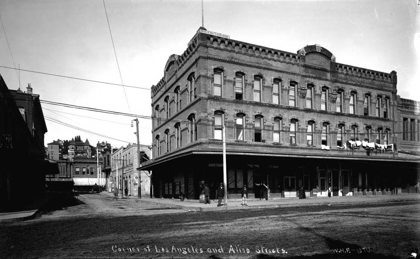
| (ca. 1895)* - Looking west on Arcadia Street from Los Angeles Street with Fort Moore Hill in the background. The three story Jennette Building is on the northwest corner of Arcadia and Los Angeles Streets with Sanchez Alley running directly behind it up to the Plaza at Republic Street. Photo is misidentified. Photo is mismarked - Aliso Street did not extend beyond Los Angeles Street. This is looking up Arcadia Street. |
* * * * * |
La Fiesta de las Flores Parade (aka La Fiesta de Los Angeles)
 |
|
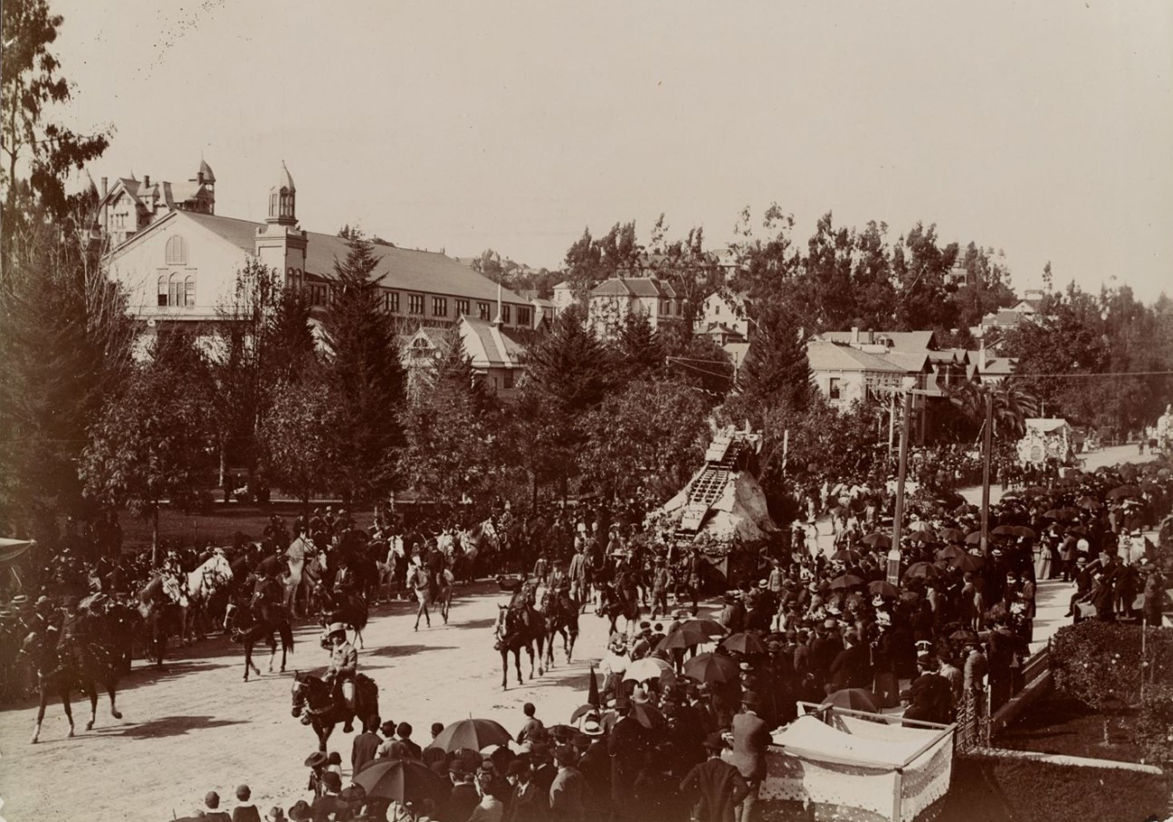
| (1894)* – A view looking northwest captures the inaugural La Fiesta de Los Angeles Parade on Hill Street, just south of 5th Street in downtown Los Angeles. Spectators and horseback riders watch as a float depicting the newly opened Mount Lowe Railway passes by. On the left is 6th Street Park, which later became Central Park and is known today as Pershing Square. The large building with towers beyond the trees is Hazard’s Pavilion, located at the northeast corner of Olive and 5th Street. The Rose Mansion can also be seen on the hillside of Bunker Hill. Photo from the Ernest Marquez Collection. |
Historical Notes “La Fiesta de Los Angeles” also called "La Fiesta de Las Floras" began on April 10, 1894 and was a four day festival that the city threw in its own honor celebrating its many different cultures. It continued throughout the 1890s and early 1900s. The event featured parades, floats, many flowers, athletic competitions, a costume ball, and carnival attended by masked revelers. It was conceived of by a local business man as a way to attract tourism at a time when the effects of the 1893 depression were being felt. |
 |
|
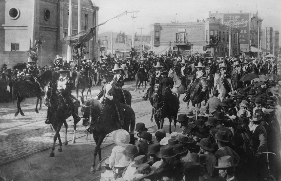
| (1901)* - Caballeros and señoras parading on horseback in front of the Plaza Church during La Fiesta de Los Angeles. Throngs of well-dressed people crowd the sidewalks on both sides of the street. The Grand Marshall of the parade is Francisco Figueroa. The young woman on the horse in black (foreground) is Katie Abbot, daughter of Merced Abbot of Merced Theatre. |
Historical Notes The Spanish title of the festival was reflective of a goal: to capture the color and the aura of old Los Angeles in its days as a pueblo under Mexican rule. Men in the garb of caballeros (horsemen) and vaqueros (cow hands) participated. So did Chinese, native Americans, and African Americans. It was a multi-cultural gala, distinct from any celebration elsewhere. |
 |
|
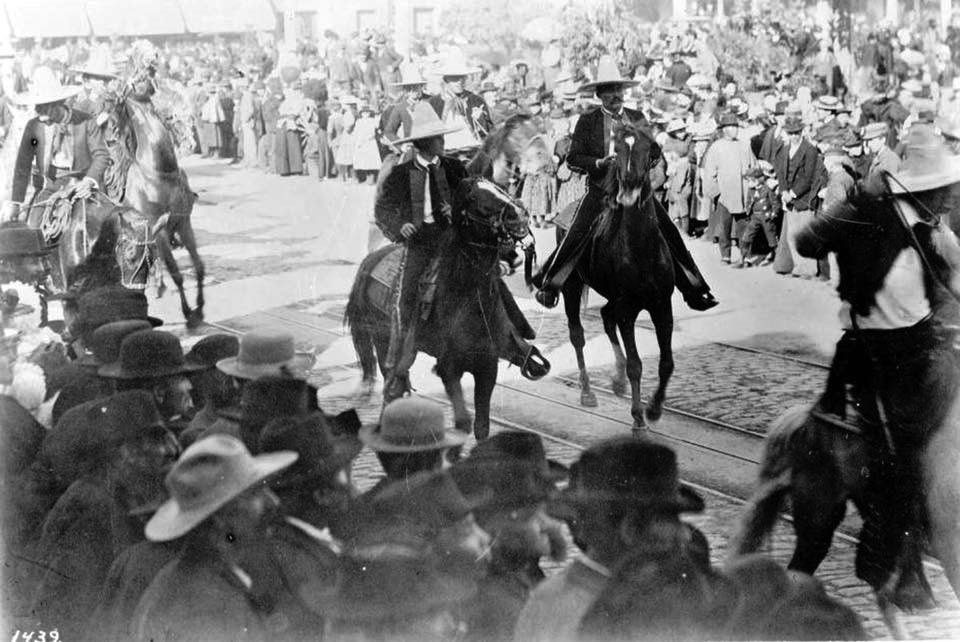
| (1895)* – Spectators line the streets to watch the La Fiesta de Los Angeles parade near the LA Plaza. |
 |
|
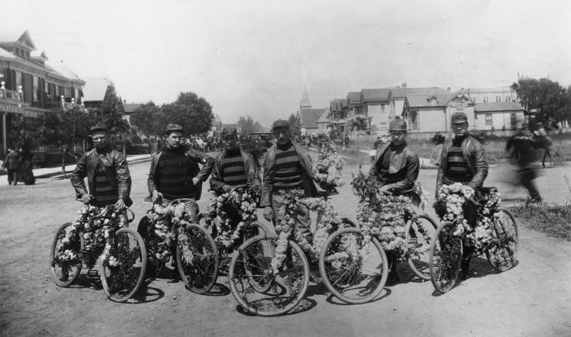
| (ca. 1894)^ - Cyclists in leather jackets and hats stand beside their flower-decorated bicycles as they pose on a wide, dirt avenue lined with houses. They are participating in the La Fiesta de las Flores parade. |
.jpg) |
|
| (ca. 1894)^ - Members of the cycling club are shown festively dressed prior to the La Fiesta de las Flores parade in downtown Los Angeles. |
 |
|
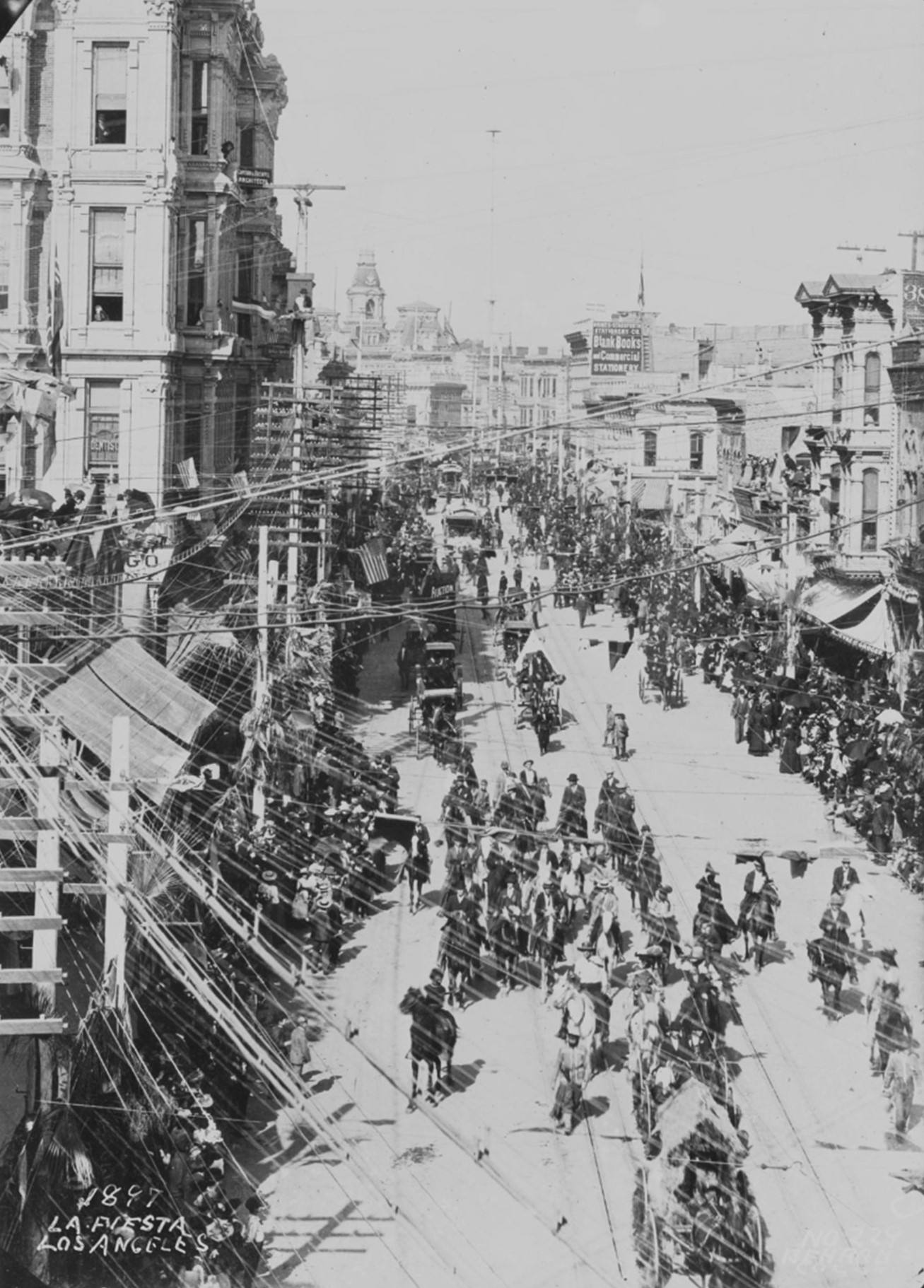
| (1897)* – Elevated view of "La Fiesta" parade on North Spring Street; shows horsemen in foreground, horse-drawn carriages and streetcars in background, utility poles and wires and spectators, multi-story business buildings, stores and shops at ground level; Jevne Grocer store in lower right foreground at 208-210 South Spring; Grimes-Strassforth Stationery Co., upper right, at 220 North Spring and 215-217 North Main; ornate cupolas of Baker Block and Main Street in background. |
Historical Notes Click HERE to see more early views of the La Fiesta de las Flores parade. |
* * * * * |
Broadway and 6th Street
 |
|
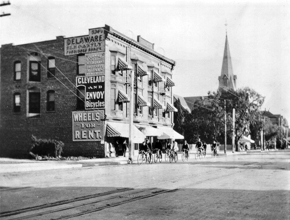
| (ca. 1896)^^ – View of the Delaware Hotel on Broadway, looking south between Fifth Street and Sixth Street, which later became the Dalton Theater. A group of nine individuals are bicycling past the front of the building whose brick-faced side sports signs which read "Delaware Elegantly", "Delaware Restaurant First Class [...] All Hours", "Cleveland and Envoy Bicycles" as well as "Wheels for Rent". Behind some tree cover in the background, the Spring St. School and the spire of the First Baptist Church can be seen. |
* * * * * |
Washington Street (later Washington Boulevard)
 |
|
| (1896)^ - View is looking west at Washington Street (now known as Washington Boulevard) and Maple Street. There are homes on both sides of the wide dirt road. Horse-drawn carriages can be seen in the background, as well as an early structure for St. Vincent Church (center). |
 |
|
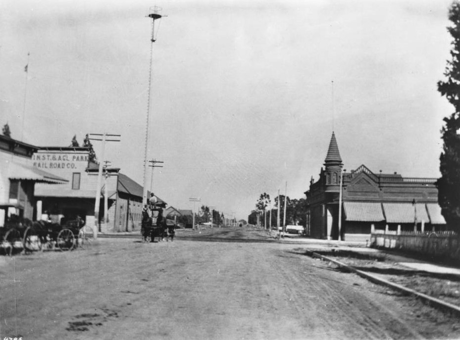
| (1896)* - View is looking east at Washington Boulevard from Main Street. There are storefronts on both sides of the wide dirt road. Horse-drawn carriages can be seen on the left as well as a very tall white pole or tower, with a small platform at the top. The platform is actually in the middle of the pole (see below). |
Historical Notes The tall pole seen in the upper-left of the photo is one of the City's first 150-ft tall electric light poles. Click HERE to see more in Early L.A. Streetlights. |
* * * * * |
Figueroa and Washington
 |
|
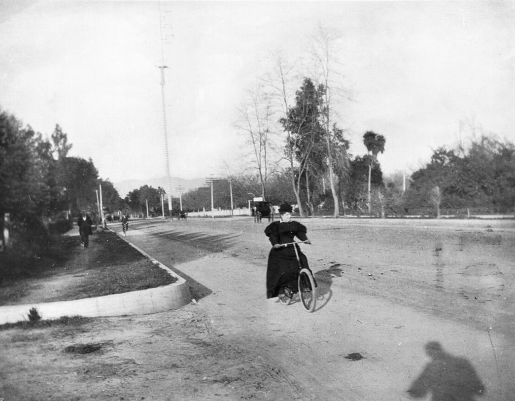
| (ca. 1898)* – Mrs. Henry Hazard on her bicycle at the corner of Washington and Figueroa Streets, looking north. Her husband, Henry T. Hazard, served as mayor of Los Angeles from 1889 to 1892 and played a key role in the city's late 19th-century development, particularly in infrastructure and city planning. In the distance, one of Los Angeles’ first electric streetlights stands tall. These 150-foot towers, equipped with carbon-arc lamps, were said to provide illumination comparable to a full moon. |
Historical Notes During his tenure as mayor, Henry Hazard focused on modernizing the city’s streets, expanding public services, and overseeing key civic projects. A lawyer by profession, he was also active in legal and real estate matters. Click HERE to see more on LA's 1st Electric Streetlights. |
 |
|
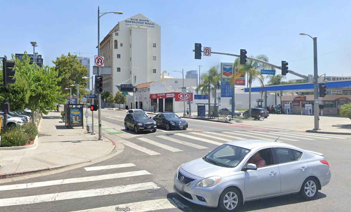
| (2022)* - Looking north on Figueroa Street at Washington Boulevard showing the 1926-built Patriotic Hall in the distance. |
Then and Now
 |
|
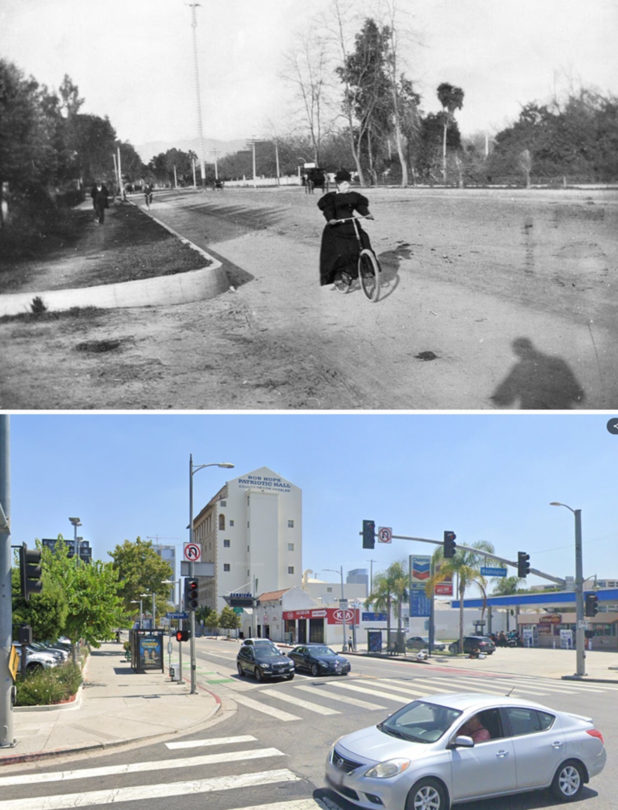
| (1898 vs. 2022)* - A 'Then and Now' comparison of Figueroa Street looking north at Washington Boulevard (originally Washington Street). Photo comparison by Jack Feldman. |
* * * * * |
First Automobile in Los Angeles
 |
|
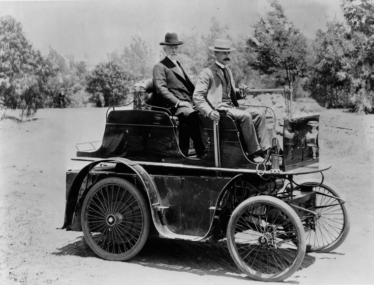
| (1897)^ - First automobile in Los Angeles, built for J. Philip Erie, the driver, a resident of Los Angeles at the time. |
Historical Notes The first automobile in Southern California appeared in 1897. It was built in a shop on Fifth Street in Los Angeles by S.D. Sturgis for J. Philip Erie. Erie became the first to drive an automobile on Los Angeles roads. By 1904, 1,600 cars were cruising the streets of Los Angeles. The maximum speed limit was 8 mph in residential areas and 6 mph in business districts. The passenger seen in the rear seat was William H. Workman, father of Los Angeles' Mayor Boyle Workman. |
* * * * * |
Echo Park Lake (Reservoir No. 4)
 |
|
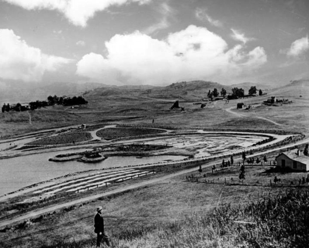
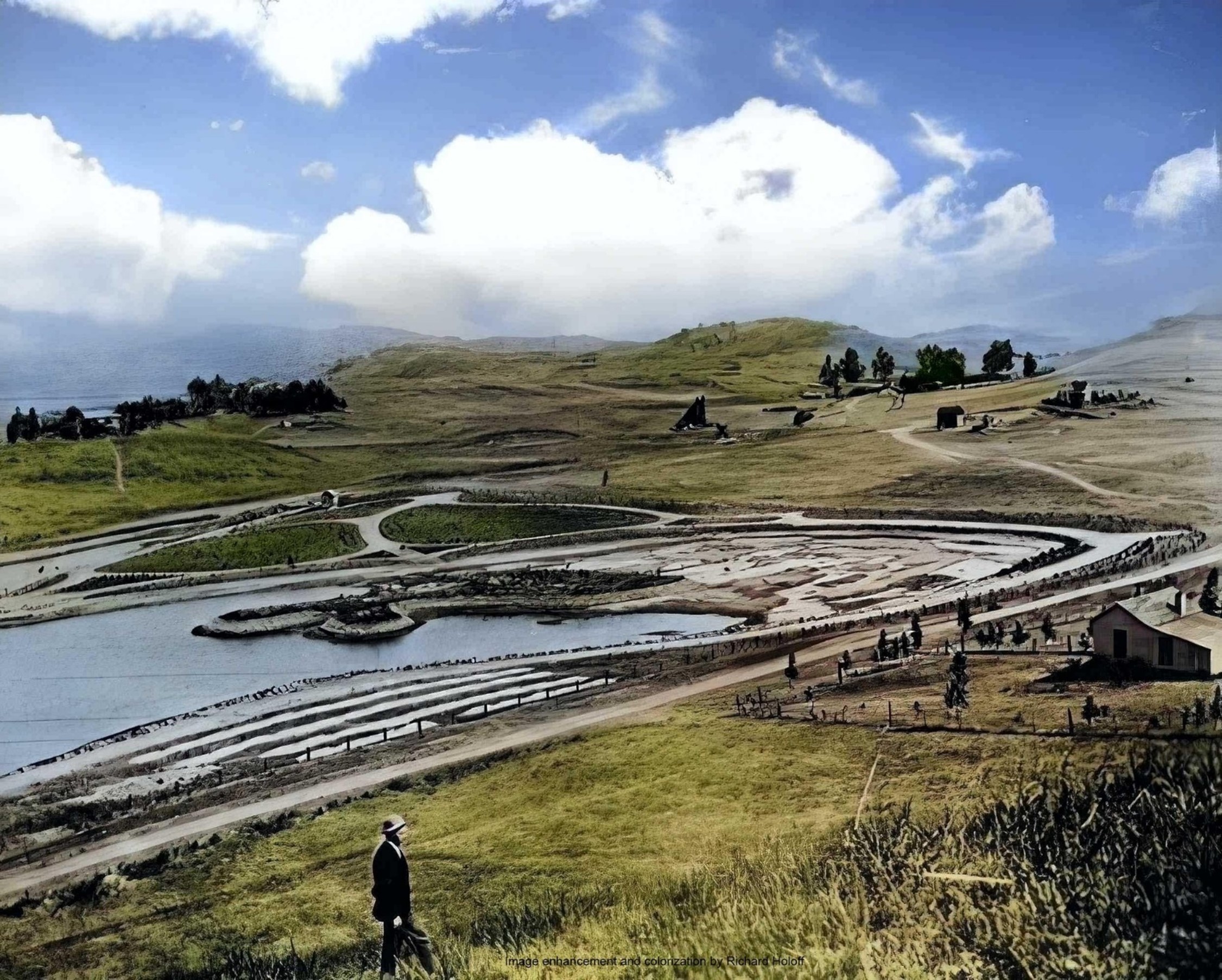
| (ca. 1894)^ - Early view of Echo Park Lake, looking northwest. The dirt road running along the lower half of the image is Montana Street, which would later become Echo Park Avenue. Trees and farmhouses pepper the landscape, and a man is visible at the bottom. |
Historical Notes Echo Park Lake didn’t start out as a man-made lake. Instead, its earliest use by the city was as a reservoir, storing water in a section sometimes known as the city’s “West End.” In those years this area was thought of as the city’s west side. The Los Angeles Canal and Reservoir Co. formed Reservoir No. 4 in 1868. The company obtained the water by digging a ditch that sent water flowing from the Los Angeles River – in the area now known as Los Feliz – along a zigzag path that merged with the Arroyo de los Reyes and then emptied into the reservoir.* The Arroyo de los Reyes originates near the Catholic school on Glendale Boulevard – right by the 2 off-ramp. It flowed southward, along Glendale Boulevard, occupied the area now taken by Echo Park Lake, and continued down to 2nd Street, then crossing through downtown LA, about a block or two south of Pershing Square, where it spread and created a big muddy mess. These flows eventually connected with the Los Angeles River, when they didn’t seep into the ground first.^ |
 |
|
| (ca. 1894)^ - Early view of Echo Park Lake, looking northwest. The dirt road running along the lower half of the image is Montana Street, which would later become Echo Park Avenue. Trees and farmhouses pepper the landscape, and a man is visible at the bottom. Image enhancement and colorization by Richard Holoff. |
 |
|
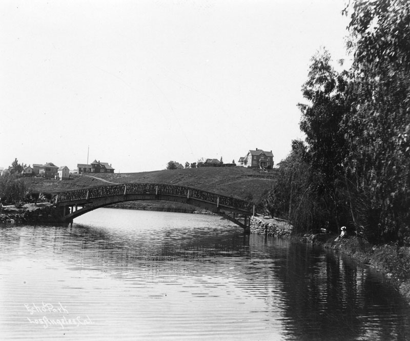
| (ca. 1895)^ - View looking northeast showing Echo Park with the snow-capped peaks of the San Gabriel Mountains in the distance and rolling countryside all around. Note the arched wooden bridge at center-right. |
Historical Notes In the late 1880s, a carriage maker turned real estate developer, by the name of Thomas Kelley, teamed up with other investors to purchase about 70 acres that included Reservoir No. 4—what is now Echo Park Lake. Kelley and his business partners sold off pieces of what they called the Montana Tract to individuals who built the business district along Sunset Boulevard and the densely packed homes and apartments that surround Echo Park Lake.* |
.jpg) |
|
| (ca. 1895)^ - View looking east showing Echo Park Lake and surrounding area with bridge seen at center-left. |
Historical Notes In those years, Reservoir No. 4 was held in check by a dam in the vicinity of Bellevue Avenue. From there, water traveled down the Woolen Mill Ditch to a mill near present-day Fifth and Figueroa Streets, not far from where Kelley lived. Kelley petitioned the city to provide a quitclaim, essentially a land swap, converting the reservoir lands into a park and private residences. That request, and quite possibly a legal challenge, led to three years of debate by the parks commission, the city council and the mayor.* |
.jpg) |
|
| (ca. 1895)^ - View looking south toward Bellevue Avenue and the dam holding up the lake, showing houses on bluff at left, a bank with trees on right, and two small wooden boats at center. |
Historical Notes In 1891, the city’s health officer inspected the lake's dam and determined that, if it were to hold a greater volume of water, it would pose a danger to residents who lived south of Bellevue Avenue. Two months later, city leaders struck a deal with the men who owned the land around the reservoir. Kelley and his associates – including William LeMoyne Wills, who like Kelley, would later serve on the school board – gave up 33 acres of land around the reservoir so that it could be used as a park. In exchange, the city agreed not to overflow the reservoir land, making the remaining land held by Kelley and his associates – including the street that would soon become Sunset Boulevard – far more valuable. When Mayor Henry Hazard signed the paperwork in 1891 allowing the park to be created, he envisioned a grand boulevard on Alvarado Street that would transport residents from Westlake – now MacArthur Park – to Echo Park Lake and then northeast to Elysian Park.* |
 |
|
| (1900)* - Wooden bridge over Echo Park Lake as it looked at the turn of the century. Note the homes on the hillside behind the bridge and the woman with the hat relaxing alongside the lake. |
Historical Notes Designed in the rustic style, one of the lake's two bridges helped pedestrians reach the island seen on the left, while a second bridge passed over the lake’s northwest corner, where the ditch delivered water from the Los Angeles River (and lotus now grow). The city began work landscaping the park in October 1892. By 1895, the park and accompanying boathouse were completed. |
 |
|
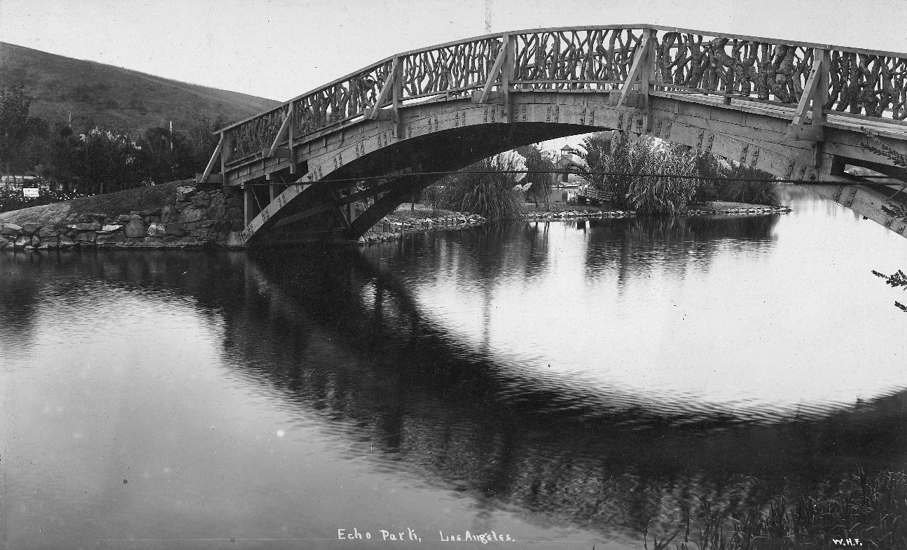
| (ca. 1895)^ – Close-up view looking south showing one of the two wooden bridges at Echo Park Lake. The bridge rail is made from fitted gnarled branches. In distance is a park bench and boathouse. |
Historical Notes The city began work landscaping the park in October 1892. By 1895, the park and accompanying boathouse were completed. |
 |
|
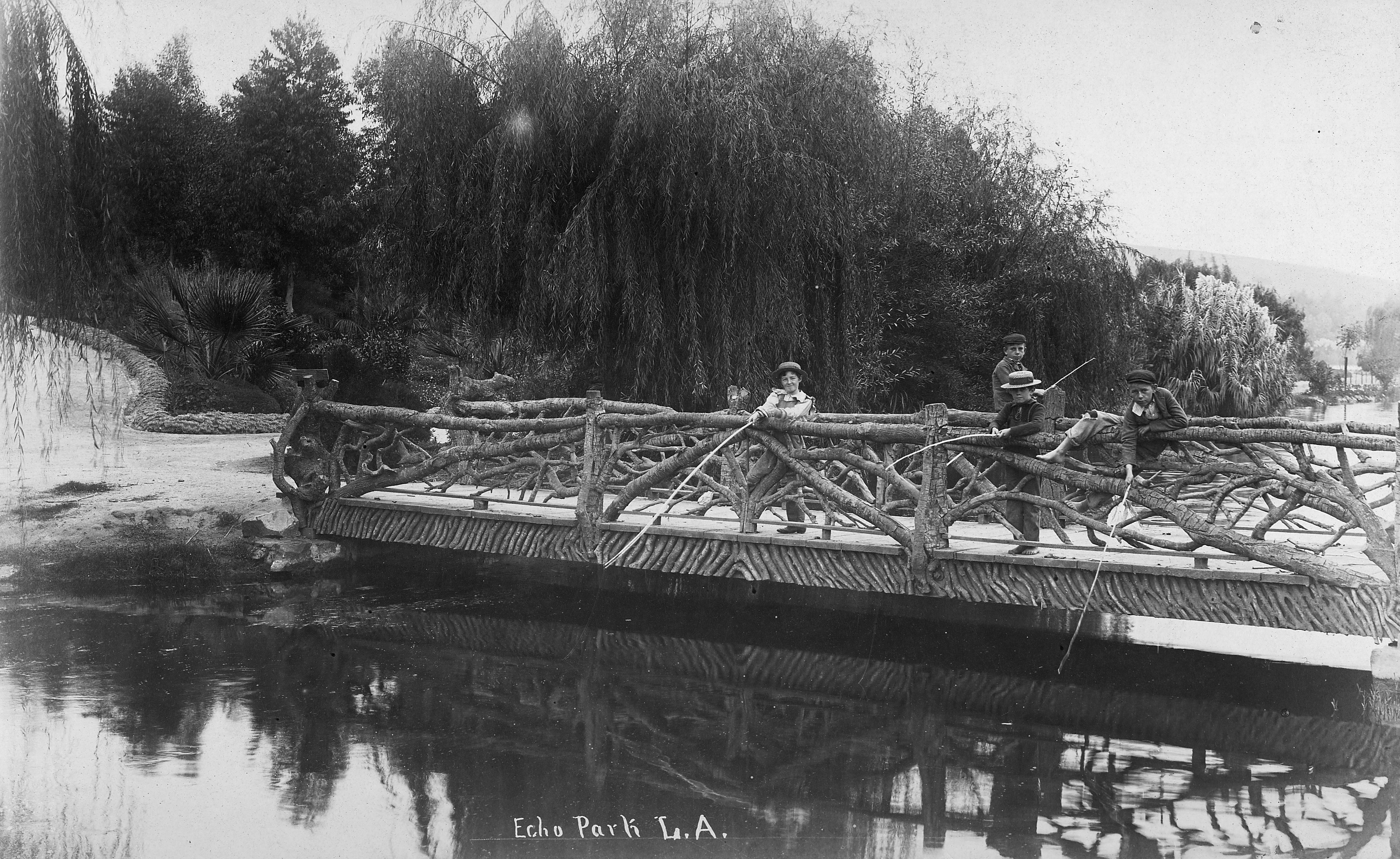
(1890s)^- View showing four boys fishing off one of the two bridges at Echo Park Lake with willow trees in the background. Note the “tree-limb” railing. |
Historical Notes The above bridge passed over the lake’s northwest corner, where the ditch delivered water to the lake from the Los Angeles River (where the lotus now grow). The city began work landscaping the park in October 1892. By 1895, the park and accompanying boathouse were completed. |
 |
|
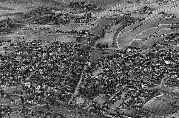
| (1894)*– Map showing Echo Park Lake (center-top) located at the intersection of Lake Shore Avenue (later Glendale Boulevard) and Bellevue Avenue. Note that there is a second smaller lake seen at lower-center. It was part of the Second Street Park, located at the intersection of Lake Shore Avenue and 1st and 2nd streets. Map courtesy of the Library of Congress. |
Before and After
|
|
 |
|
| (ca. 1894)^ vs. (1911)^ - Echo Park Lake before and after landscaping. |
Historical Notes Echo Park development began in 1891 with landscaping a year later. The first Superintendent of Parks for the city was an English immigrant named Joseph Tomlinson who was assigned the task of creating the park. Mr. Tomlinson, being somewhat homesick for his favorite park in Derbyshire, England, decided to model the park after his favorite childhood place to play. At the same time, the reservoir was closed and the stream was capped. The park superintendent created a 16-acre lake where the reservoir had been. It cost $5,637.00 to create the lake that is now filled with city water. Once that was accomplished, the planting began on the other 15 acres of park. One day, while overseeing the work, Mr. Tomlinson thought he heard his workers talking during a break, but he knew they were across the park from him. The park had an echo! He knew what the name of the park would be! Unfortunately, the plantings he installed destroyed the echo, but the name remained. The park was dedicated and opened to the public in 1895. The famous bed of lotuses that grow in the lake at the northwest end of the park, the largest stand of lotuses outside Asia, is a mystery yet to be solved. One legend says that evangelical Chinese missionaries planted them for use as food, but no one knows the real story. They appeared some time in 1923 or 1924. Nonetheless, they remain a beautiful addition to the park and have inspired the city to sponsor the annual Lotus Festival that celebrates Asian and South Pacific Island cultures.^^ By 1899, city leaders were intent on adding even more green space, by extending the parkland south to Temple Street. Bounded by Temple on the south and Bellevue on the north, the area was completed by 1907, with an extensive network of playing fields and courts for tennis and croquet. Called Echo Park Playground, it was only the second public playground to be built in the city of Los Angeles and still remains today. Click HERE to see more on the Echo Park Playground. Click HERE to see more contemporary views of Echo Park Lake (1975+). |
* * * * * |
Main and 4th Street
 |
|
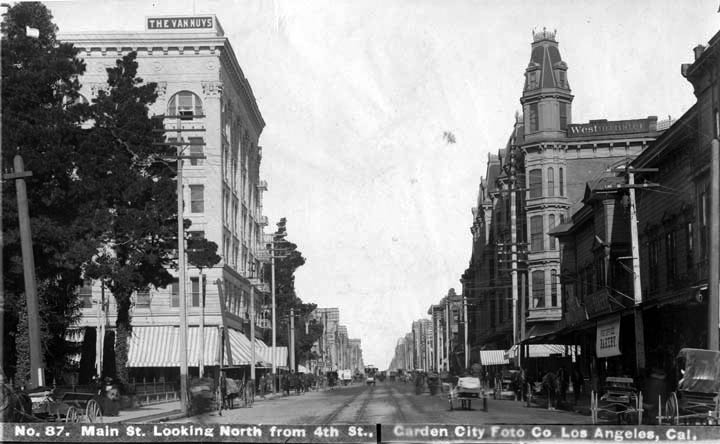
| (ca. 1898)^*# - View looking north on Main Street at 4th Street. On the N/E corner stands the Westminster Hotel. On the N/W corner is the Van Nuys Hotel. On the S/W corner (on the left) is the Hellman Residence and future site of the Farmers and Merchants Bank. |
 |
|
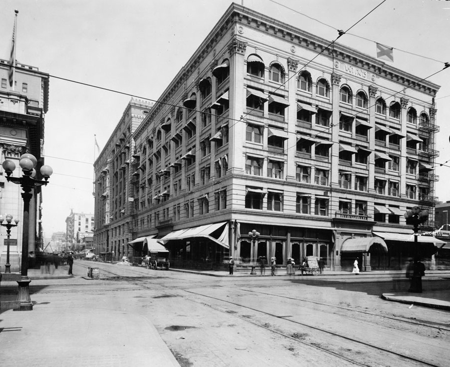
| (1905)^^ - View looking west on 4th Street at Main Street where the Van Nuys Hotel (later the Barclay) is seen on the northwest corner. Across the street, on the southwest corner, can be seen part of the Farmers and Merchants Bank (built in 1905). Both buildings are still standing. Click HERE to see contemporary view. |
Historical Notes In 1985, the Barclay Hotel Building (Van Nuys Hotel Building) was designated Los Angeles Historic-Cultural Monument No. 288 (Click HERE to see complete listing). |
* * * * * |
Overhead Line Congestion
 |
|
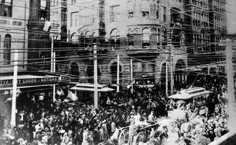
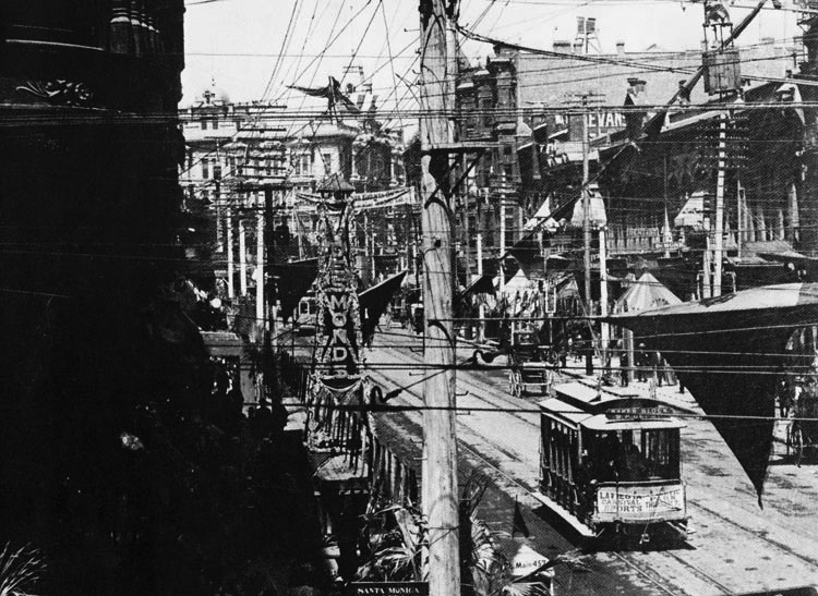
| (1892)^ - The streets are crowded during a Columbus Day parade on October 26, 1892 at the interesection of Spring and 2nd Streets. The Bryson-Bonebrake Building can be seen in the background (NW corner). On the left (SW corner) is the B.F. Coulters store on the ground floor of the Hollenbeck Hotel. Note the overhead wire congestion. |
Historical Notes Before most cables ran underground, all electrical, telephone and telegraph wires were suspended from high poles, creating strange and crowded streetscapes.* |
 |
|
| (late 1890s)^^# - View of the south 100 block of Spring Street showing overhead line congestion mainly from electric streetcar car and telephone wires. The corner of the Bryson Block looms darkly at extreme left. |
Historical Notes By the early 20th Century, wooden poles were carrying telephone lines and electrical lines as well as telegraph lines. Between electrification and the rapid adoption of telephony, wooden poles grew larger and more heavily burdened with utility lines to an extent that is unimaginable today.* |
* * * * * |
Gasoline Powered Streetcar
 |
|
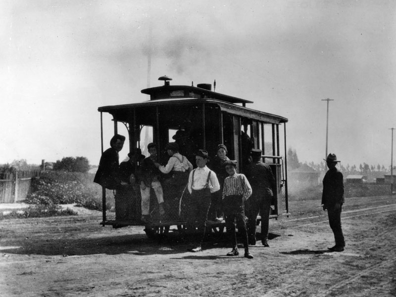
| (1897)^ - Young boys fill a small gasoline powered streetcar of the "Mateo Street & Santa Fe Ave. Street Car Co." seen traveling on an unpaved Santa Fe Avenue at 9th Street. |
Historical Notes The Mateo Street Line ran from First and Santa Fe Avenue South via Santa Fe Avenue to Fourth, using a private right-of-way to Mateo, then from Mateo to Ninth Street. The Los Angeles Railway purchased the Mateo Street Line in April, 1901.* |
* * * * * |
Broadway Parade
 |
|
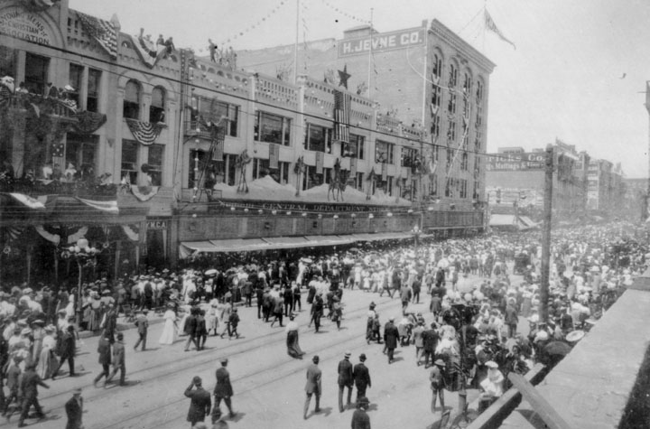
| (1898)^ - A view of Broadway in 1898. Pedestrians stroll through the street, and flags are draped from buildings for a parade or other festivities. People are gazing at pedestrians from balconies of the Young Men's Christian Association (YMCA) building. |
* * * * * |
LA Sharpshooters (aka Kelly's Kayotes)
 |
|
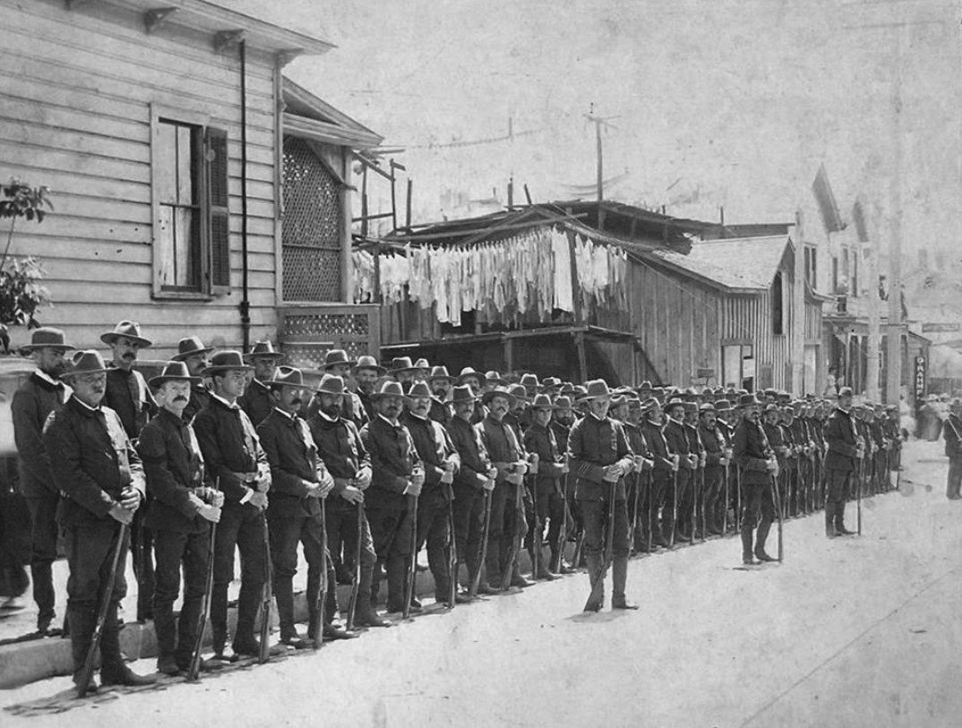
| (ca. 1898)^*^# – View showing the Los Angeles Sharpshooters, also known as Kelly's Kayotes, an exclusive club of marksmen that existed in the late 1890s. |
Historical Notes The Los Angeles Sharpshooters, also known as Kelly's Kayotes, was an exclusive club of marksmen that existed in the late 1890s. The team was formed in May 1898, under the leadership of Captain Allen Kelly, with around 65 members. Its team rifle was the Winchester. After receiving permission from the Governor to carry firearms in Los Angeles County, the Sharpshooters made quite a showing marching in the July 4 parade. Soon others wanted to join and by the end of the month, there were over 100 members, with others wanting to join. Of course, in order to be accepted, an applicant needed to prove himself with a rifle. The club did, however, offer honorary membership at $20, which was then invested in ammunition. Their practice range was a gulch called "Hunter Highland View" in Highland Park. Apparently, during their meetings, there would be a lot of drinking, smoking, and tall stories. However, they took their drills seriously. The team occasionally competed against divisions of armed forces (like the National Guard) and other sharpshooter organizations. Rifle tournaments were held on Round Hill and Glassell Park. The group ended around 1901-02, when it appears to have merged with another gun club, thus losing its identity.^*^# |
* * * * * |
Water in Early Los Angeles
 |
|
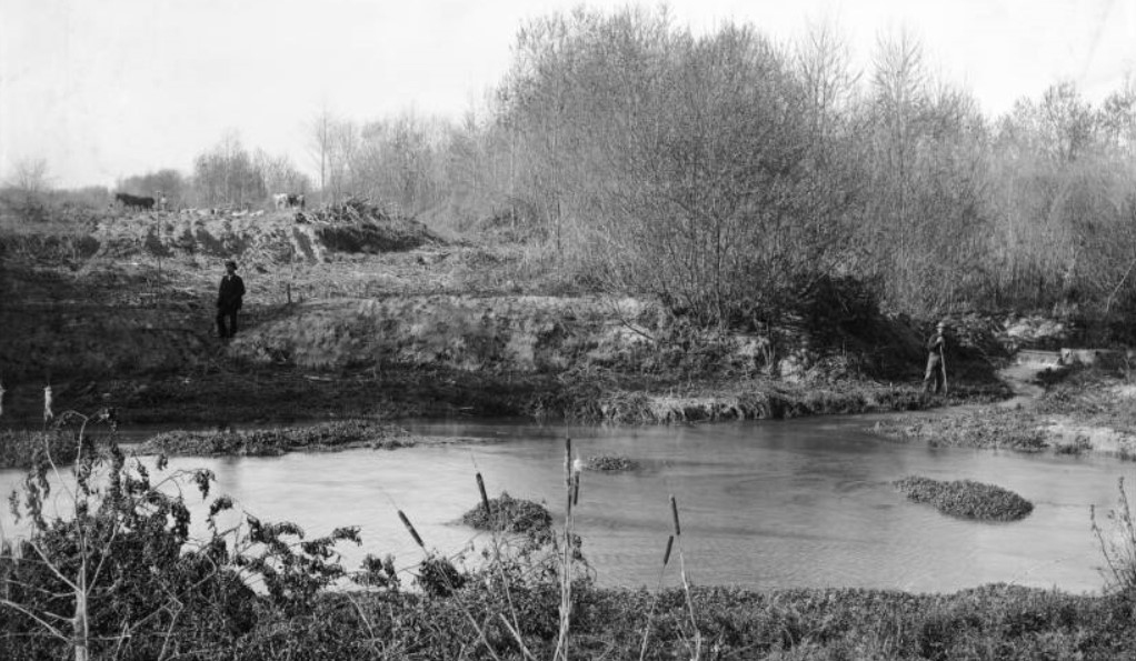
| (ca. 1895-1898)^^ – View of 2 men standing near a water ditch at the bank of Los Angeles River, north side of Griffith Park. One man leans against a shovel. Horses are visible in the background. Trees are behind the man with the shovel (at right). In the foreground are relatively still waters and cattails.; Originally, the record was entitled as "Los Angeles River headwaters in Griffith Park". The Los Angeles River's headwaters, however, are farther NW in the San Fernando Valley, CA. |
 |
|
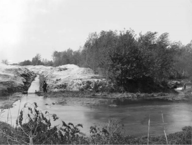
| (ca. 1900)^^ - View of a man standing near a water ditch at the bank of Los Angeles River, north side of Griffith Park. The ditch (full of water) has been dug at left. A stand of trees is beside the relatively still water. This is the same view as previous photo but a couple of years later. |
 |
|
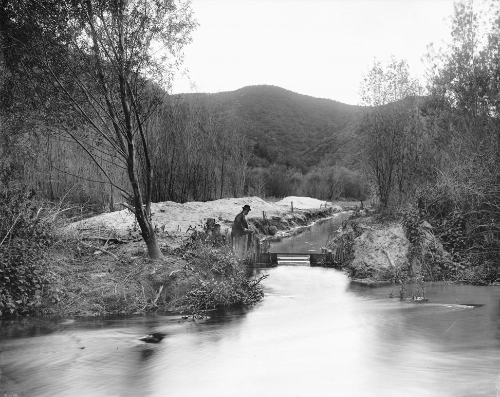
| (1898)^^ - A man is seen by a water ditch gate at the bank of the Los Angeles River at the present-day site of Griffith Park. |
Click HERE to see more in Water in Early L.A. |
* * * * * |
Zanja Madre
.jpg) |
|
| (ca. 1890)#^*– View looking northwest showing an unpaved Figueroa Street. Note the water-filled ditch (Zanja) on the west side of Figueroa with walkway crossings in front of each of the large homes. A two-story Victorian-style house is visible to the left, followed further to the right by a one-story clapboard-sided home with a porch, to the left of which a windmill is situated. |
Historical Notes The Zanja (Spanish for ditch) was the original water supply channel for the southwest part of the city. It was built in 1868 and rebuilt in 1885 with concrete. By the 1880s there were 10 zanjas that covered 93 miles.^ |
 |
|
| (ca. 1895)^ - View of Figueroa Street near 23rd Street, showing the Zanja water supply channel and people walking on the sidewalk. The houses have massive lawns. |
Historical Notes The original water supply for Los Angeles was delivered in open trenches despite serious problems with public dumping into the trenches. In the 1880s and 1890s gradually piped water was introduced into more expensive neighborhoods, and the zanjas were used for irrigation only. The zanjas served the city until 1902, when they were replaced with a system of underground pipes.^ |
 |
|
| (ca. 1900)^ - Zanja on Figueroa Street near Washington Boulevard. The original water supply channel for the southwest part of the city was built in 1868 and rebuilt in 1885 with concrete. |
Click HERE to see more in Zanja Madre (Original LA Aqueduct) |
* * * * * |
Adams and Figueroa
 |
|
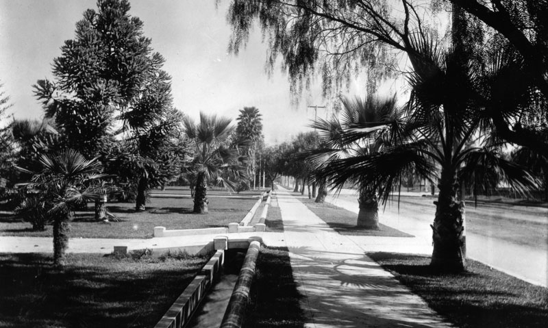
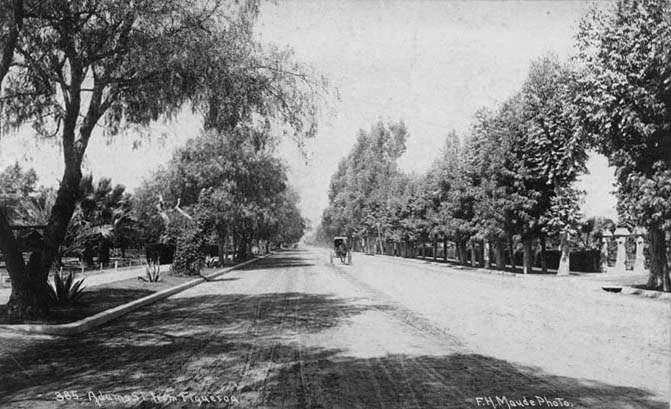
| (1897)^*# - View of Adams Boulevard as seen from Figueroa St. A horse-drawn carriage is seen moving toward the camera on the tree-lined dirt road. |
Then and Now
 |
|
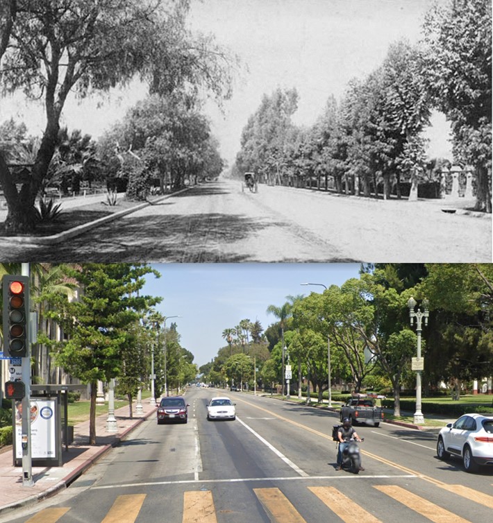
| (1897 vs. 2021) – Adams Boulevard looking West from Figueroa Street. Not much has changed. Photo comparison by Jack Feldman. |
* * * * * |
Western and Pico
 |
|
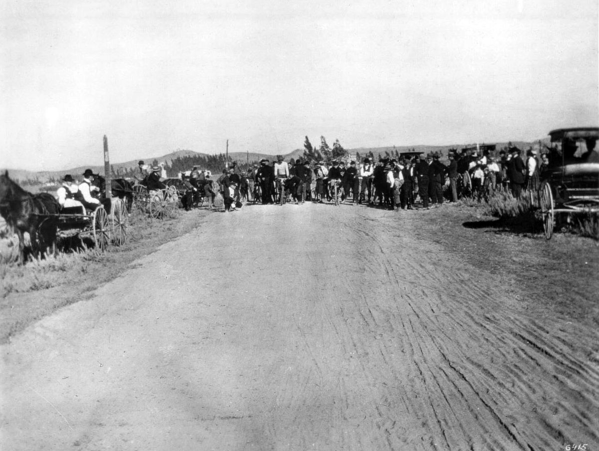
| (1895)* - The Los Angeles Times Bicycle Club on Western Avenue north of Pico. |
Historical Notes Western Avenue, apart from Sepulveda Boulevard, is one of the longest north–south streets in Los Angeles. Its name comes from its early role as the western edge of the city. In the late 1800s, Western Avenue marked the city limit, beyond which lay farms, ranch land, and open countryside. As Los Angeles expanded through annexations in the early twentieth century, the city grew far beyond this former boundary. In 1895, the area around Western Avenue and Pico was still lightly developed. Dirt roads, windmills, and scattered farms dominated the landscape. Bicycling was a popular pastime at the time, and organized rides such as those by the Los Angeles Times Bicycle Club were common. Before automobiles became widespread, bicycles offered both recreation and a practical way to travel longer distances. Pico Boulevard was originally called Pico Street, named after Pío Pico, the last Mexican governor of California. As the city grew and streets were widened and improved, Pico Street was renamed Pico Boulevard in 1914. These changes reflected Los Angeles’ rapid growth, as rural crossroads like Western and Pico began their transition into important city streets. |
Then and Now
 |
|
| (1895 vs. 2023)* - Western Avenue looking North from Pico Boulevard. Photo comparison by Jack Feldman. |
Historical Notes In 1895, Western Avenue at Pico Boulevard was still a quiet, lightly traveled road surrounded by open land and farms. At the time, this location marked the edge of the city, with few buildings and no continuous development. Over the next century, Los Angeles expanded outward, gradually filling in these open spaces with streets, homes, and businesses. Today, this intersection sits within one of the more densely populated parts of Los Angeles. The surrounding neighborhoods are home to people from many cultural and ethnic backgrounds, including large Latino communities along with Asian, Black, white, and multiracial residents. Pico Boulevard continues to serve as an important east–west corridor connecting these diverse communities. The comparison highlights how a former city boundary became part of the city’s interior. What was once rural land at the edge of Los Angeles is now a busy urban crossroads shaped by growth, transportation, and changing populations. |
* * * * * |
Western and Santa Monica
 |
|
| (ca. 1896)* - Bicycle race on Western just north of Santa Monica Boulevard. |
Historical Notes Western Avenue derives its name from its history as the western–most border of Los Angeles city limits in the 19th century, before annexations in the early 20th century expanded the city westward and onwards. |
* * * * * |
Western and Melrose
 |
|
| (1899)^ - Western Avenue looking north from Melrose along a dirt road and a row of trees. |
* * * * * |
Western and Washington
 |
|
| (ca. 1897)^^ - Orchard at Western Avenue and Washington Boulevard. A mule or horse appears to be tied to a tree. |
* * * * * |
North Main Street
 |
|
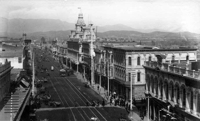
| (1898)#*** - View looking north on Main Street showing the Baker Block in the background. Pedestrians are seen crossing the streetcar tracks on Main Street in front of the Ducommun Building. One of the City's original 150-ft electric streetlights stands at center of photo. Click HERE to see more in Early L.A. Streetlights. |
 |
|
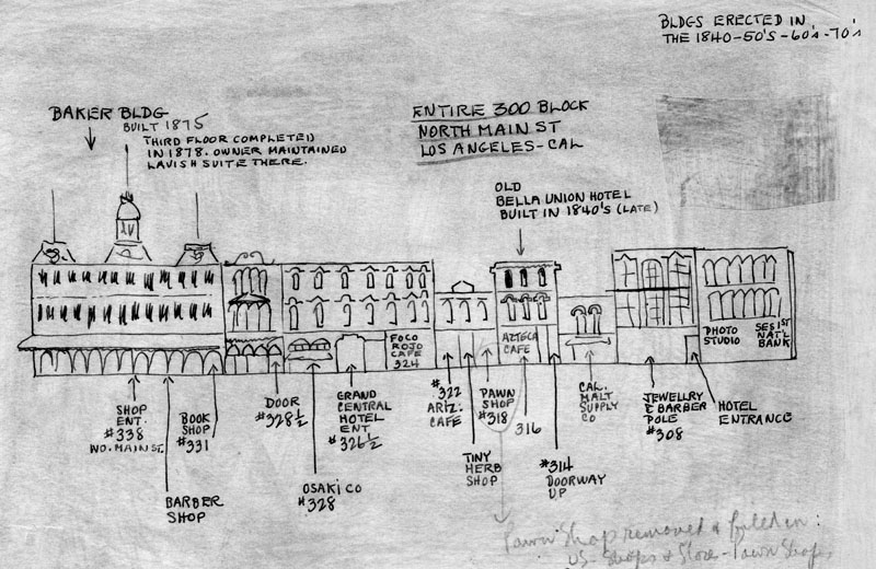
| (late 1800s)^ - Drawing of North Main Street showing the location of the businesses in the entire 300 block, starting with the Baker Block on the left. The building on the far right is the Ducommun Building, located at 304 N. Main Street. |
Click HERE to see more in Early Views of the Historic 300 Block of N. Main Street |
* * * * * |
View from First and Spring
 |
|
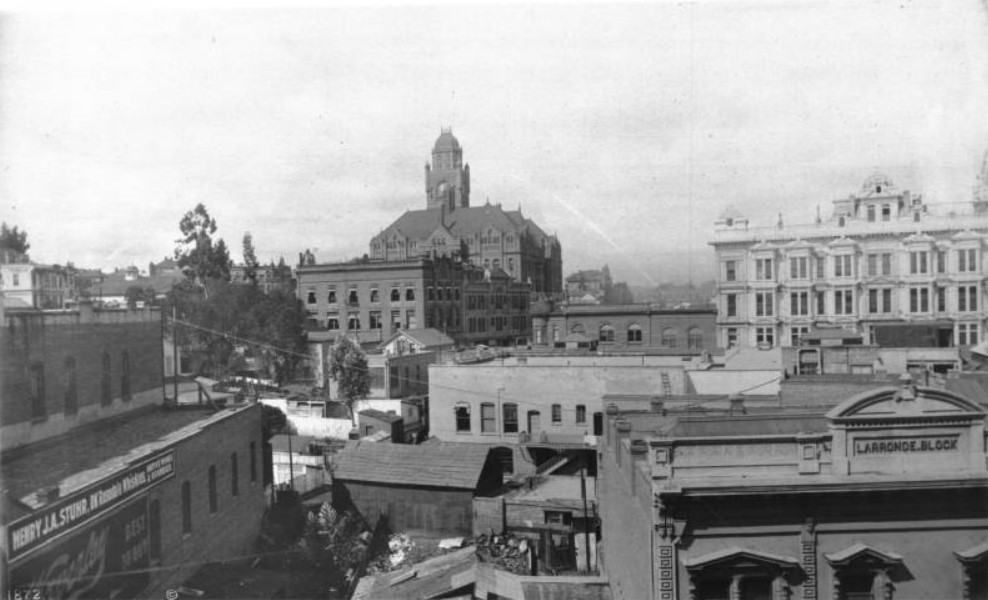
| (ca. 1890)^ - Panoramic view of downtown Los Angeles from Spring and 1st Streets looking north. The County Courthouse with clock tower is located on Poundcake Hill (former site of the high school) in the center background. At center-right is the Phillips Block (2nd 4-story building built in LA - 1887). Most of the buildings are two- or three-story brick structures. Mostly roofs are visible. Legible signs include: "Henry J.A. Stuhr, OK Rosedale Whiskies, native wines & brandies", "Waverly [...], best to buy", "Larronde Block", and "Los Angeles ABC Tract Co." |
 |
|
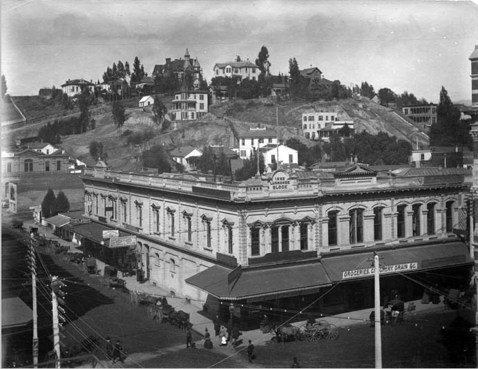
| (ca. 1898)^## - View of the northwest corner of Spring and 1st Streets showing the Larronde Block with Bunker Hill in the background. Horse drawn-wagons are parked in front of the Larronde Block and pedestrians are seen crossing the intersection. Sign on the awning facing Spring Street reads: "Groceries Crockery Grain - " |
Historical Notes At one time, the name Larronde was a fairly well known one in the City of Angels. Pierre Larronde was a native Frenchman who landed in San Francisco in 1847 and made a killing in the gold mines. When he relocated to Los Angeles in 1851, he amassed a further fortune by successfully raising sheep on one of the Ranchos. Always the astute businessman, Larronde cashed out his sheep empire in the late 1880s and focused his energies on real estate. His holdings included prime land at the corner of First and Spring, and a parcel on North Hope Street near Temple where he built the family home. |
* * * * * |
Aliso and Alameda Streets
 |
|
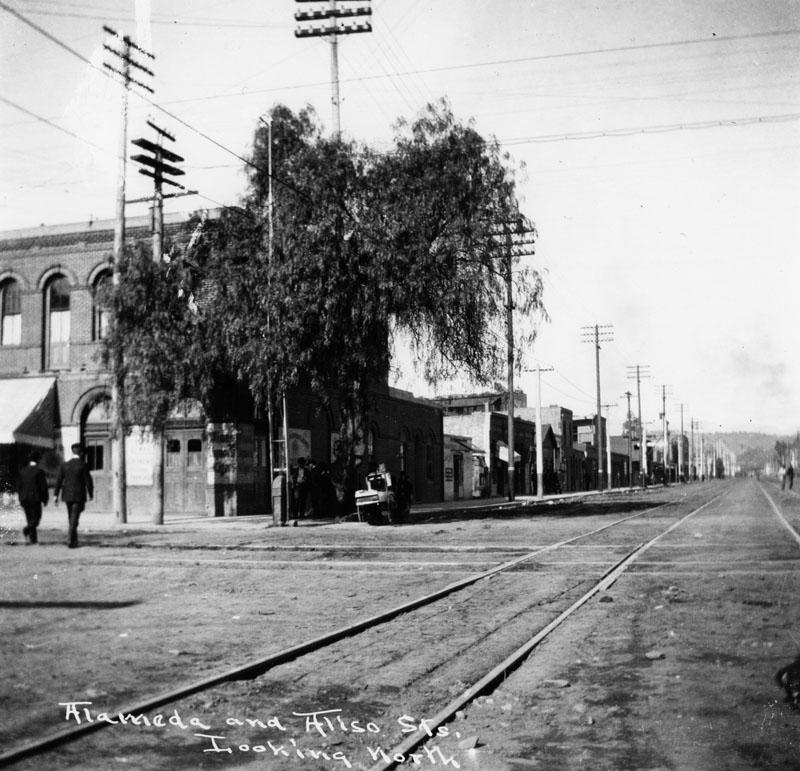
| (ca. 1890s)* - Looking north on Alameda Street at Aliso Street. |
 |
|
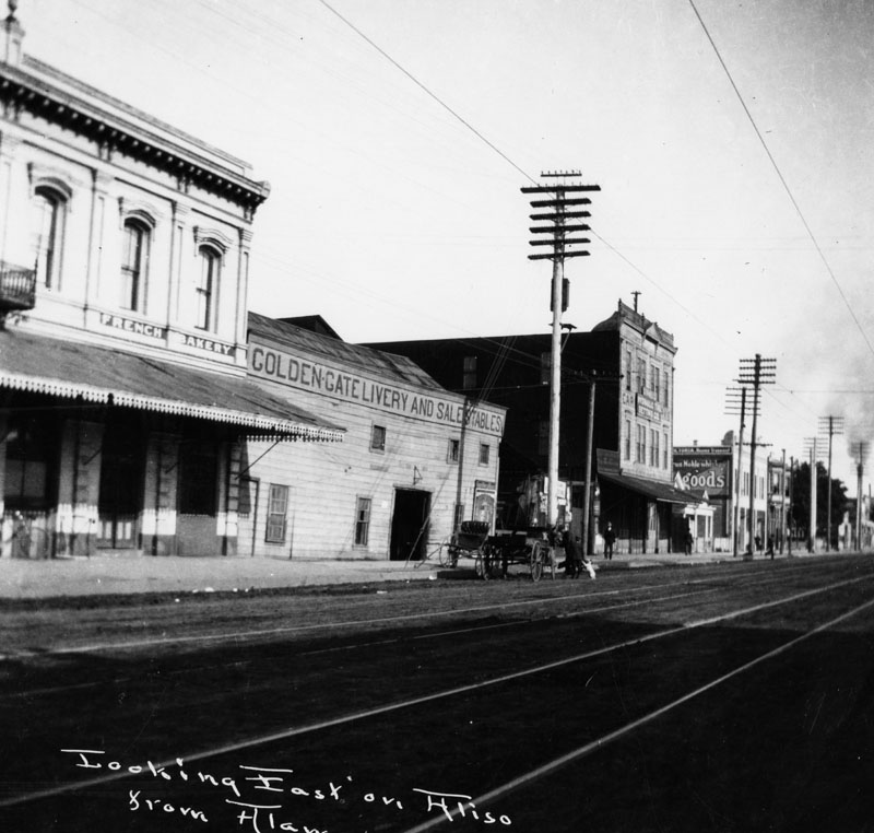
| (ca. 1890s)* - View looking east on Aliso Street from Alameda Street. A French bakery is seen next to the Golden Gate Livery and Sale Stables. |
 |
|
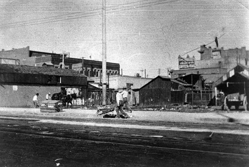
| (1898)* - Alameda Street north of Aliso Street showing men working in the street on June 6, 1898. |
* * * * * |
Aliso and Alameda Streets
 |
|
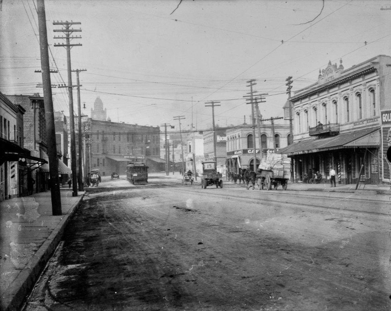
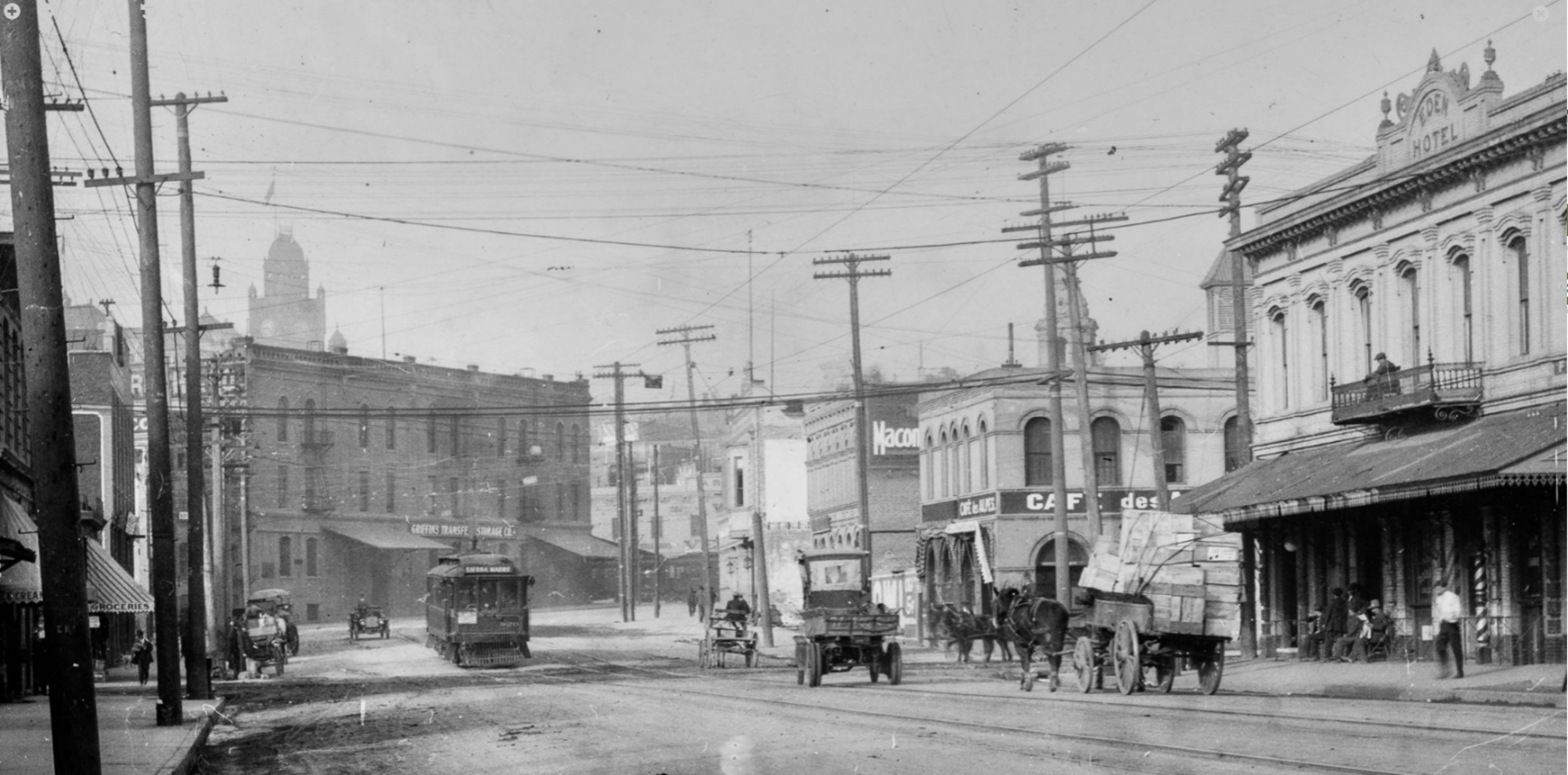
| (ca. 1905)* - Image of Aliso Street in downtown Los Angeles with signs labeling buildings "Griffins Transfer and Storage Co." and "Cafe des Alpes" next to "Eden Hotel," which are located on opposite corners of Aliso and Alameda Streets. A Pacific Electric streetcar sign reads "Sierra Madre" and automobiles and horse-drawn wagons are seen in the dirt road. |
Historical Notes This view looks into what was then a busy gateway between the Plaza area and the riverfront industrial district. The Eden Hotel occupied the northeast corner of Aliso and Alameda and catered to travelers, railroad workers, and residents of nearby Old Chinatown and the French district; period photos show its ground floor sharing the block with cafés, storage yards, and livery stables. A Pacific Electric line ran along Aliso, making this intersection an important streetcar stop on the way to and from the San Gabriel Valley. In the distance, the clock tower of the Los Angeles County Courthouse on Poundcake Hill anchors the western edge of downtown. |
 |
|
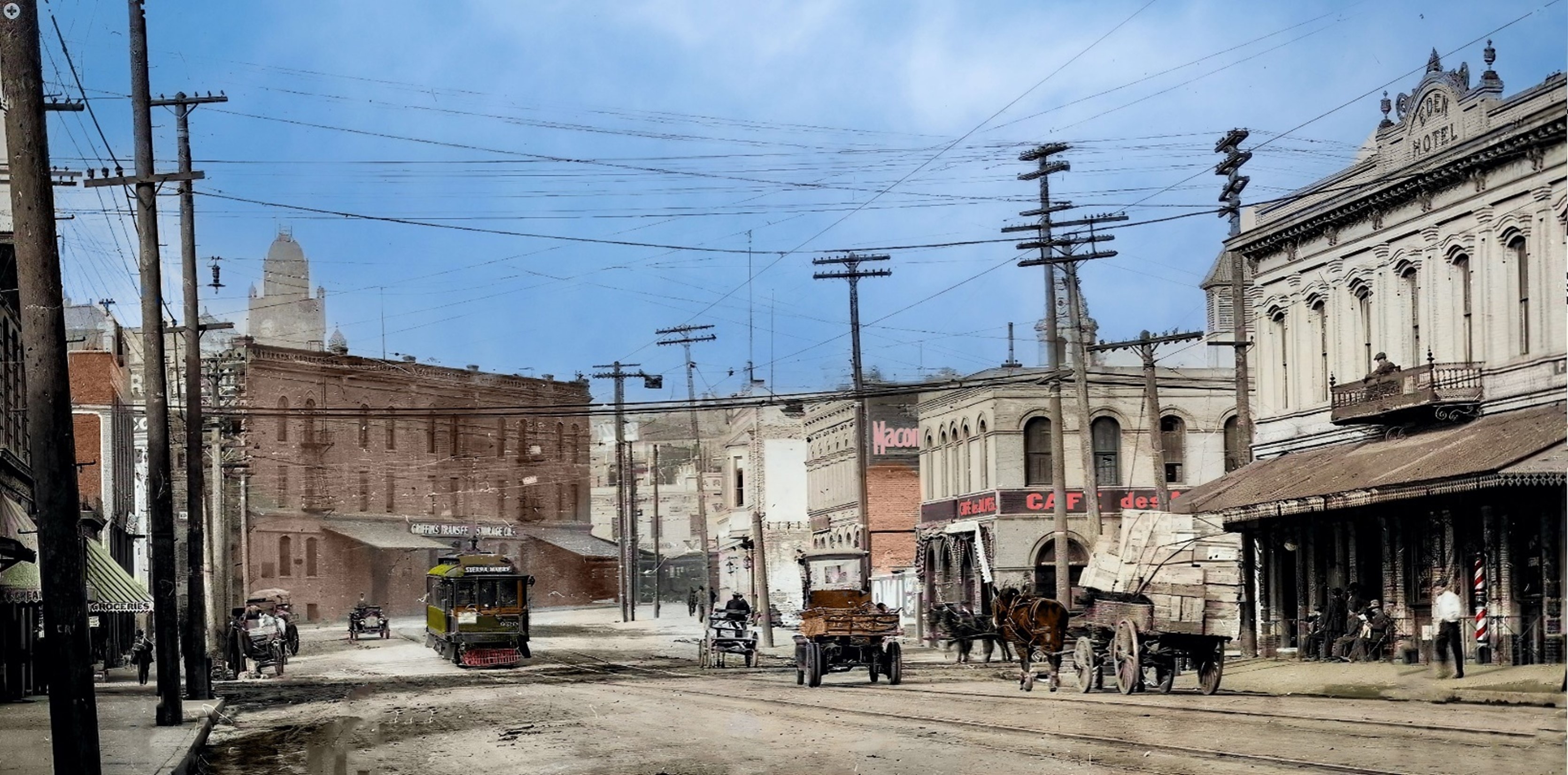
| (ca. 1905)* – Looking west on Aliso Street toward Alameda Street, with the Eden Hotel on the northeast corner. The clock tower of the County Courthouse is visible in the distance on Poundcake Hill. |
Historical Notes This slightly elevated view shows how Aliso Street served as a busy connector between the Plaza area and the rapidly industrializing corridor along Alameda Street. The Eden Hotel stands prominently on the northeast corner, sharing the block with cafés, storage yards, and rail-related businesses that catered to travelers and laborers working in the nearby freight depots. To the left, signage for the Café des Alpes and Griffin's Transfer & Storage reflects the strong French and Swiss presence in the neighborhood at the turn of the century. Overhead wires mark the route of the Pacific Electric’s Sierra Madre line, which brought passengers from the San Gabriel foothill towns directly into downtown. In the far distance, the clock tower of the County Courthouse rises above the low skyline, visually linking Aliso Street with the civic center on Poundcake Hill. |
 |
|
| (ca. 1905)* – Looking west on Aliso Street toward Alameda Street, with the Eden Hotel on the northeast corner. The clock tower of the County Courthouse is visible in the distance on Poundcake Hill. Image enhancement and colorization by Richard Holoff. |
Historical Notes The colorized version emphasizes how Aliso Street functioned as a transition zone: modest brick hotels and cafés at right, industrial yards and rail facilities to the east, and the civic core rising on the horizon. At street level, the mix of wagons, early automobiles, and the overhead trolley wires hints at a city in mid-transition from horse-drawn traffic to electrified mass transit. The Eden Hotel’s corner sign and balcony mark it as one of several small European-run hostelries that gave the area its reputation as part of Los Angeles’s “French quarter.” |
Then and Now
 |
|
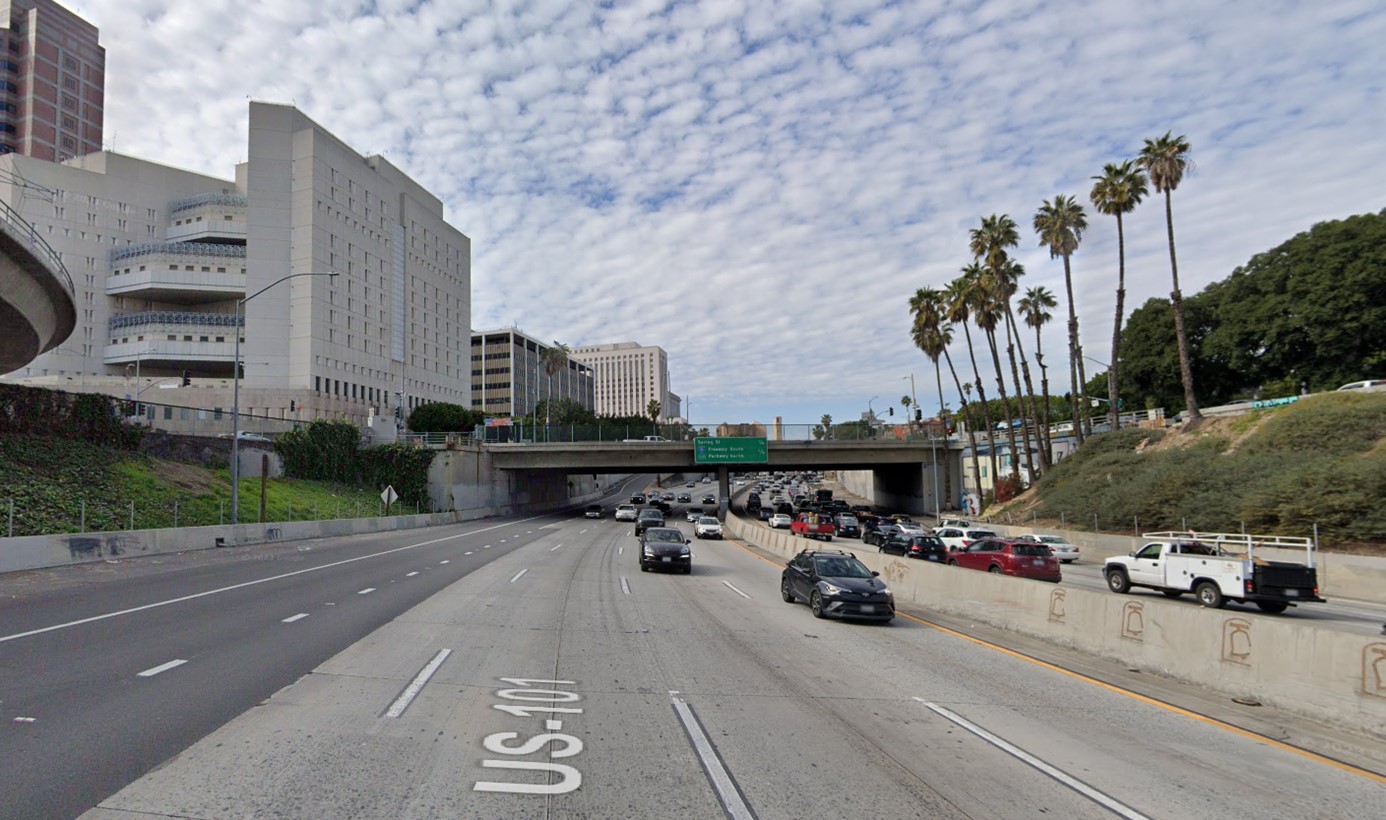
| (2023)* – Looking west on the US-101 Freeway toward the Alameda Street overcrossing. |
Historical Notes The US-101 freeway in this view occupies the old line of Aliso Street, which was excavated and widened in the early 1950s to carry the Hollywood Freeway into downtown. Where two- and three-story hotels, warehouses, and streetcar tracks once crowded the corridor, the landscape is now dominated by concrete retaining walls, ramps, and sound barriers. This final downtown segment of the Hollywood Freeway opened in 1954 and became one of the busiest stretches of U.S. 101, symbolizing the city’s mid-century pivot from streetcar streets to automobile freeways. |
Then and Now
 |
|
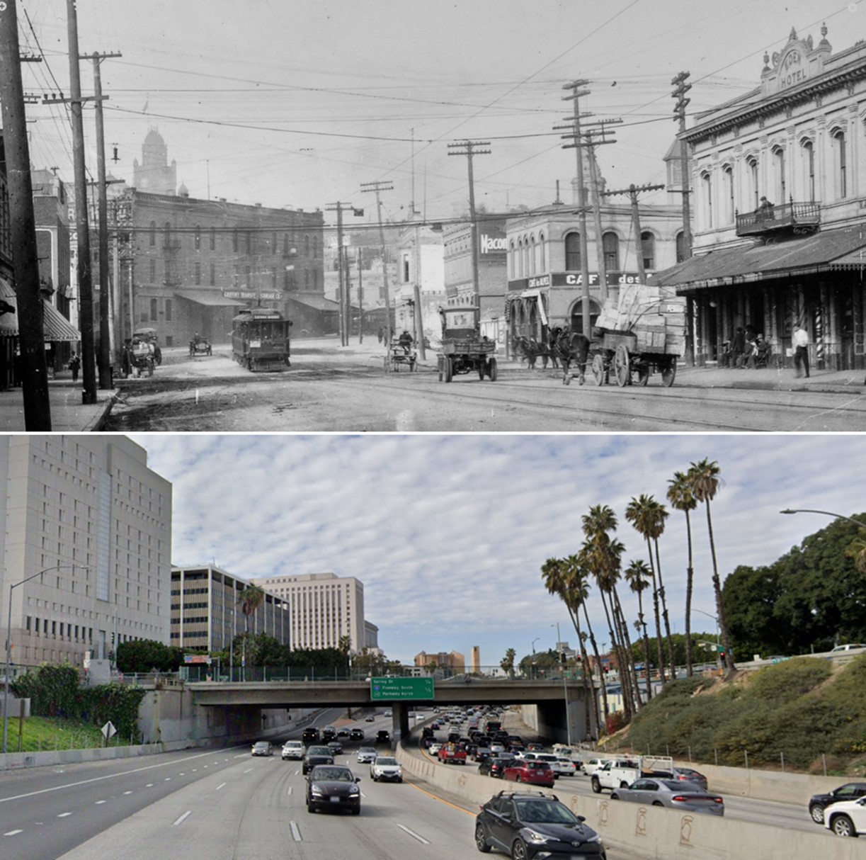
| (1905 vs 2023)* – Looking west on Aliso Street (today 101 Freeway) toward Alameda Street (today Alameda Street overcrossing). Photo comparison by Jack Feldman. |
Historical Notes The paired views highlight how an intimate commercial street at the edge of Old Chinatown was transformed into a depressed freeway trench. In 1905, Aliso Street at Alameda was lined with small hotels, cafés, freight yards, and a Pacific Electric streetcar line serving workers and immigrants who lived within walking distance of the Plaza. By the 1950s, freeway construction had erased nearly every building in the original scene, part of a larger wave of clearance that had already removed Old Chinatown for Union Station a decade earlier. Today, only the alignment of the roadway—and a few surviving landmarks closer to the Plaza—hint at the district that once stood here. |
* * * * * |
Aliso Street (Looking west toward Downtown LA) |
 |
|
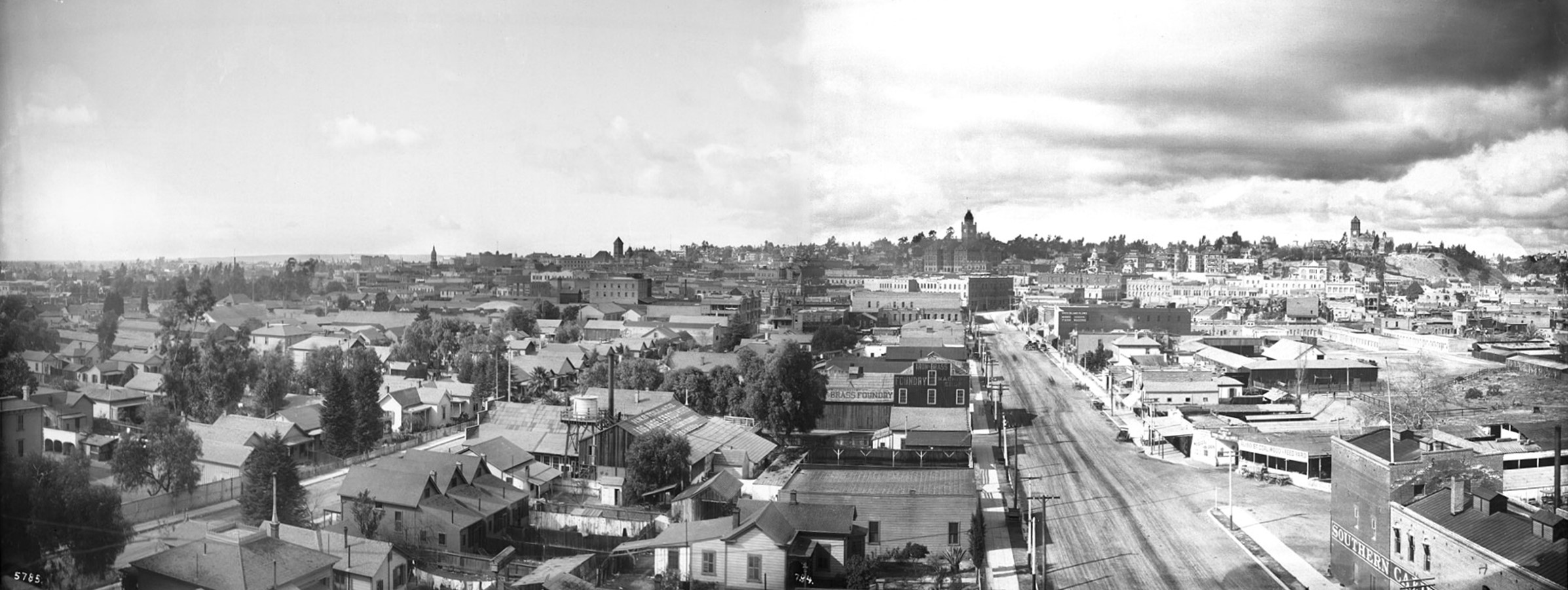
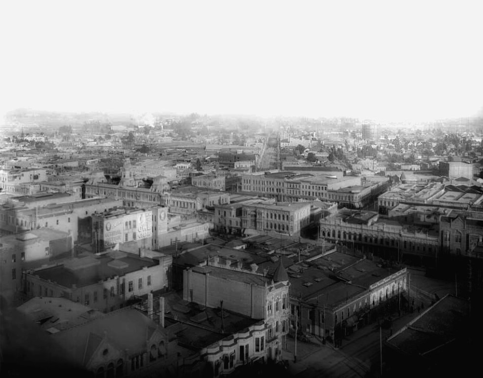
| (1899)* - Panoramic view of Los Angeles looking westerly on Aliso Street (right) from the brewery (Maier Brewing Co). Residential buildings cover a majority of the area in the foreground. Horse-drawn carriages are parked along the curb of the street at right. The tall building with the clock tower (center) is the LA County Courthouse. The tall building to the upper right, also with a clock tower, is Los Angeles High School. |
Historical Notes This panorama was taken from the grounds of the Maier & Zobelein brewery (later Maier Brewing Company), which occupied the former Philadelphia Brewery site along Aliso Street near the Los Angeles River. The brewery complex stood on land once planted in vines and orchards and was closely associated with the nearby landmark sycamore known as “El Aliso,” a gathering place for the Tongva people and an early way-finding point for Spanish and Mexican travelers. In the foreground, Aliso bends west toward downtown, with horse-drawn wagons lining the unpaved street; beyond, the tower of the County Courthouse and the clock-topped Los Angeles High School on Fort Moore Hill mark the young city’s civic skyline. |
 |
|
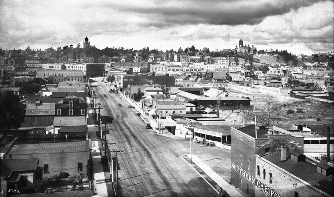
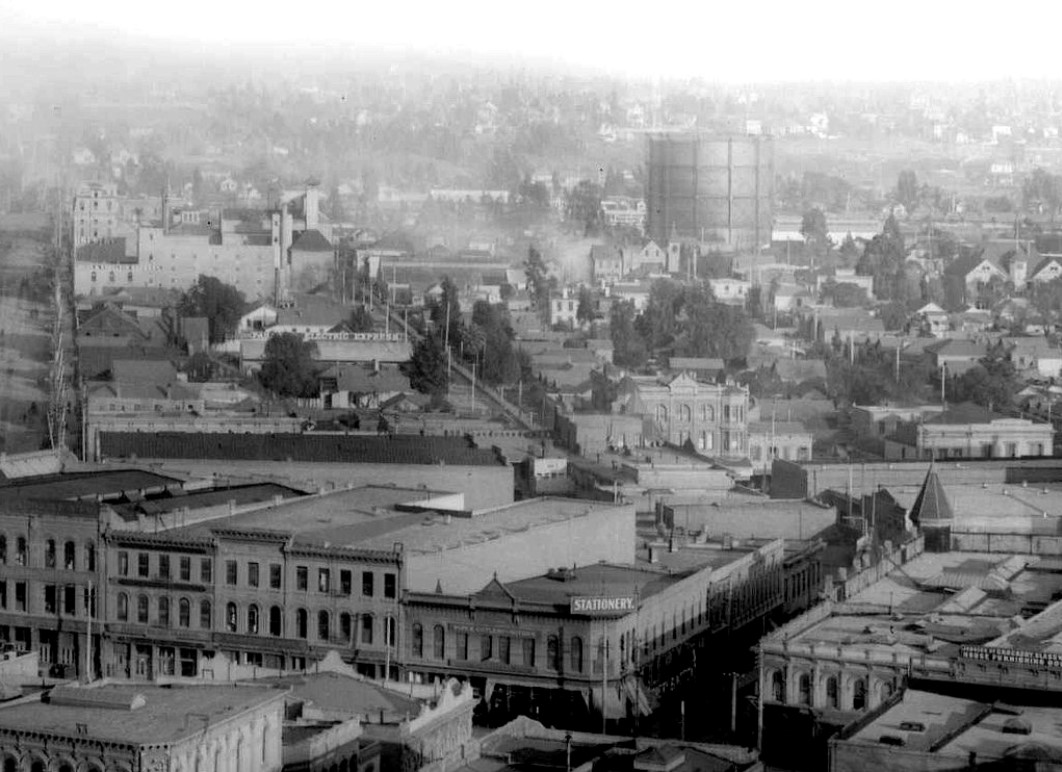
| (1899)* - Panoramic view of Los Angeles looking westerly on Aliso Street from the brewery (Maier Brewing Co). Residential buildings cover a majority of the area in the foreground. Horse-drawn carriages are parked along the curb of the street at right. The tall building with the clock tower to the upper left is the LA County Courthouse. The tall building to the upper right, also with a clock tower, is Los Angeles High School. |
Historical Notes Aliso Street was first named in 1854. When early settlers arrived at the Los Angeles River (El Río de Nuestra Señora de Los Ángeles de Porciúncula) by way of Mission Road, they picked as a nearby gathering point a huge sycamore that gave them shelter and became a landmark, "El Aliso." That Spanish word for sycamore was later used to name the road carved out near the river. The landmark "El Aliso" was located right about where this photo was taken from. Today, the tree's site is underneath an onramp for the 101 freeway, directly across the highway from Union Station. |
 |
|
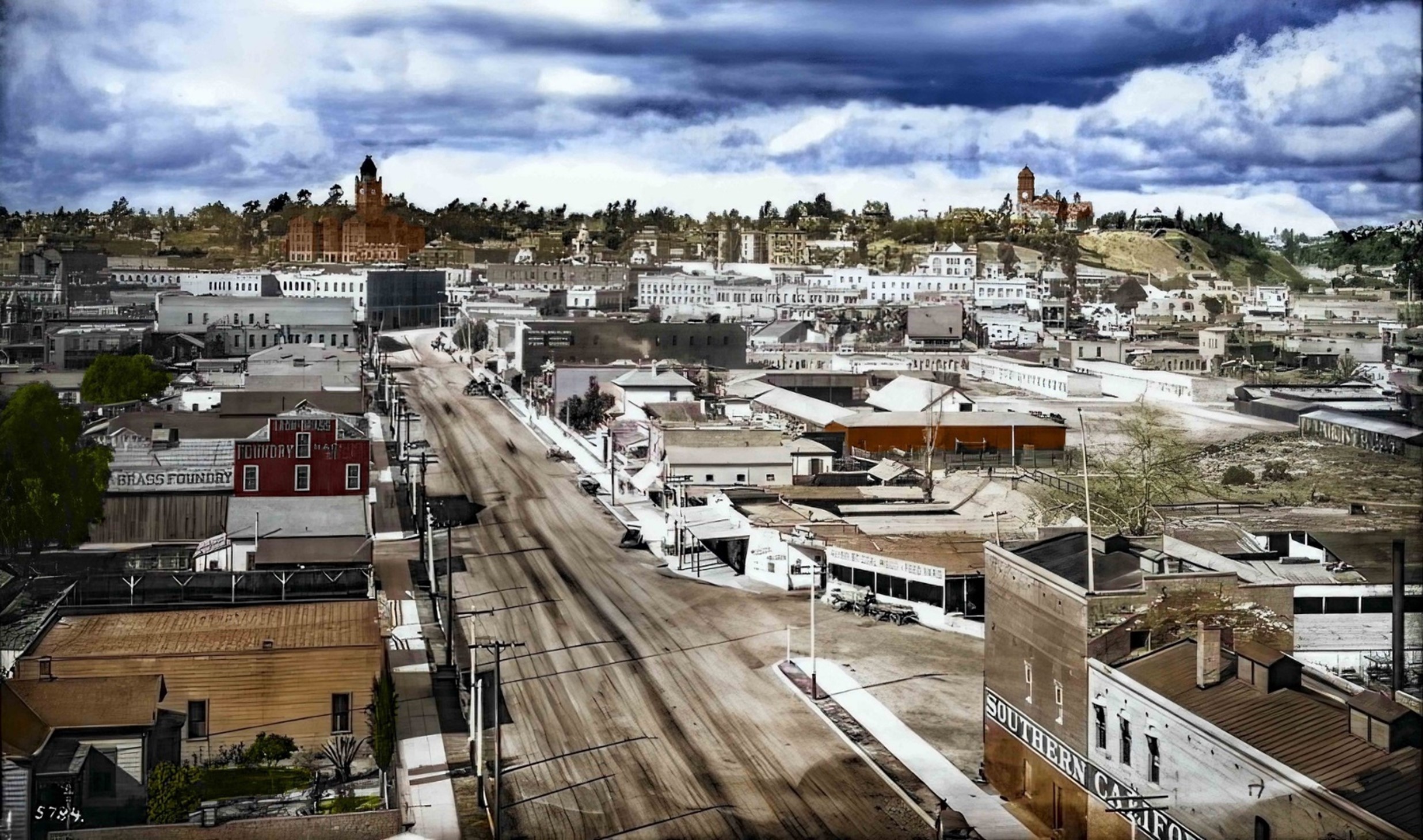
| (1899)* - Panoramic view of Los Angeles looking westerly on Aliso Street from the brewery (Maier Brewing Co). Residential buildings cover a majority of the area in the foreground. Horse-drawn carriages are parked along the curb of the street at right. The tall building with the clock tower to the upper left is the LA County Courthouse. The tall building to the upper right, also with a clock tower, is Los Angeles High School. Image enhancement and colorization by Richard Holoff |
Historical Notes Seen in color, the scene underscores how quickly industrial and residential uses overlapped along the riverfront at the turn of the century. The red-brick brewery buildings and storage sheds hug the tracks in the foreground, while modest frame houses and boarding-houses step up the hill toward the courthouse and high school. At this moment, Aliso Street was still one of the principal east–west approaches into downtown from Mission Road and the river crossing, carrying brewery wagons, farm produce, and passengers heading toward the Plaza and Main Street. |
 |
|
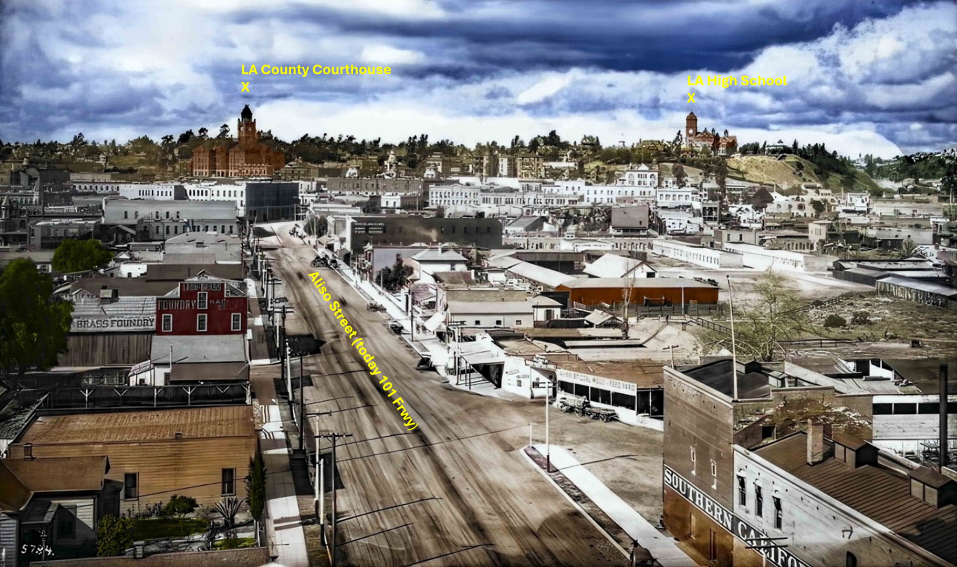
| (1899)* – Aliso Street looking west toward early downtown LA, with the Courthouse and LA High School in the distance. Annotated by Jack Feldman. |
Historical Notes This annotated view clarifies several key landmarks along Aliso Street at the end of the 19th century. The bend of Aliso at right marks its role as both a residential edge street and one of the primary approaches into downtown from the east. Brewery wagons from the Maier & Zobelein complex—visible in the lower foreground—regularly traveled this route toward the Plaza and Main Street. Beyond them, the clustered frame houses and small commercial buildings reflect the dense mixed-use character of the riverfront district before the arrival of large-scale industry. Dominating the horizon are two of the city’s most important civic structures: the Los Angeles County Courthouse on Poundcake Hill and Los Angeles High School on Fort Moore Hill. Together, they form a skyline emblematic of a city transitioning from its pueblo roots into an emerging metropolitan center. |
Then and Now
 |
|
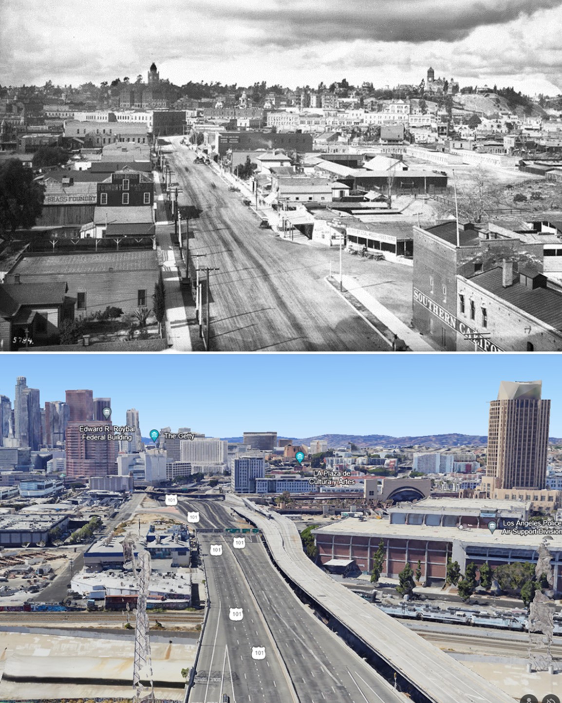
| (1899 vs 2022)* – Looking westerly on Aliso Street (today 101 Freeway) toward downtown Los Angeles. Photo comparison by Jack Feldman. |
Historical Notes The comparison between the 1899 brewery panorama and today’s freeway corridor shows how Aliso Street’s industrial riverfront was transformed by mid-century infrastructure. The Maier brewery complex, the residential blocks on the hill, and even the courthouse and high school have vanished, replaced by lanes of freeway, ramps, and modern civic buildings. Although the original streetscape is gone, the 101 Freeway still traces the historic alignment of Aliso Street, preserving the path that once carried brewery wagons, horse-drawn traffic, and Pacific Electric cars into the heart of downtown Los Angeles. |
* * * * * |
Aliso Street (Looking east from County Courthouse) |
 |
|
| (ca. 1900)* – View looking northeast in line with Aliso Street as seen from the County Courthouse. Aliso Street did not extend past Los Angeles Street until the 1940s. Note the large tank to the right of Aliso Street. It was a gas holder (aka Gasometer) installed by LA Gas and Electric Corporation at the turn of the century. |
Historical Notes Aliso runs directly away from the camera in the middle distance. Baker Block is at center-left. The confluence of Temple, Spring and Main Streets is in the lower right. The intersection of Temple and New High Streets is in the bottom center-right at the base of the peaked turreted building. Central Jail is in the lower left corner beyond the blurred diagonal roof cornice from the courthouse. The section of today's Hollywood Freeway that runs through downtown goes right through where Aliso Street is shown above. The freeway makes a slight turn here and passes directly beneath the former site of the Baker Block on the 300 block of North Main Street, which was demolished in 1942 when Aliso Street was extended toward the Civic Center. Click HERE to see more in Early Views of the Historic 300 Block of N. Main Street |
 |
|
| (ca. 1900)* – Closer view looking northeast from the County Courthouse with Aliso Street at left and the large Gasometer at top-right. |
Historical Notes Detail shows Aliso Street on the left edge with the Maier Brewery reaching through from Aliso to Commercial Street about halfway up the image. Hotel Oriental in bright sunlight, directly beneath the Gasometer and below the dark stand of trees at Commercial and Alameda Streets. A stationery store stands on the northeast corner of Commercial and Los Angeles Streets. |
* * * * * |
Los Angeles Railway
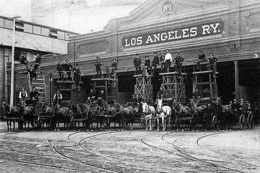 |
|
| (ca. 1899)* – View of Los Angeles Railway (LARy) Division 1, horse-drawn tower wagons, facing Central Avenue south of 6th Street. This site is still in operation. |
Historical Notes Los Angeles Railway (1895-1945) also known as the Yellow Cars of Los Angeles, was the local streetcar transit system running down the center of city streets and connecting the city center to neighborhoods in about a six mile radius of downtown. The original address for the above site was 648 South Central Avenue, but was later changed to 1130 East Sixth Street. Today the division operates hundreds of natural gas powered Metro buses for the Gateway Cities Service Sector. |
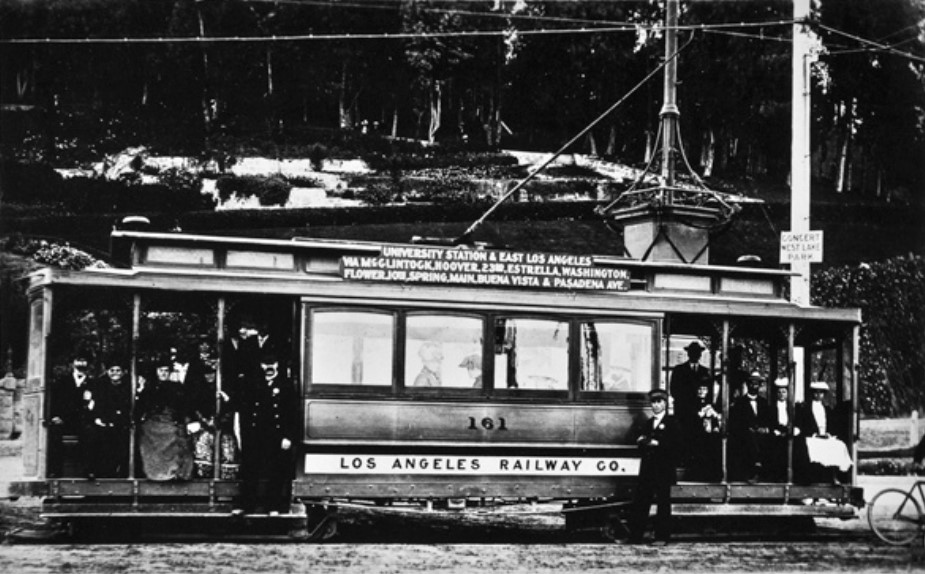 |
|
| (1900)* – View showing No. 161, a former Main St and Agricultral Park car with Elysian Park behind. No. 161 was built in 1898 and scrapped in 1933. |
Historical Notes There were about 642 miles of track at its peak in 1924. Henry E. Huntington ran the system until his death in 1927. The Huntington Estate later sold LARy to Los Angeles Transit Lines in 1945. |
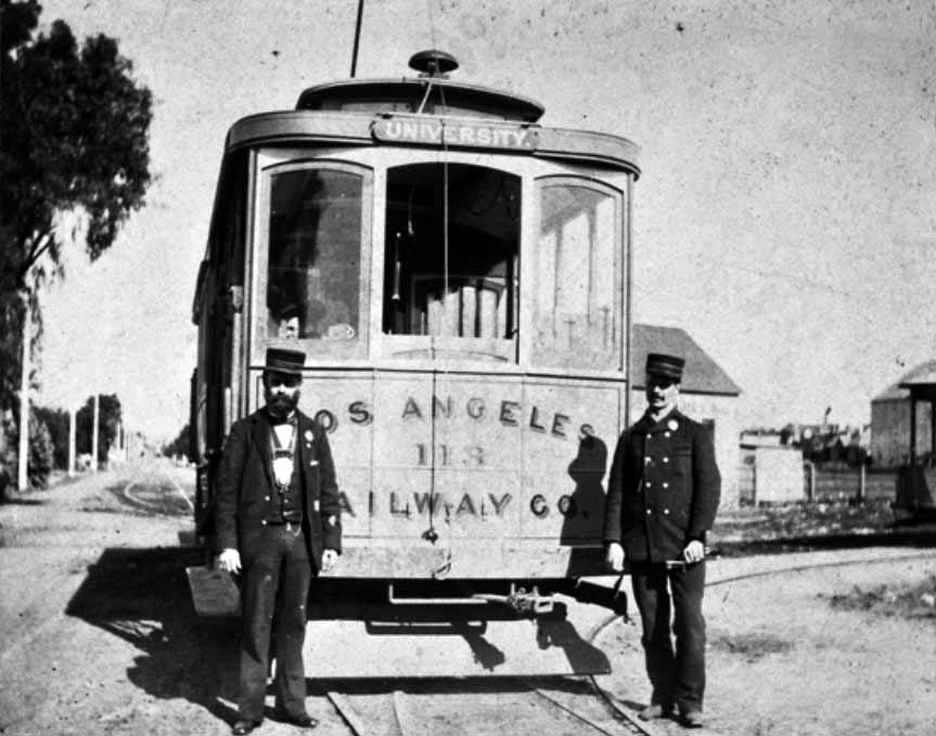 |
|
| (ca. 1900)* – View showing two conductors standing in front of Los Angeles Railway Car No. 113 on 39th Street, opposite the entrance to Agricultural Park. |
Historical Notes The system slowly morphed into a bus system over the years until the last streetcar ran in 1963. After a 27 year absence, light rail returned to Los Angeles with the opening of the Metro Blue Line in 1990. |
* * * * * |
Los Angeles Traction Company
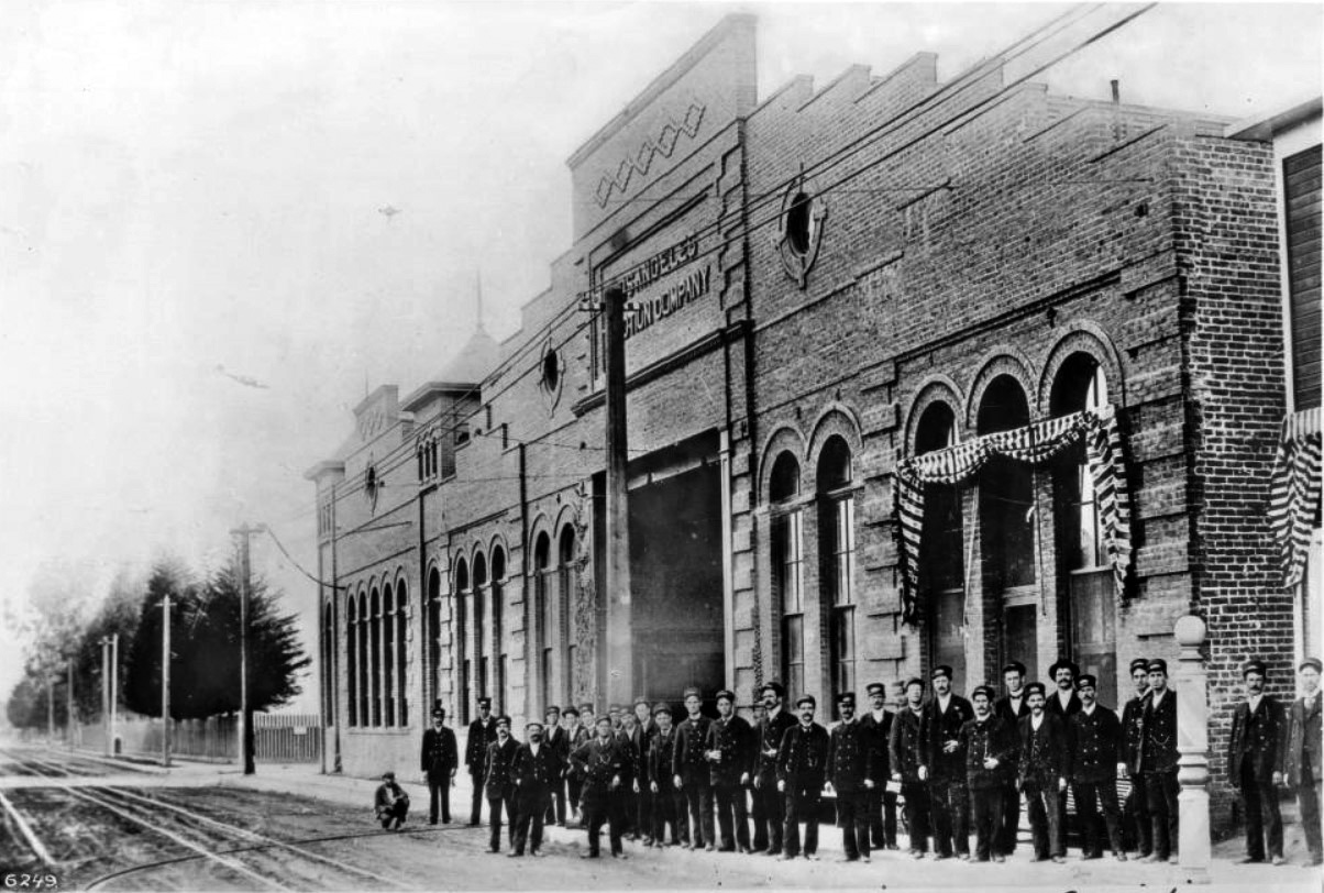 |
|
| (1897)* - The above is a photograph of the powerhouse and main offices of the L.A. Traction Company building on the southwest corner of Twelfth and Georgia Bell Streets. A group of thirty men in uniforms of what appear to be peacoats and kepi hats can be seen standing in front of the arched windows of the Traction Company building. Identifiable men include: Al Clifford, Captain of the Police Department, and Y.C. Knapp, the moustached man pictured in the back row. The brick building has tall, thin arched windows. A sign reading, "Los Angeles Traction Company" is visible above the entrance. Beyond the building, telephone poles recede into the background at the extreme left along a picket fence. |
Historical Notes W. S. Hook came here from Illinois in 1895 and organized the LOS ANGELES TRACTION COMPANY, and commenced to build a system of car lines. The first line starting at the Santa Fe Station, then by way of Third Street to Hill Street, Hill to Eighth Street; Eighth to Figueroa Street; Figueroa to Eleventh Street; Eleventh to Georgia Street; Georgia to Sixteenth Street; Sixteenth to Burlington Avenue; thence on Burlington Avenue, Hoover, Twenty-fourth and Vermont Avenue to Vermont Avenue and Thirty-ninth Street. This line was put in operation from the Santa Fe Station to Sixteenth Street and Burlington Avenue on the 29th day of August, 1895. The construction continued and in a few months the line was completed and in operation to Vermont Avenue and Exposition Boulevard and a year later was extended to Thirty-ninth Street. Franchises were obtained by the Los Angeles Traction Company, as follows: From Eighth Street, Lake, Seventh and Commonwealth Avenue to First and Virgil Streets. From Twenty-fourth Street and Vermont Avenue by way on Twenty-fourth, Normandie and West Adams to Western Avenue. From Jefferson and Wesley Avenue (now University Avenue) west on Jefferson to Fourth Avenue. On East Fourth Street and connecting streets from Third and Stephenson Avenue to First and Fresno Streets. All these lines were built and in operation by 1898.* |
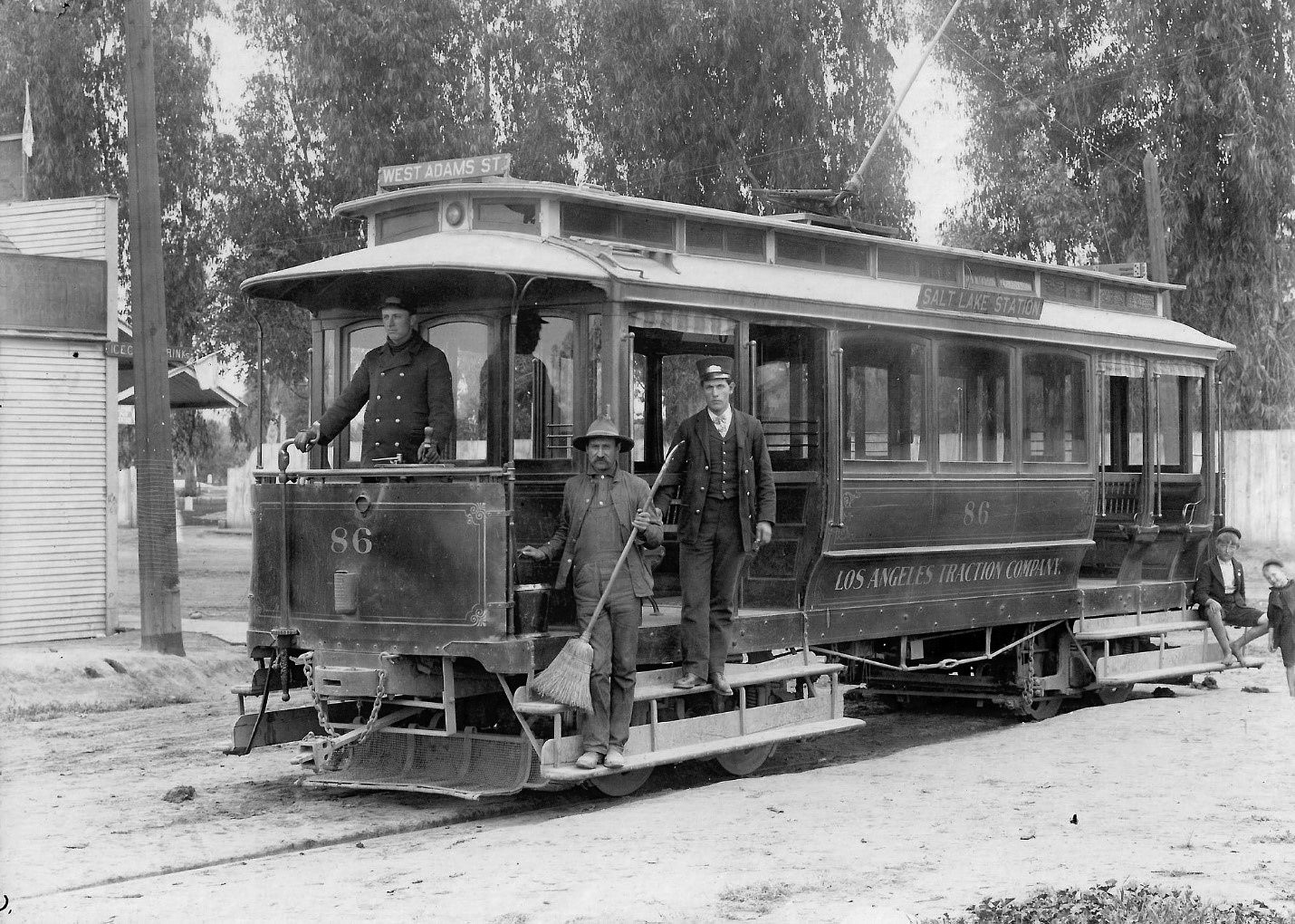 |
|
| (ca. 1899)* - View showing a Los Angeles Traction Company streetcar at East First and Fresno Streets. Evergreen Cemetery is in the background. Pictured are the Motorman, Conductor and track sweeper. Also notice the two young boys at the back of the car. Soon the car will depart for its western terminal at Adams and Western Avenue, via Fresno, East Fourth, Merrick, Stephenson (now Traction Avenue), East Third, Hill Street, Eighth, Figueroa, Eleventh, Georgia Street, Sixteenth (now Venice Blvd.), Burlington Avenue, Hoover, Twenty-Fourth, Normandie Avenue, and West Adams. |
Historical Notes The Hooks sold their interests in the Los Angeles Traction Company to the Southern Pacific Company who continued to operate these lines until 1910 when they were transferred to the LOS ANGELES RAILWAY.* |
* * * * * |
Spring and Court Streets
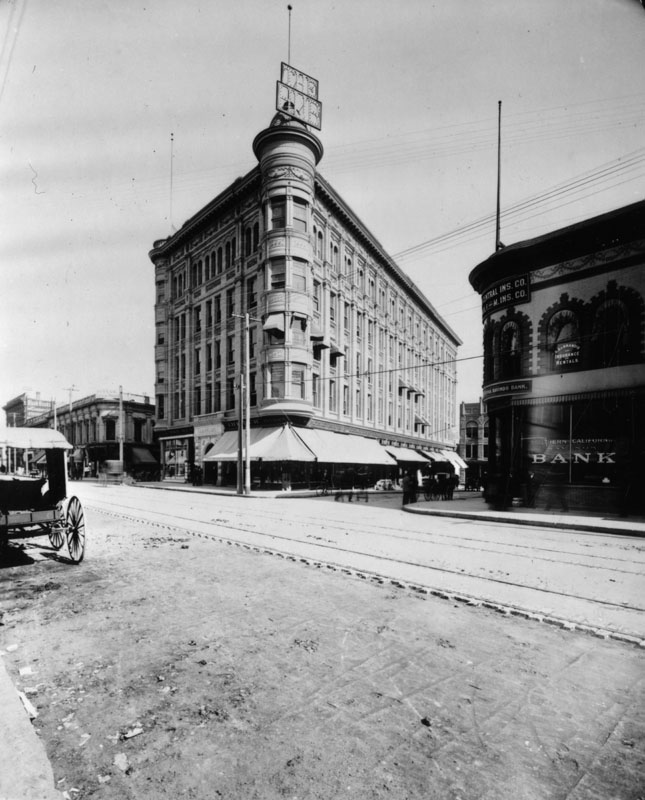 |
|
| (ca. 1900)^ - View of the John Anson Bullard Block on Spring and Court streets, looking north on Spring. Southern California Savings Bank is on the southeast corner across the street. Streetcar tracks are seen on Spring, and a carriage is parked at left. A lighted sign above the turret announces the bar in the building. |
Historical Notes The Bullard Block was once the site of the old Clocktower County Courthouse. Today, City Hall stands at this location. |
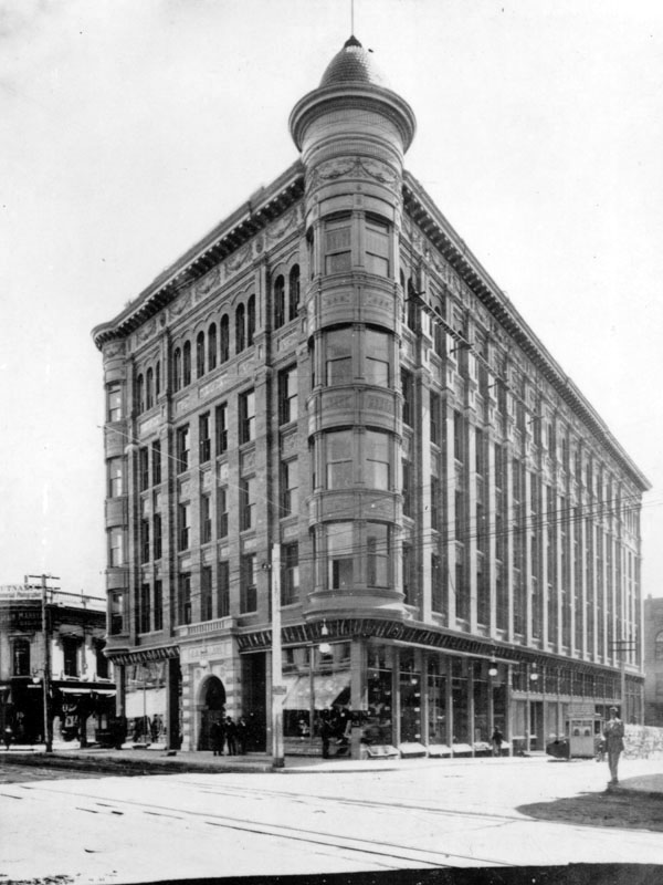 |
|
| (ca. 1900)^ - Closer view of the intersection of Spring and Court streets. The Bullard Building stands on the northeast corner. |
Historical Notes Click HERE to see more Early Views of Spring and Court Streets (1800), where the old Clocktower County Courthouse. Today, City Hall stands at this location. |
* * * * * |
Los Angeles Plaza
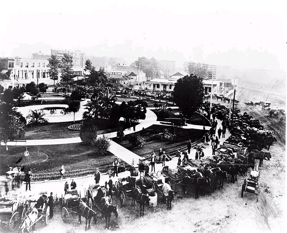 |
|
| (ca. 1900)^*# - Open air market at the Los Angeles Plaza. View is looking northwesterly from the Plaza Firehouse. The Old Mission Church is out of view to the left. |
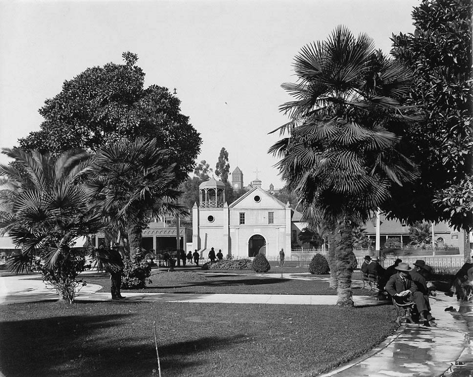 |
|
| (ca. 1900)*#*#* - View of the Old Mission Church from across the LA Plaza. Several men are seen relaxing on the Plaza's benches. There is a clear view of Los Angeles High School (2nd location, built in 1891) up on Fort Moore Hill and its relative relationship to the Plaza and the Plaza Church. |
Historical Notes The new Los Angeles High School replaced the original one that was built in 1872, at the former site of Central School on what was then known as Poundcake Hill, at the southeast corner of Fort Street (later Broadway). This second location atop a hill was completed in 1891 and LAHS moved in. It was an enormous, for then, building. The new high school was built on part of the site of the abandoned Fort Moore Hill Cemetery, the first Protestant cemetery in Los Angeles, which was spread over the slopes of the hill. Early buildings commissioned to house the Los Angeles High School were among the architectural jewels of the city, and were strategically placed at the summit of a hill, the easier to be pointed to with pride. One of the school's long standing mottos is "Always a hill, always a tower, always a timepiece." |
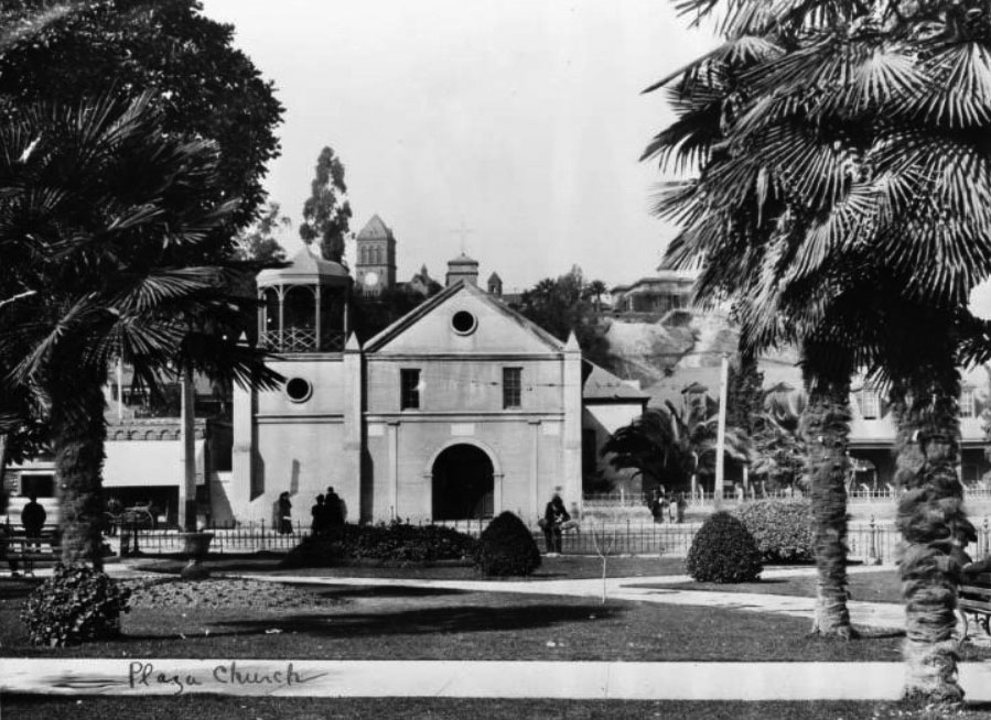 |
|
| (ca. 1900)*- Closer view of the Old Plaza Church as seen from the Los Angeles Plaza. The clock tower of Los Angeles High School can be seen in the background. |
Historical Notes This would be one of the last photos taken of the Plaza Church with its gazebo-like tower. It would soon be replaced with a "bell wall" similar to the one it had prior to 1861. |
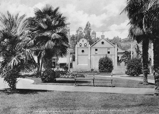 |
|
| (ca. 1900)^*# - Front view of the Old Mission Church with its newly installed "bell wall", similar to the one it had prior to 1861. |
Before and After
|
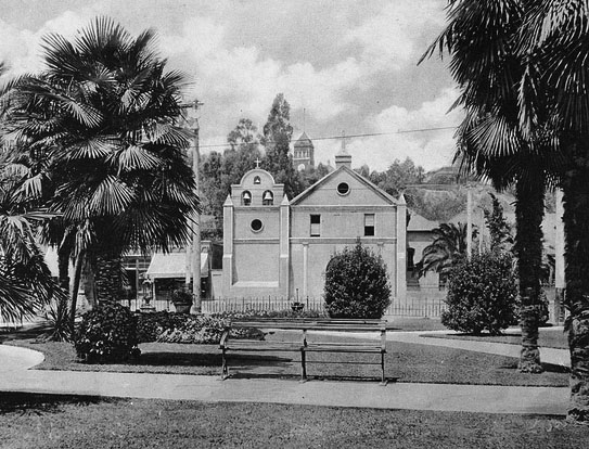 |
|
| (ca. 1900)* - Old Mission Church with "Gazebo Tower" |
(ca. 1901)^*# - Old Mission Church with "Bell Tower" |
Click HERE to see more in Early Plaza of L.A. |
* * * * * |
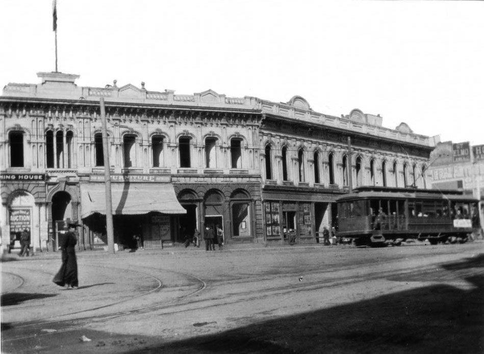 |
|
| (1900)* – View looking northwest showing the Downey Block on the northwest corner of Main and Temple streets. There is a streetcar in the street in front of the building at right, and several pedestrians can be seen as well. |
Historical Notes The Downey Block was demolished in 1904. Since then the corner has been the site of two Federal Buildings: the Federal Building and Post Office (1910 - 1937) and the Federal Courthouse and U.S. Post Office Building (1940 - Present). |
* * * * * |
More Historical Early Views
Newest Additions
Early LA Buildings and City Views
History of Water and Electricity in Los Angeles
* * * * * |
References and Credits
* DWP - LA Public Library Image Archive
^ LA Public Library Image Archive
^* The Valley Observied: Street Name Origins; Timeline of Valley History
^# Chatsworth Historical Society
#^ Huntington Digital Library Archive
*# Publications of the Historical Society of Southern California, Volume 9: Eternity Street
***Los Angeles Historic - Cultural Monuments Listing
+**Facebook.com: Old Photos of Los Angeles
*^*California Historical Landmarks Listing (Los Angeles)
*#*KCET: When L.A.'s Most Famous Streets Were Dirt Roads
*^#Public Art in LA: Campo Santo
*##Metro.net - Los Angeles Transit History
^##California State Library Image Archive
**#The Cable-Car-Guy.com: The Los Angeles Railway; Temple Street Cable Railway
^^#CSULB - A Visit to Old LA: Hamburger Dept. Store; Overhead Line Congestion on Spring
^*#Noirish Los Angeles - forum.skyscraperpage.com; Arcade Palm Tree; Spring St. Central Market; Adams and Figueroa; Westminster Hotel; Angels Flight; Robinson Manison and Teed Street; Main and 4th; Hollenbeck Park
#^*Flickr.com: Michael Ryerson
^#*LA Almanac: First Automobile in Southern California
^#^Historic Hotels of Los Angeles and Hollywood (USC - California Historic Society: Van Nuys Hotel
**^History Matters: Calle de los Negros, 1880s
^^*LA Fire Department Historical Archive
^^^LA Times: The Gush of Oil Was Music to 'Queen's' Ears; Gas-powered carriage didn't have much speed to burn
****Theeastsiderla.com: Angelino Heights Oil Boom
***^TheZephyr.com: O.T. Johnson
***#Historicechopark.org: Echo Park Lake
#***Photos of Vintage Los Angeles: Facebook.com
++^^Boyle Heights History Blog: Hollenbeck Park
*^^*Los Angeles Past: City Hall (ca. 1895)
^*^*KCET - El Aliso: Ancient Sycamore Was Silent Witness to Four Centuries of L.A. History
^*^#Facebook.com - Bizarre Los Angeles
*^#*Automobile Club of Southern California
*#**Mojave Desert.net: Remi Nadeau
*#^*USC Facebook.com
*###Nuestra Señora Reina de los Angeles Asistencia Gallery
^#*#Electronic Scrapbook of Alhambra History
*##^The Street Railway History of Los Angeles - erha.org
^##*Pacific Coast Architecture Database (PCAD): Bryson-Bonebrake Block
^###Exposition Park History - Expositionpark.org
^^##UC Irvine - The White City by Miles Clement
^**^Wikipedia Images: Early L.A. Oil Wells
#^^*Early Downtown Los Angeles - Cory Stargel, Sarah Stargel
#^*^Calisphere: University of California Image Archive
#*#*Walk N Ride LA: Exposition Park
#*#^LAPL-El Pueblo de Los Angeles Historical Monument Photo Archive
#*^^The Department Store Museum: J. W. Robinson's
#**#On Bunker HIll: Larronde Block and Residence; Crocker Mansion
#*^#Google Maps
*#*#*Flickr.com: Views of Los Angeles
*^ Wikipedia: Arcadia Bandini de Stearns Baker; Bunker Hill; Prudent Beaudry; Jonathan Temple; Los Angeles High School; Joseph Widney; Pershing Square; Port of Los Angeles; Belmont High School; Hollenbeck Park; Ducommun; Isaias W. Hellman; Abel Stearns; Sawtelle Veterans Home; Arcade Station; Alhambra; Fort Moore; History of Santa Monica; History of Los Angeles; Burbank; Mt. Lowe Railway; Los Angeles City Oil Field; La Grande Station; MacArthur Park; Los Angeles Athletic Club; Western Avenue; History of Los Angeles Population Growth; Garvanza, Los Angeles; Highland Park; Cawston Ostrich Farm; Arroyo Seco; History of Santa Monica; Los Angeles and Independence Railroad; Pío Pico; John Edward Hollenbeck; Alvarado Terrace Historic District; Sawtelle, Los Angeles; Angelino Heights; Angels Flight
< Back